Good Monday to one and all. Our round of severe weather is moving out of the region, but this looks to be the opening act to a much more impactful setup later this week and weekend. Rounds of severe thunderstorms and flooding rains may cause significant issues throughout our region.
Our Monday starts with severe storms rolling out of southeastern Kentucky with some chilly showers leftover on a colder northwest wind. Temps fall into the 50s and hang there for most of the state today.
Tuesday is a pretty good looking day with highs reaching the upper 50s to middle 60s.
Temps surge into the 75-80 degree range on Wednesday as a strong southwest flow kicks in ahead of a potent storm system. This rolls from the plains into the Great Lakes Wednesday and Thursday, dragging a cold front in here from the west. That front will become stationary with waves of strong to severe storms rumbling along it from southwest to northeast.
Our region looks to be in the bullseye of the worst of the weather from this…
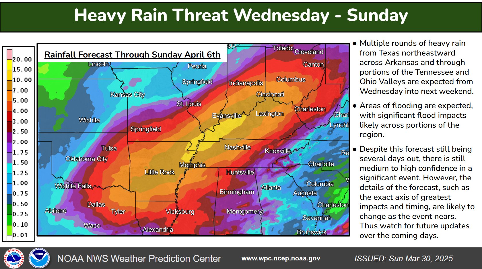
The potential for a major flood event is there and the Weather Prediction Center is pretty aggressive with the forecast and messaging…
The operational forecast models are still figuring out where the corridor of heaviest rains set up, but they are all on board with the possibility of major flooding. These are the rain forecasts through this weekend…
In addition to the threat of flooding, a significant severe weather outbreak is possible late Wednesday through the weekend.
The Storm Prediction Center is already on board with an increased severe weather threat for Wednesday…

Here’s a look at the probability map for Wednesday into Wednesday night…

The SPC is already highlighting the severe weather potential for Thursday…

I will have another update later today. As always, I leave you with your tracking tools of the day…
s…
Possible Watch Areas
Make it a great Monday and take care.


We dodged a bullet in South Central Kentucky, with only an EF0 tornado briefly touched down. My PWS recorded 1.15 inches of rain yesterday and a peak wind gust of 42mph. The Wednesday Thursday event has me really concerned, especially since the ground is already saturated. Severe storms on top of that incrases the likelihood that trees will be uprooted, causing significant power outages in the process.