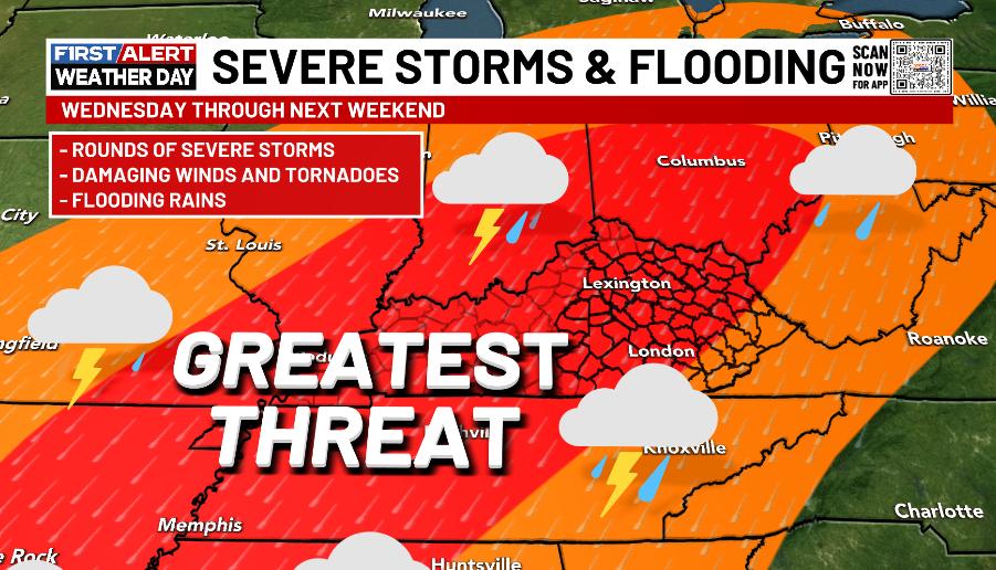
Good evening, everyone. It’s full steam ahead toward a multi-day severe weather and flood threat for Kentucky and surrounding states. This happens as a potent storm system moves into the Ohio Valley and leaves a stationary boundary behind.
This boundary will be the focus for rounds of strong to severe thunderstorms rumbling in from late Wednesday through Sunday…
The forecast models continue to spit out a lot of rain, but differ a bit on totals and placement…
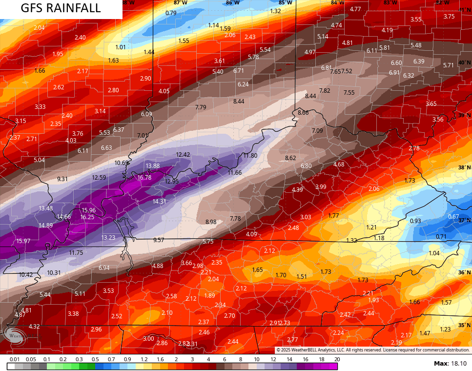
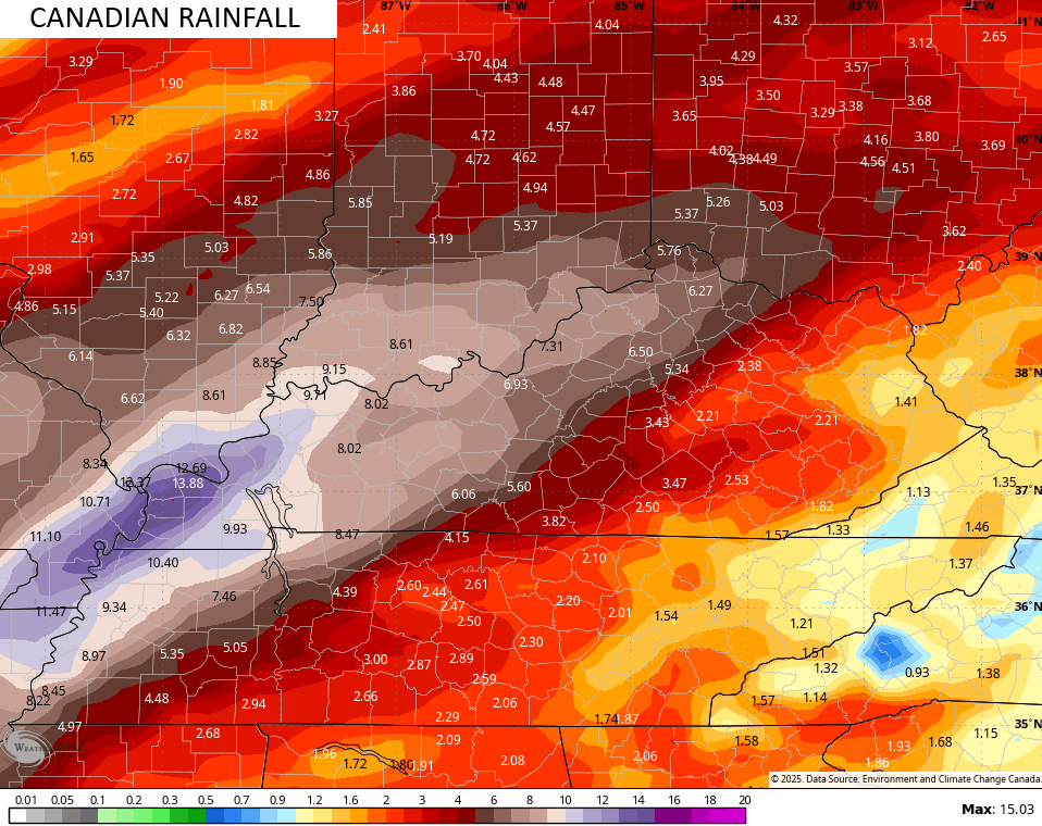
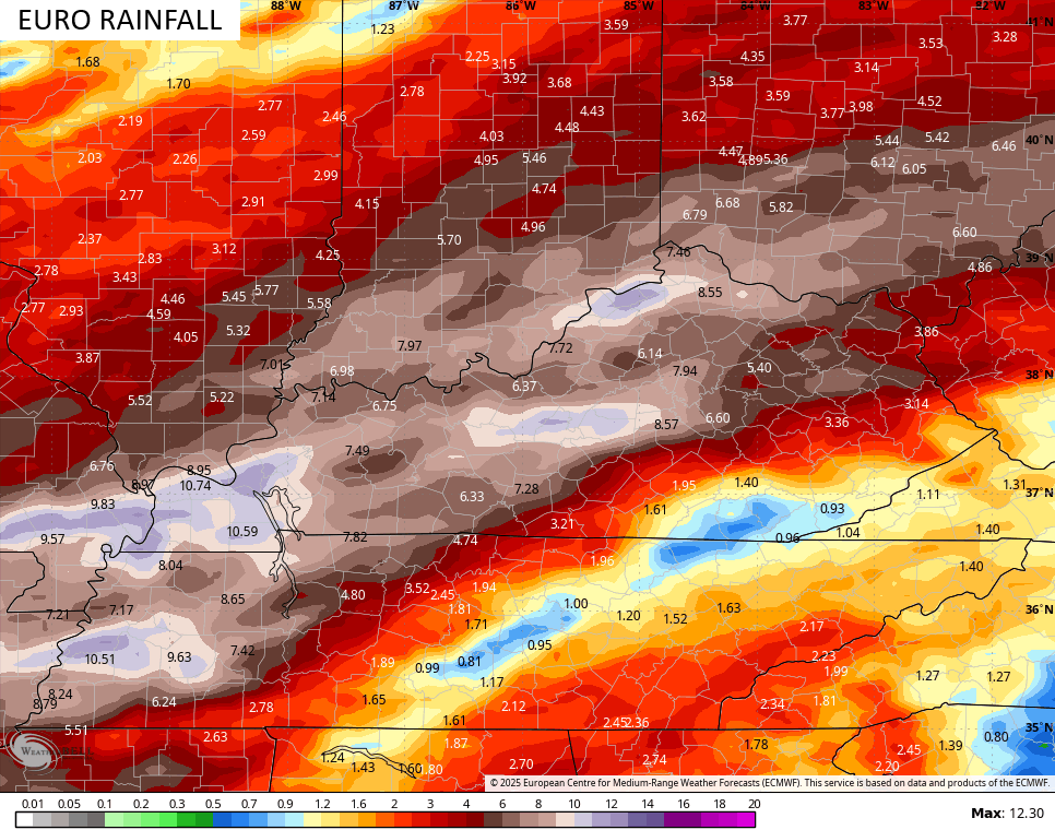
Here’s the early look at what I’m expecting for rainfall totals through Sunday…
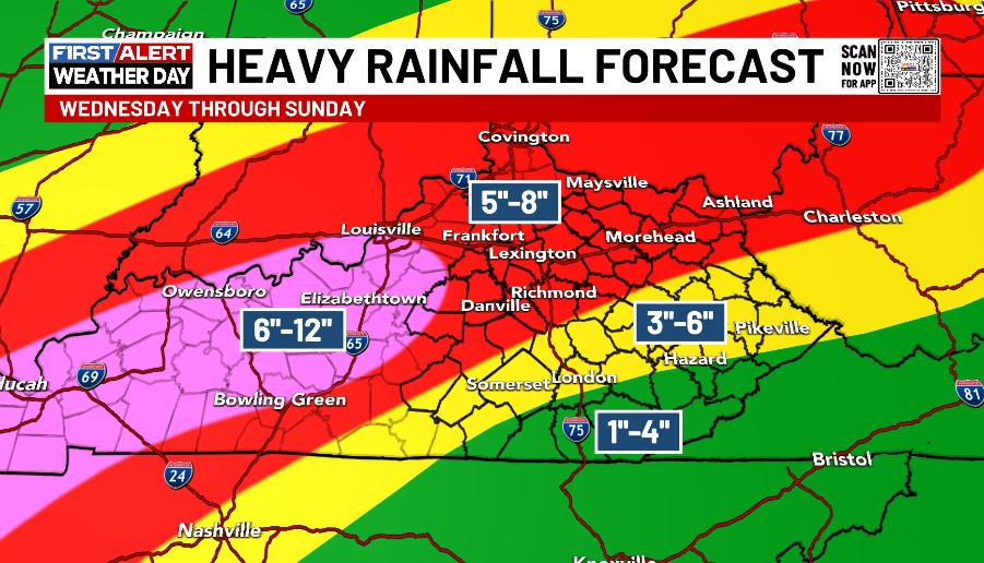
Changes to that forecast are likely as everything comes into better focus, and let’s hope the totals come way, way down.
The National Weather Service is forecasting widespread flooding for our region with some of our rivers already forecast to hit Major Flood stage…

Each day will feature the threat for severe thunderstorms, including damaging winds, large hail and a few tornadoes.
Wednesday is now within the traditional 3 day Severe Weather Outlook window and the SPC has an Enhanced Risk for much of Kentucky…

The probability of severe weather is REALLY high…

The severe risk continues into Thursday…

I’ll have a full update on all this later tonight. Make it a great evening and take care.
