Good Thursday, everyone. We continue to track the increased threat for MAJOR flooding across much of Kentucky as waves of torrential rain producing showers and storms rumble through. Some of these storms may be strong or severe through Saturday evening.
All modes of flooding are likely through the weekend:
- FLASH FLOODING
- GENERAL FLOODING
- RIVER FLOODING
This wouldn’t be run of the mill flooding, but would likely reach MAJOR status in many areas.
Several inches of rain fell on Thursday and we, unfortunately, have a lot more to go through. The HRRR goes through 8pm Saturday and is showing additional rainfall totals that would cause catastrophic flooding in many areas…
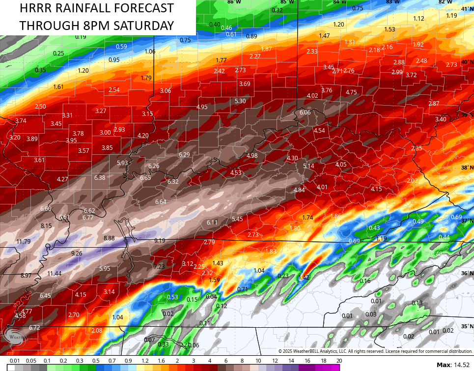
Please stay alert to increased threat for life-threatening flooding today through early Sunday.
The threat for severe storms continues out there on this Friday with a Marginal Risk to a Slight Risk for severe weather…

Here’s a look at today’s individual severe weather threats…


The threat for severe storms is likely to increase Saturday into Saturday evening with all modes of severe weather a possibility. Here’s the Saturday Severe Weather Outlook from the Storm Prediction Center…

Here’s a breakdown of the individual severe weather threats…


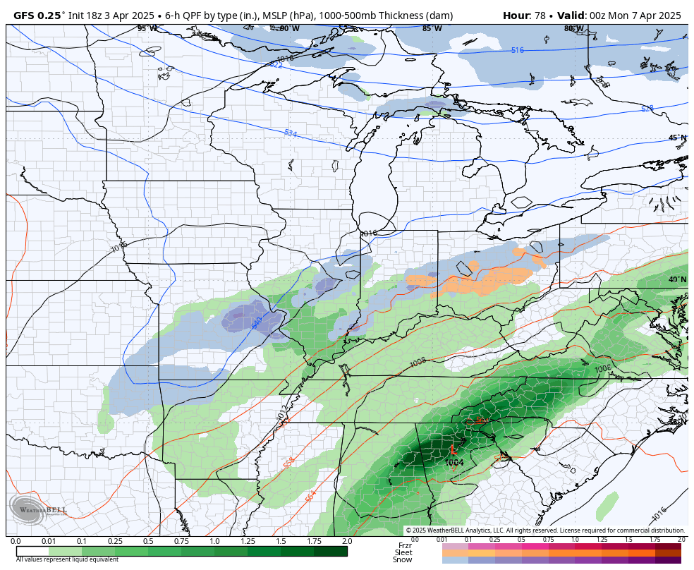
This pattern will FINALLY break as we go through Sunday as much colder air crashes in from the northwest. This sets the stage for an early March type of a look and feel as we head into next week. A few systems drop in from the northwest with chilly showers and the chance for a few snowflakes to show up…
Temps from Sunday through next week will be MUCH colder than normal with some days only in the 40s and a couple of mornings reaching the 20s. Just look at how much colder than normal we will be…
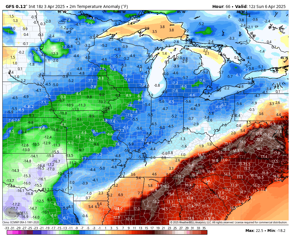
The potential of a colder than normal April and May is increasing. Ugh.
I’ll update things later today and be back on WKYT-TV to walk you through today’s nasty weather. As always, I have you all set to track today’s severe storms and flooding rains…

Current watches

Possible Watch Areas

Make it a great Friday and take care.

Chris I hope you get some rest, you worked long hours you forgot what day it is. Lol Thanks for all you do even know your out of my range…
April and May will not be cold.
The rain in Warren County is unrelenting and the quantities recorded by my PWS approach the absurd. Rainfall since midnight 3.15 inches, since Wednesday 7.25 inches, and adding in the rain that fell on Sunday brings the total to 8.30 inches. Wednesday night in BG was crazy, with 2 tornado warnings, and nearly constant lightning as shown here.
https://youtu.be/2pIiedgkivU?feature=shared
Hello, would anyone know where I can look to see how much rain we have gotten so far by country?
I’m thinking you mean by county? best thing to do is to go http://www.kymesonet.org when it loads… There’s an option on the left for precip/wind/temp, etc… click precip and click “last 48 hours”