Good evening, everyone. A massive amount of rain has fallen across Kentucky in the past 36 hours, creating major flooding issues. Unfortunately, a lot more rain is on the way and will bring the severe weather threat back into the region.
Much of Kentucky is currently under Flood Warnings and Flash Flood Warnings. We also have a Tornado Watch in the west and a Severe Thunderstorm Watch across the southern half of the state.
Here’s a look at all the current watches and warnings…

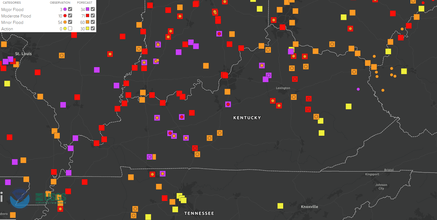
Many of our larger creeks and rivers are forecast to reach moderate to Major Flood Stage in the coming days. This map shows the status of many of these…
Several more inches of rain will fall over the weekend, leading to potentially catastrophic flooding.
The greatest severe risk this evening into the wee hours of the morning is still across the west as the Storm Prediction Center pushed the Enhanced Risk into this region…

The west is where we have the greatest tornado risk…

Damaging winds are also a good bet out here…

Large hail will continue to be a threat…

The Severe Weather Outlook for Saturday takes the overall risk area farther south and east…

I think we can get some of that upgraded to an Enhanced risk before all is said and done.
Here’s a breakdown of the individual severe weather threats for Saturday…


I leave you with all your tracking tools…

Current watches

Possible Watch Areas

Make it a great rest of the day and take care.
