Good Saturday, everyone. It’s another day of waves of torrential rain producing showers and thunderstorms rolling across the Commonwealth, leading to more in the way of major flooding. Today’s storms are also bringing the potential for damaging winds and a few tornadoes.
Our day is starting out with rounds of showers and thunderstorms sweeping eastward across the state and some of these may be strong or severe, especially in central and western Kentucky. These storms may also produce more in the way of flooding and flash flooding on top of what we were already seeing.
Here’s a look at all the current watches and warnings…
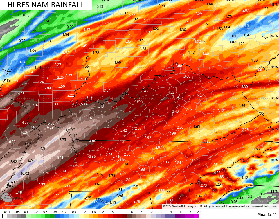
Several inches of rain are still likely today through Sunday, especially in some of the same areas that picked up 4″-8″ of rain the past few days. The Hi Res NAM is ugly in these same areas…
In terms of the severe storms threat today, we know the potential is there this morning, but there’s another risk for severe storms later this afternoon and evening. Here’s the Severe Weather Outlook from the Storm Prediction Center…

The low-end tornado risk is there today…

The damaging wind threat is the biggest threat of the day…

Large hail can’t be ruled out but it’s a smaller threat than the wind…

Much colder winds will FINALLY shut this extreme setup down as we reach late Sunday into Monday, setting the stage for a chillier than normal week ahead.
I will update things later in the day and be on WKYT-TV as needed. As usual, I have all your storm tracking needs for the day…

Current watches

Possible Watch Areas

Make it a great Saturday and take care.

Dislike