Good Sunday, everyone. Historic rains continue to fall across Kentucky, bringing major flooding to most of our region. The good news is that the overall pattern is about to change and turn much calmer… And chillier.
Major flooding continues along several rivers with the Kentucky River near Frankfort about to reach one of the highest crests in recorded history. Creeks and streams for the entire region continue to run high or in flood and with another inch of rain possible today, more issues are likely.
Here’s a look at the current warnings and watches for our area…

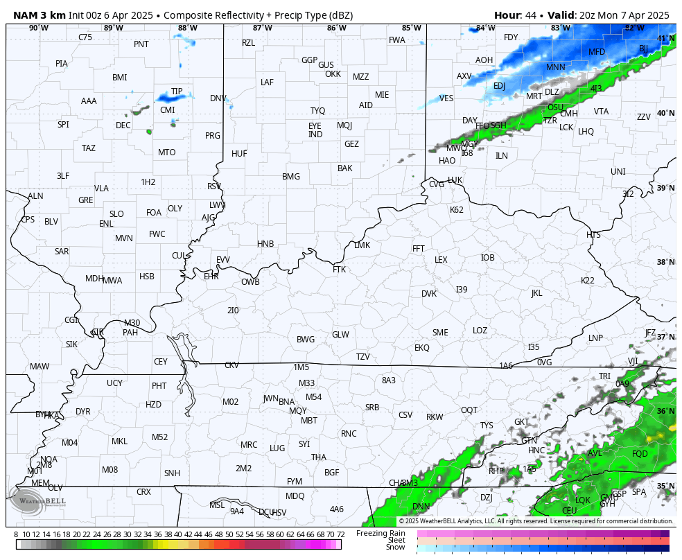
Today’s rains are chilly with a northwest wind kicking in. That colder pattern settles in more in the coming week, especially behind another cold front arriving Monday night. This brings a band of showers with it and may even bring a snowflake into eastern Kentucky.
The future radar from the Hi Res NAM shows this potential…
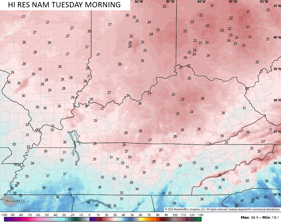
This ushers in a blast of frigid air that sends temps deep into the 20s to start Tuesday…
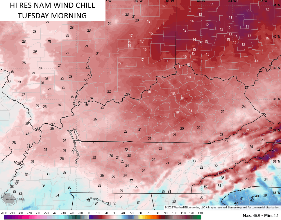
Wind chills will be in the teens…
Highs are in the 40s for Tuesday.
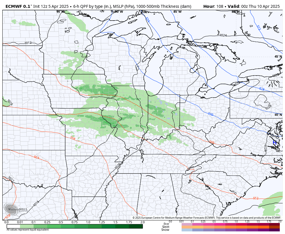
Behind that comes a series of systems dropping in from the northwest. These keep our temps solidly below normal through the week and into next weekend. They can also bring a few showers to the spring break party by the end of the week…
That’s just ugly, but it’s much better than where we’ve been.
Here are your radars to track today’s rounds of rain…

Have a great Sunday and take care.

As I keep checking my PWS rain gauge, I keep shaking my head. At 2:00am CDT, my rainfall total from 6:00 pm Wednesday through right now is a mind-blowing 12.05 inches. Insane!!
Since Thursday @ 12:00 a.m., our PWS has recorded 10.02” – and it’s raining.
Only (!) a quarter inch more since 2:00 am, but now we have Freeze Watches for Monday and Tuesday nights. It never ends.
I don’t have a gauge at my house. I just go by KLEX since it’s relatively close to the McConnell’s Trace area.. From what I can math it was around 7 and 1/2 inches. Both Fayette mesonets were around the same. But the way they rains moved I’m sure there are 10 inch pockets.. My area could possible be one of those. I don’t know anyone who has a weather station in this particular part of town. All this and there are wildfires in the county in western NC that I’m from… I talked to my brother he said the smoke was terrible. I hope they get some of this rain
I hope this isn’t one of the years when we get tons of rain in spring… then the summer just bakes with no rain.
I don’t like the thought, but I can see a 2012 summer happening.