Good Sunday, everyone. Much milder winds are blowing across Kentucky today as spring tries to fight back. This fight leads us into the potential for a few strong to severe storms later Monday with another blast of spring chill behind it.
Temps today reach the 60s under a partly to mostly sunny sky. There’s the slightest chance for a stray shower across the north and northeast, but most stay dry.
Winds are cranking today into Monday with gusts that can reach 40mph at times. Those winds boost temps into the 70s ahead of a cold front arriving Monday night. These front touches off a few thunderstorms Monday afternoon and evening.
One or two of those could become severe with the greatest potential in the north and northeast. Here’s a look at the Storm Prediction Center’s Severe Weather Outlook for Monday…

Chilly temps settle in behind this departing front with below normal temps Tuesday and Wednesday.
Milder winds kick in starting Thursday and taking us into the upcoming Easter Weekend. Can we keep the storms away during this time? That may be a bit of a tall task as, at least, some scattered showers and storms rolling in from the west.
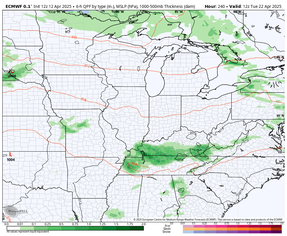
The EURO shows a pretty good severe weather signal to our west with a low-end chance for some of these to zip in here at some point. This animation starts on Friday and goes through the following Monday…
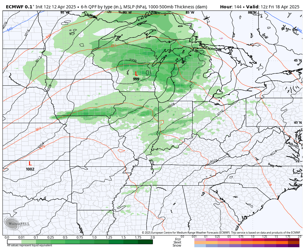
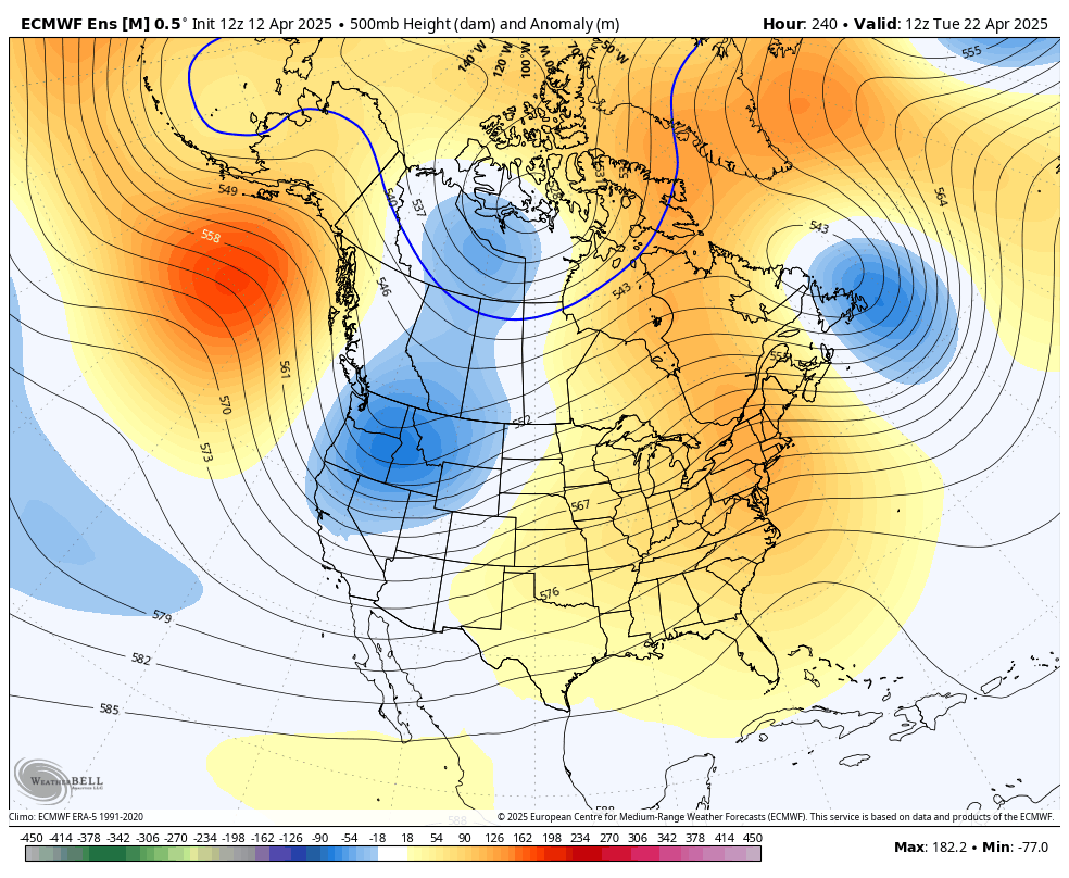
This leads us into a very mild final full week of April as the severe weather signal continues to show up strongly to our west…
The Plains severe signal comes as troughs dig into the west with ridging in the eastern half of the country. That’s something showing up very well on the EURO Ensembles…
This pattern won’t hold, though, as I expect the severe weather threats to return as we get into May. The pattern may wind up going back pretty wet with cooler than normal temps.
I leave you with your Kentucky Weather Radars just in case any stray shower or storm goes up today…

Have a great Sunday and take care.

I don’t think think we revert to wet and cool.