Good Monday, everyone. The threat for severe weather returns to parts of Kentucky this afternoon and evening as another cold front drops in. This ushers in chilly air for the next few days, but the pattern is looking to start skewing warmer for a while starting this Easter Weekend.
Winds are cranking ahead of the front as temps surge into the 70s for most of the region.
Instability along and ahead of our approaching front spells the increasing potential for severe storms Monday afternoon and evening with the greatest risk east of Interstate 65. Storms will develop into a line that goes from northwest to southeast with individual storms going southwest to northeast.
Here’s today’s Severe Weather Outlook from the Storm Prediction Center…

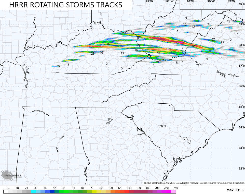
Some of these storms may get cranking pretty good with the threat for a few storms to rotate. The HRRR shows some pretty good rotating thunderstorm tracks across central and eastern Kentucky into West Virginia…
Because of this, the SPC has much of this same area in today’s Tornado Outlook…

Damaging winds continue to be the main threat…

Some of these storms may also have some hefty hail with them…

Once the storms sweep through, chilly winds kick in for Tuesday and Wednesday as many areas stay in the 50s for highs. There could also be a lingering shower on Tuesday across the east.
Mild temps filter back in on Thursday and those temps turn warm on Friday and likely carry us through the Easter Weekend. Scattered showers and thunderstorms may also rumble in from time to time…
The pattern for next week looks very warm and increasingly active…
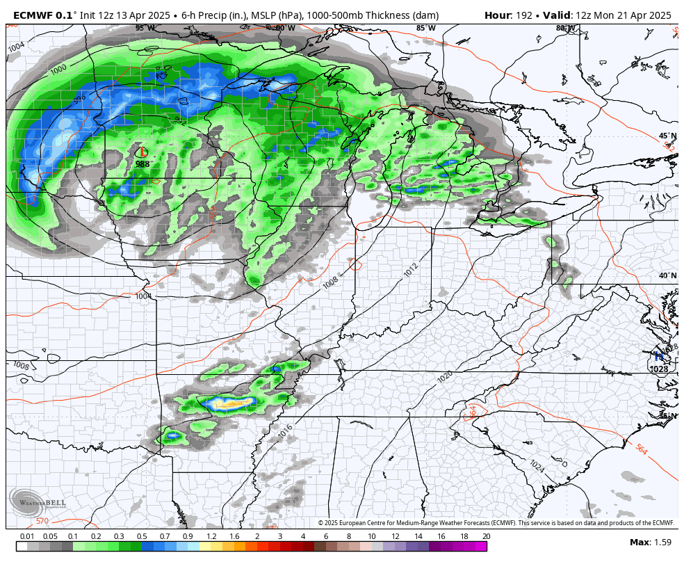
The Plains into the Mississippi Valley appear primed for significant rounds of severe weather and you can see the EURO trying to push some of those into our region. As a matter of fact, the latest rainfall forecast from the EURO is starting to get a bit concerning…
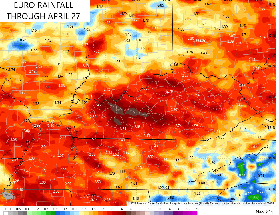
We don’t want that, so let’s hope the Plains keep much of the storminess next week.
The overall pattern is likely to skew chillier than normal again as we get into May. I wouldn’t be surprised to see a mid-month frost threat show up.
I will update things later in the day and be on WKYT-TV as needed. As usual, I have all your storm tracking needs for the day…


Current watches

Possible Watch Areas

Make it a magnificent Monday and take care.

I don’t think we get real cold in May.