Good Wednesday to one and all. It’s a much milder flow taking control today and this will really ramp it up later in the week into Easter Weekend. Temps turn downright warm, but the chance for some storms looks to show up as well.
Let’s begin with today’s dose of better weather. Skies are mostly sunny with highs ranging from near 60 in the east to near 70 in the west. Winds are still a little gusty, but nothing like what we had Tuesday.
Temps really take off on Thursday as a warm front sweeps through here. This boundary may touch off a stray shower or storm, especially in the west. Temps hit the upper 60s to low 70s.
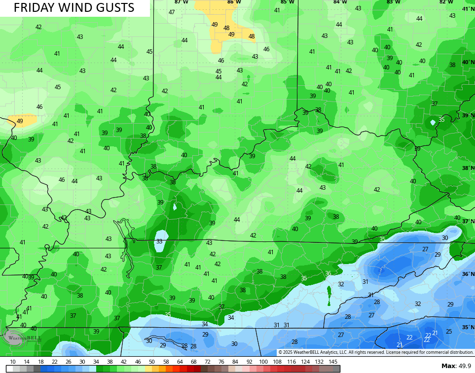
Friday is a VERY warm day with 75-80 degrees in most of Kentucky, but it may also feature southerly wind gusts reaching 40mph at times…
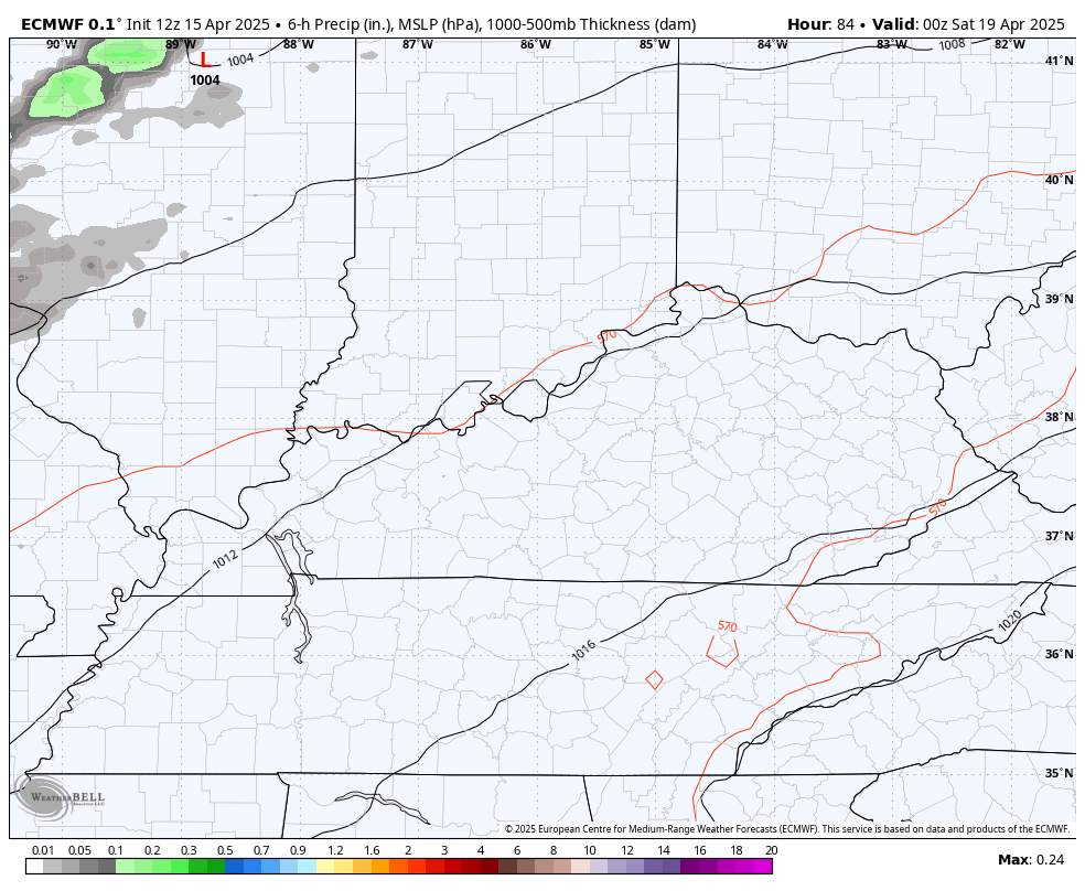
This is ahead of a front dropping in from the north and northwest. How far south does this get for Saturday and Sunday? That’s the million-dollar question as the answer to that determines how high our thunderstorm chances are this weekend.
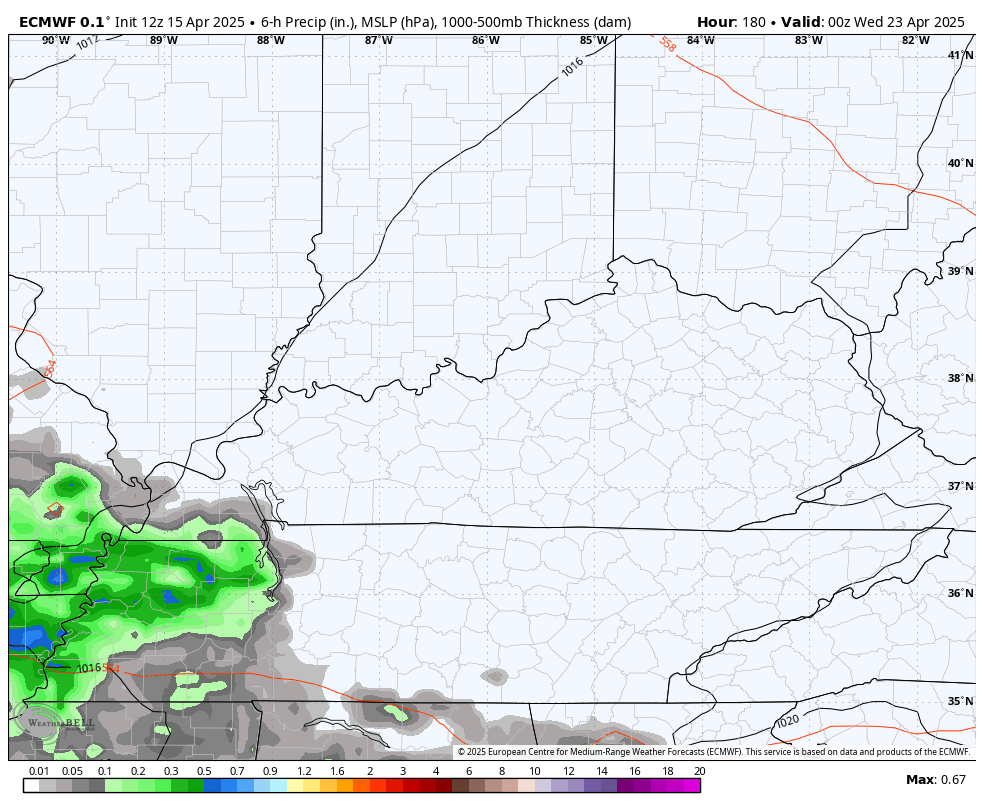
The EURO doesn’t bring this too far south with only a few storms in the north. It then brings a better threat for storms in here Sunday night and early Monday…
The Storm Prediction Center is monitoring parts of the region for the threat for strong to severe storms on Saturday…

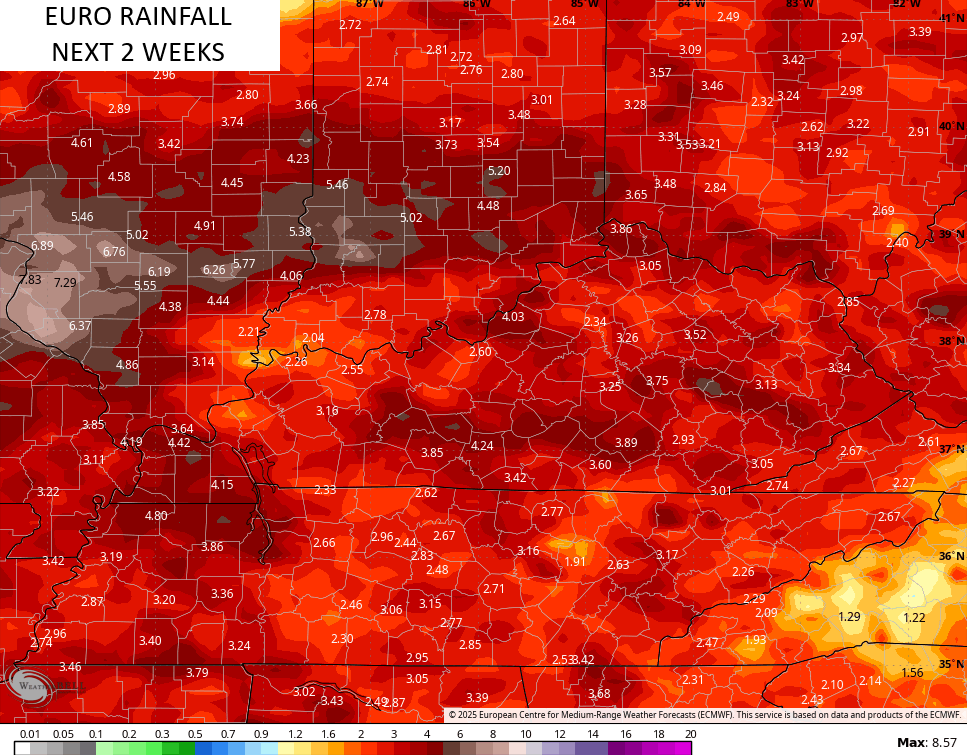
The threat for showers and thunderstorms looks to ramp up into next week as the pattern turns back to active…
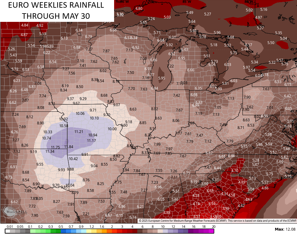
The EURO continues to point toward the potential for some hefty rainfall numbers over the next few weeks…
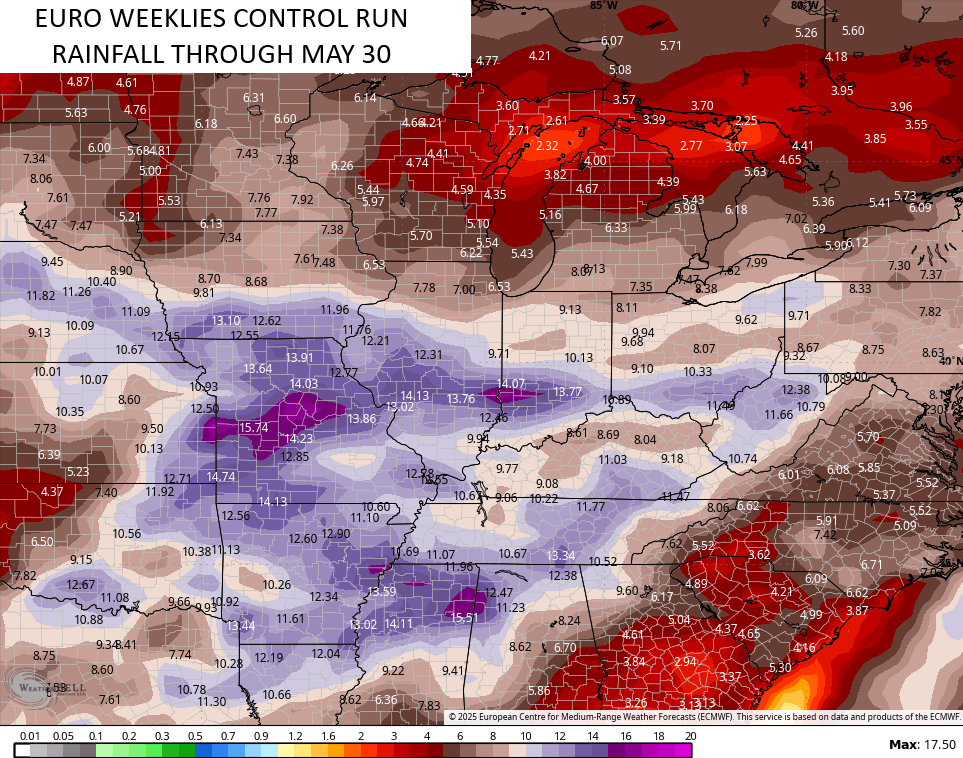
We are starting to see the EURO Weeklies trending wetter through much of May…
The Control Run is even stormier looking…
May is likely to bring several rounds of significant severe weather, while also bringing the potential for few chilly shots of air that would skew our temps below normal.
Enjoy your Wednesday and take care.

Bring the warm air. SCHRODOER I hope your are okay haven’t heard from you for a while
Thanks Winterlover. I have been under the weather, but much better now. I agree bring on the warmth. Also we were without internet for a week.
Glad you doing better and its good to hear from you.