Good Thursday to one and all. We have a warm front pushing through Kentucky today and it’s unleashing a big-time warmup. This means our Easter Weekend will look and feel more like Memorial Day weekend and I don’t think anyone will complain too much.
Temps today reach the upper 60s to low 70s in many areas as a small band of showers and embedded thunder rolls through ahead of the cold front. Winds increase behind this boundary as temps climb Thursday night and Friday. Gusts on Friday may hit 40mph at times as temps surge into the 75-80 degree range.
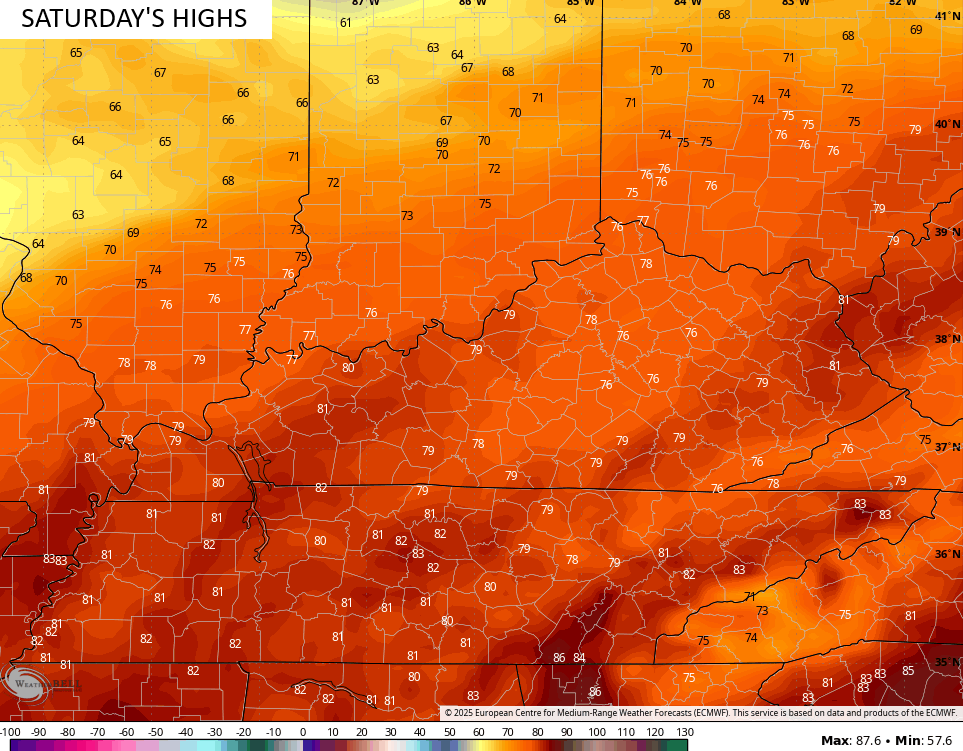
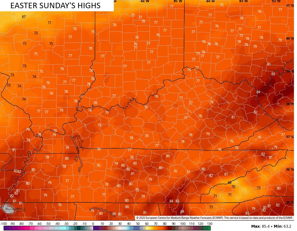
Temps this weekend are very warm with temps ranging from the middle 70s to low 80s. I can’t rule out a few mid and upper 80s in the east and southeast. Here’s what the EURO is seeing…
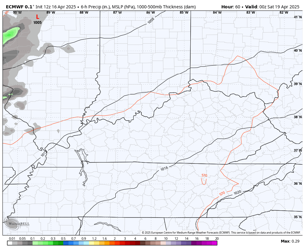
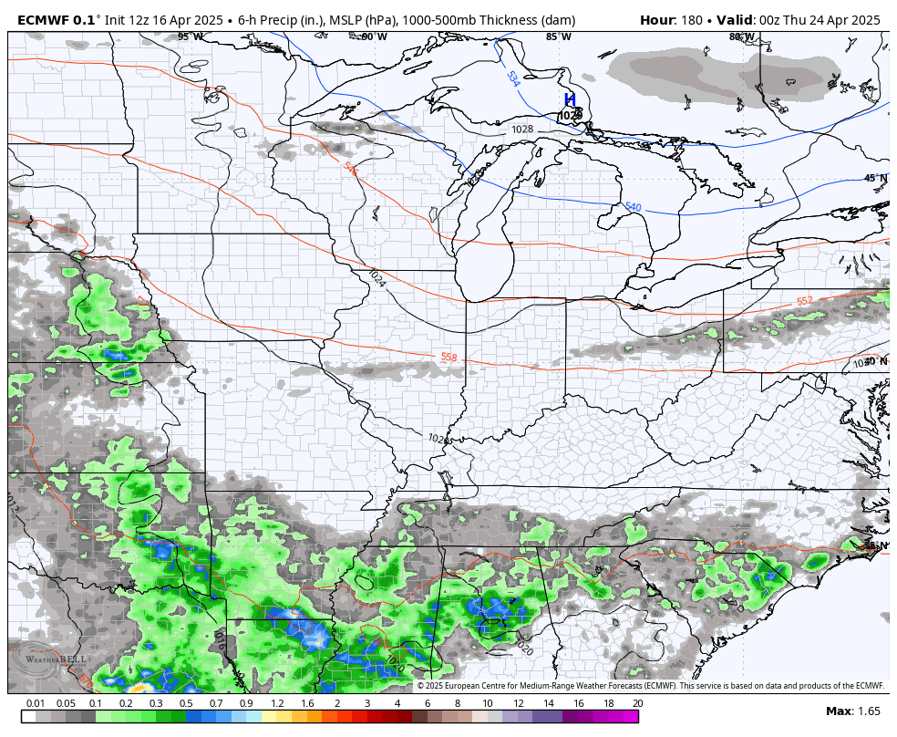
The threat for storms continues to show up in the west and north Saturday into early Sunday, but this looks rather scattered as of right now. A cold front then sweeps eastward Sunday night and Monday morning, bringing showers and storms to man…
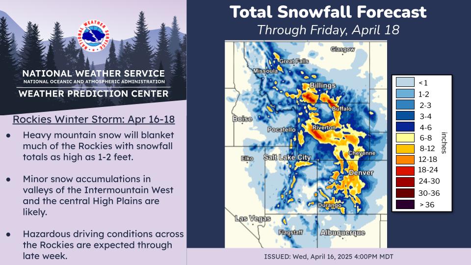
While we are enjoying a very warm pattern, the western half of the country is experiencing a major winter storm. Look at the snowfall across the Rockies through…
Back here in the Bluegrass state, temps drop a small bit for Monday and Tuesday but bounce right back up toward 80 for the rest of next week into the following weekend. The threat for some thunderstorms will get back in during this time…
Looking toward May, the EURO Weeklies continue to suggest temps average below normal…
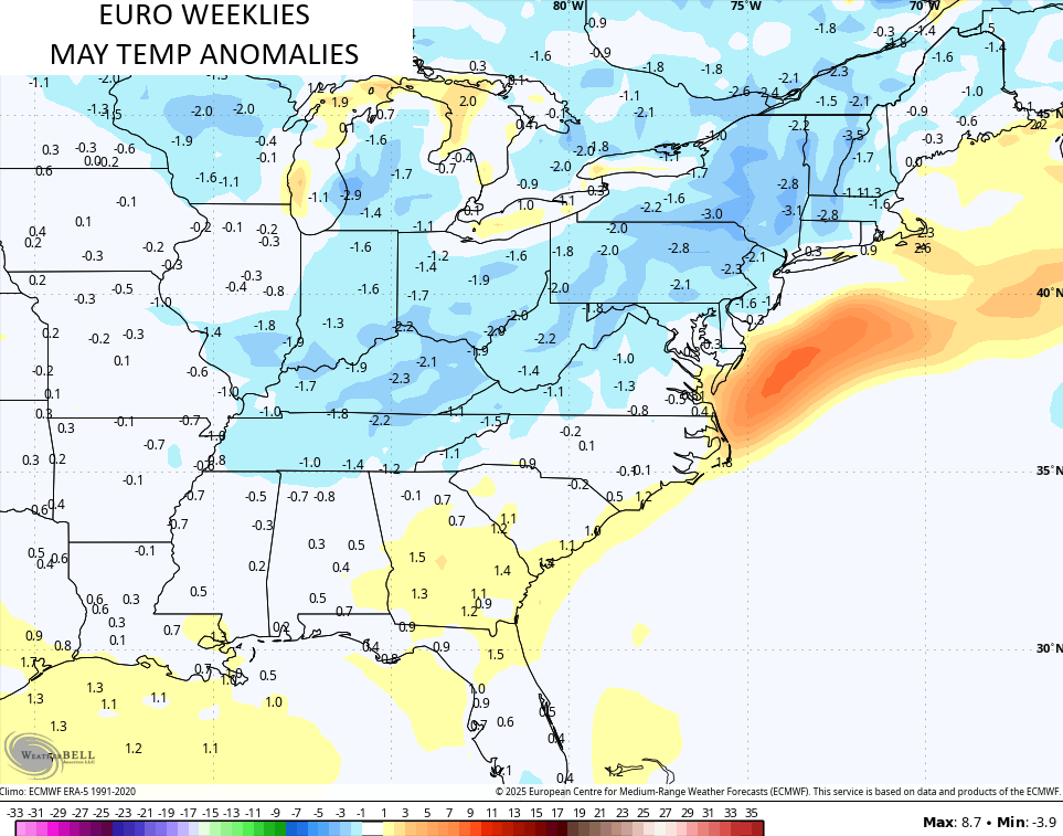
A mid-month frost threat is possible with the pattern I see setting up.
I leave you guys with your Kentucky Weather Radars to track today’s broken band of showers and thunderstorms along our warm front…

Have a great Thursday and take care.

It’s not going to frost in mid-May.
Thanks Chris. About time we receive some growing season weather. Hoping it stays dry, so the Farmers can plant their crops. I always waited to plant (garden plants) at the end of May.
Enjoy the Day Everyone !
Glad to see you back Schroeder!
Thanks Dottie ! Glad to be back.