Good Saturday, everyone. It’s another windy and warm day out there as our Easter Weekend looks and feels more like Memorial Day Weekend. This warm air also brings about a few storms impacting northern and western parts of the state.
Temps today head back into the upper 70s to middle 80s on a strong southwest wind flow. This warm air is ahead of a boundary dropping toward the region from the northwest, but it never makes it south of the Ohio River.
That means any thunderstorm action can only make it into parts of northern and western Kentucky and those look fairly scattered. Some of these storms may be strong or locally severe, but the majority of the big storms stay to our west and north.
That shows up well on today’s Severe Weather Outlook from the Storm Prediction Center…

Here are the individual threats for the day…


Easter Sunday is another very windy and very warm day with temps reaching the upper 70s to middle 80s. This will make for one of the warmest Easters on record across our part of the world.
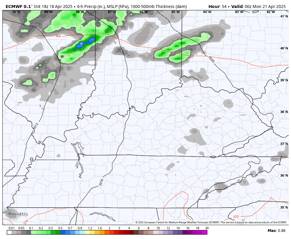
Much of the day looks dry ahead of a cold front moving in Sunday night into Monday. This boundary has showers and thunderstorms along and ahead of it and some of those may be a bit on the strong side or locally severe in the west.
The Storm Prediction Center’s Severe Weather Outlook for Sunday has the bulk of the severe to our west…

This line of showers and storms rolling through here Sunday night and Monday may still produce some strong storms, but the severe threat looks diminished…
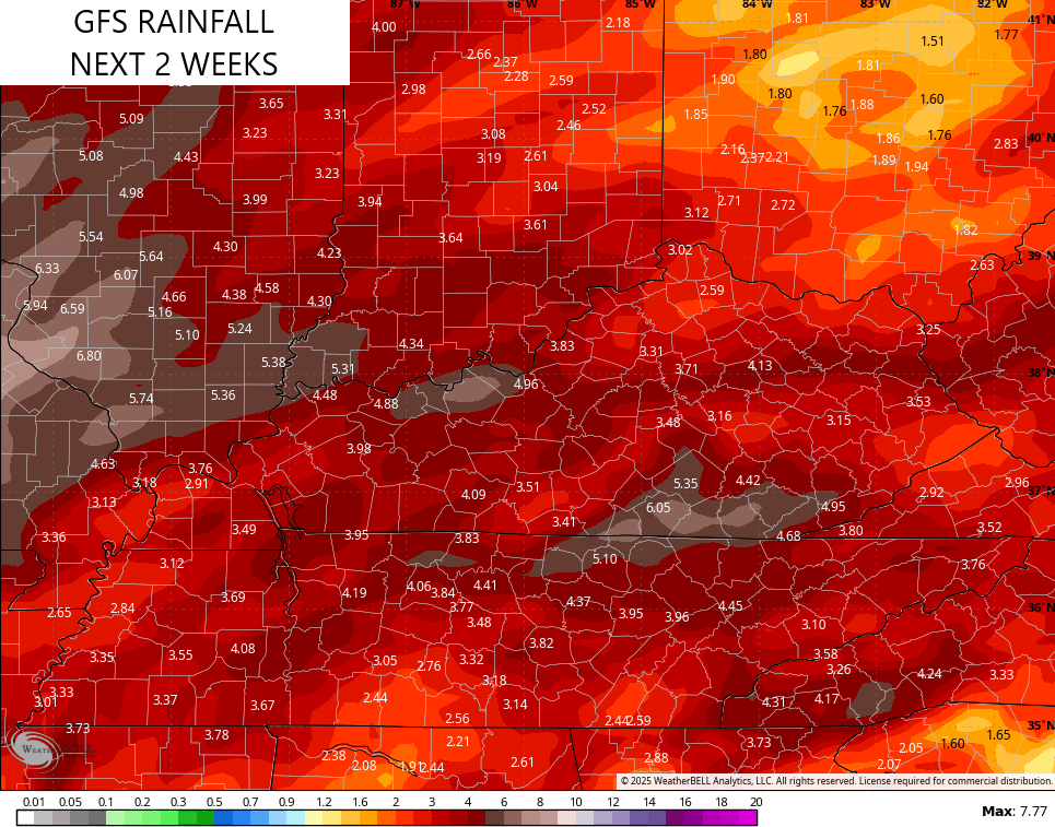
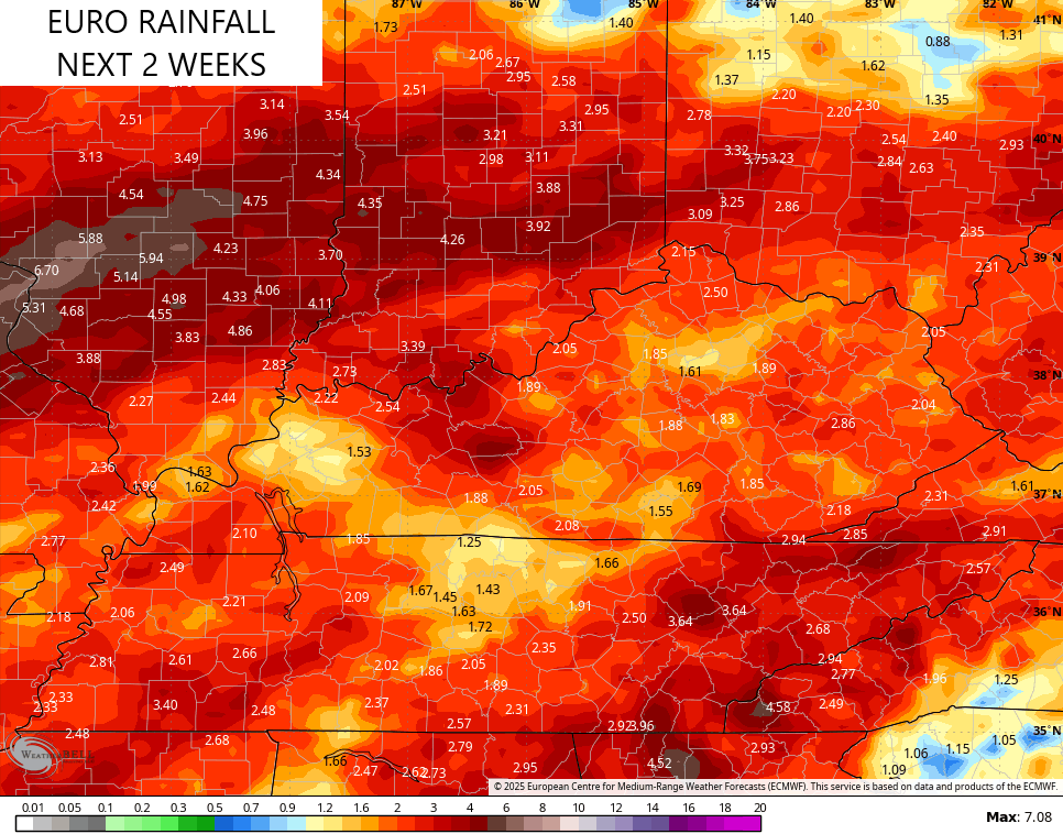
Better weather blows in behind this Monday night and Tuesday as temps stay seasonable. Temps climb later next week as the threat for showers and storms fires back up across our region. Does this kick off a more active pattern to end April and begin May? The models are split on that idea.
The GFS says yes to much more action…
The EURO isn’t as excited about the potential…
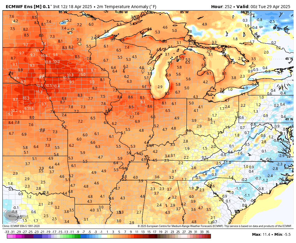
As far as temps are concerned, the EURO Ensembles show warmer than normal numbers during this same time period…
I leave you with the Saturday edition of your storm tracking tools…

Current watches

Possible Watch Areas

Make it a sensational Saturday and take care.

I hope the EURO is right.
Very likely with a very strong high pressure ridge to our east.