Good Sunday and Happy Easter, everyone. It’s shaping up to be one of the warmest Easters on record for Kentucky as many areas see temps surge into the 80s. This is ahead of a cold front bringing showers and storms into the region tonight and early Monday.
Temps today can reach the mid and upper 80s across parts of the state. Record daily highs or record warm Easters, or both, are possible today. Wow!
The threat for severe storms should hang to our west today…

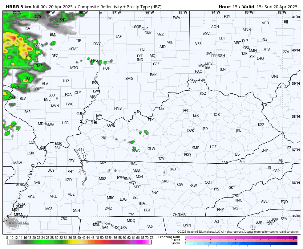
The future radar from the HRRR shows our line of showers and thunderstorms moving from west to east across the state tonight and Monday…
Highs come down into the low 70s Monday and Tuesday before bouncing back up again on Wednesday. This is ahead of a pattern that turns more active from late next week and this pattern looks to stick around into the first few days of May…
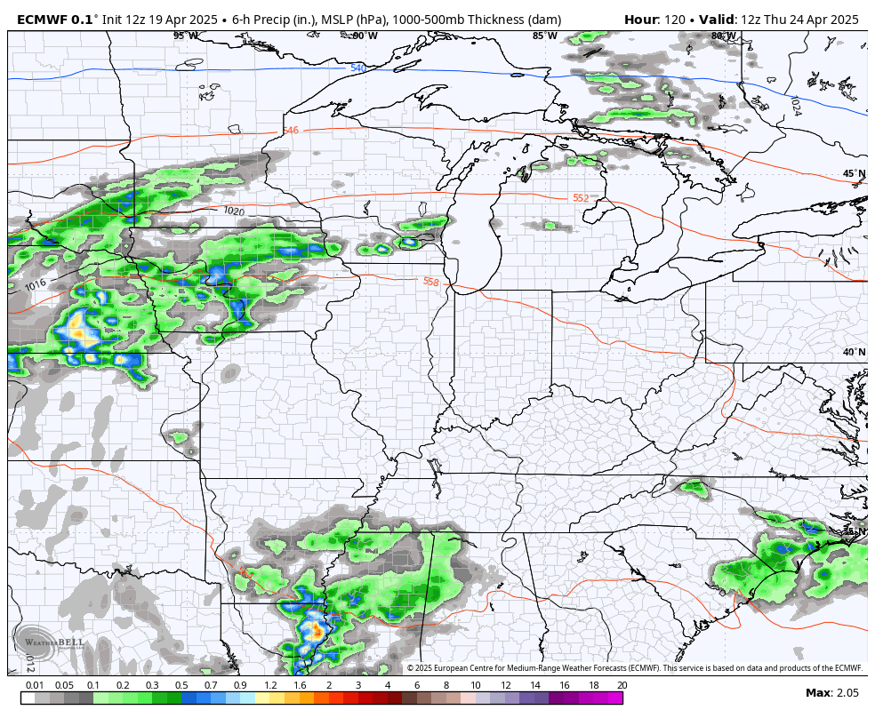
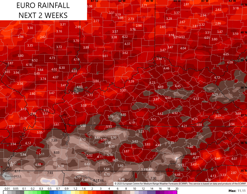
That’s the EURO and it joined the GFS in seeing the possibility of heavier rains setting up during this time…
The GFS has had this trend for the past few days and continues to suggest stormy times…
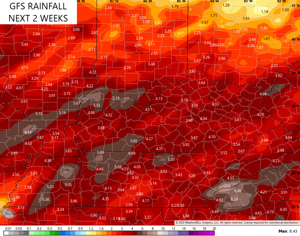
This may vewry well mean rounds of showers and storms kicking in for Kentucky Derby week.
I still expect the overall pattern to turn back to below normal for the month of May as a whole.
I lave you guys with your daily dose of storm tracking toys…

Current watches

Possible Watch Areas

Make it a sensational Sunday and take care.

Has anyone else been using their AC? I don’t care what month of the year it is, if it’s overly warm I turn it on. I’m the complete opposite with the heat… I’ll wait until the BITTER END to turn it on.
Yes, I turned on my air conditioning units last week. Also the ceiling fans. Not looking forward to the possibility of storms / tornadoes in the next two months, but that’s what we have to deal with in this climate we live in.
A friend of mine, who lives in Colorado sent me pictures of the beautiful Snowfall. The kind of Snow that our area never recieves. Best out West in my opinion.
Have a Bless Easter Everyone
Yes, I finally had to turn it on last night (which was probably at least one day too late) but my mom gets cold easily so I tried to hold off for her sake. After 2 days with temps above 86 degress, it was just too hot upstairs & I had to get some cool air flowing!
I have a unit for the upstairs and the main unit downstairs. The basement stays naturally cool to cold year round.
I turn on heat and air when I need it.
Also, I still contend that May will not go below normal.