Good Thursday, everyone. Scattered showers and thunderstorms are back into the picture today and will increase a bit before we hit the weekend. After a cooler wind cleans the skies up, the focus turns to Kentucky Derby week and the potential for more in the way of showers and storms.
Temps out there today hit 75-80 in most areas with moisture streaming in from the south. That means a scattering of showers and thunderstorms with some hit and run heavy rains oni the local scale.
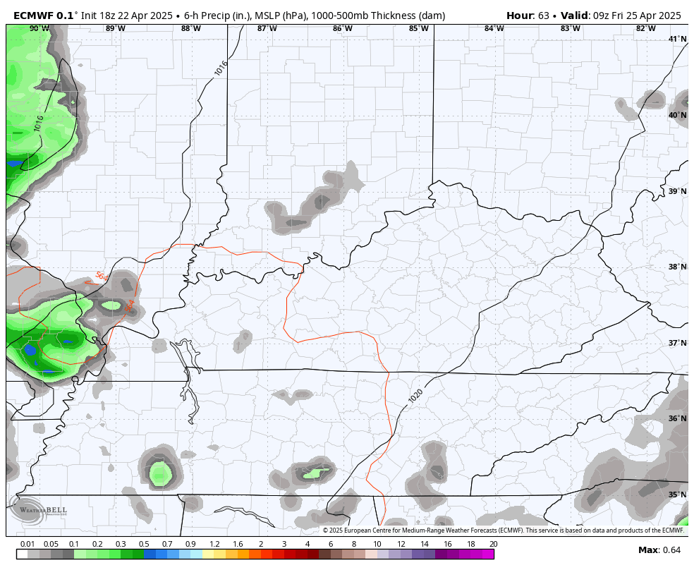
A cold front moves into the picture Friday night with an increase in showers and boomers ahead of it. A few strong storms will be possible along and ahead of this front with just a few lingering showers behind the boundary into Saturday morning.
The EURO shows all this Friday through Saturday…
Cooler winds take over this weekend with highs in the 60s. Overnight lows will also fall and may reach the upper 30s and low 40s by Sunday morning.
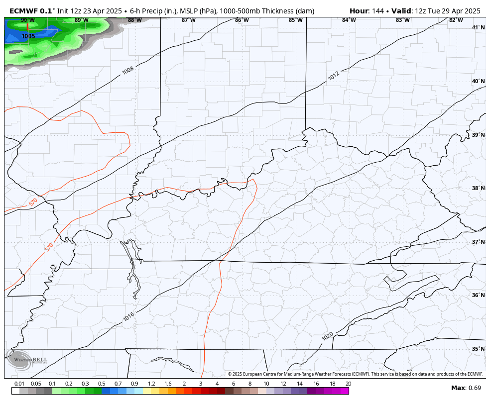
Monday looks much warmer with more in the way of sunshine. That warm air is ahead of the first of two cold front sliding in Kentucky Derby week. The first brings showers and storms to the region late Tuesday and Wednesday with the second front arriving at some point by Oaks Day or early Derby Day.
The EURO looks like this…
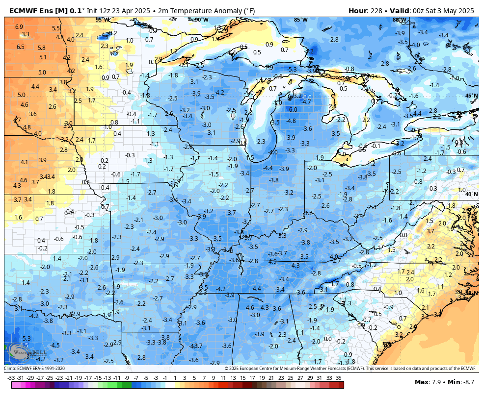
Whenever that second front moves in, it’s likely to unleash a much colder air mass that takes us into the first full week of May. Look how far below normal the EURO is showing temps from Derby Day through May 8th…
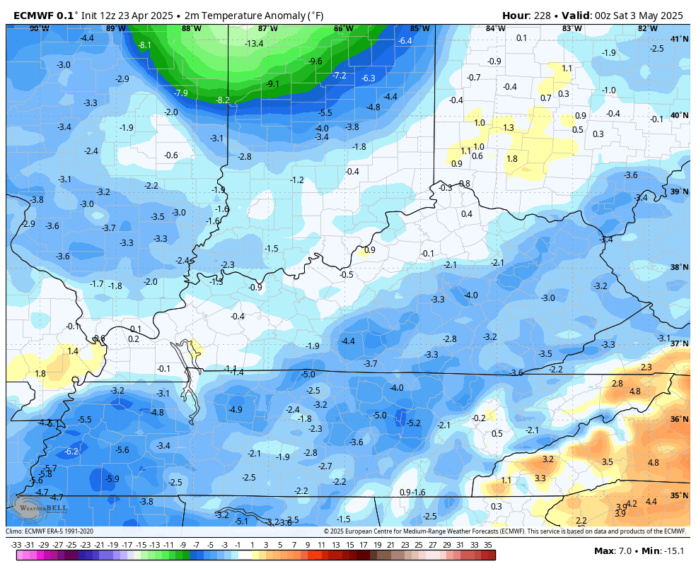
Both the EURO and GFS are showing the potential for lows to reach the 30s at some point during this time…
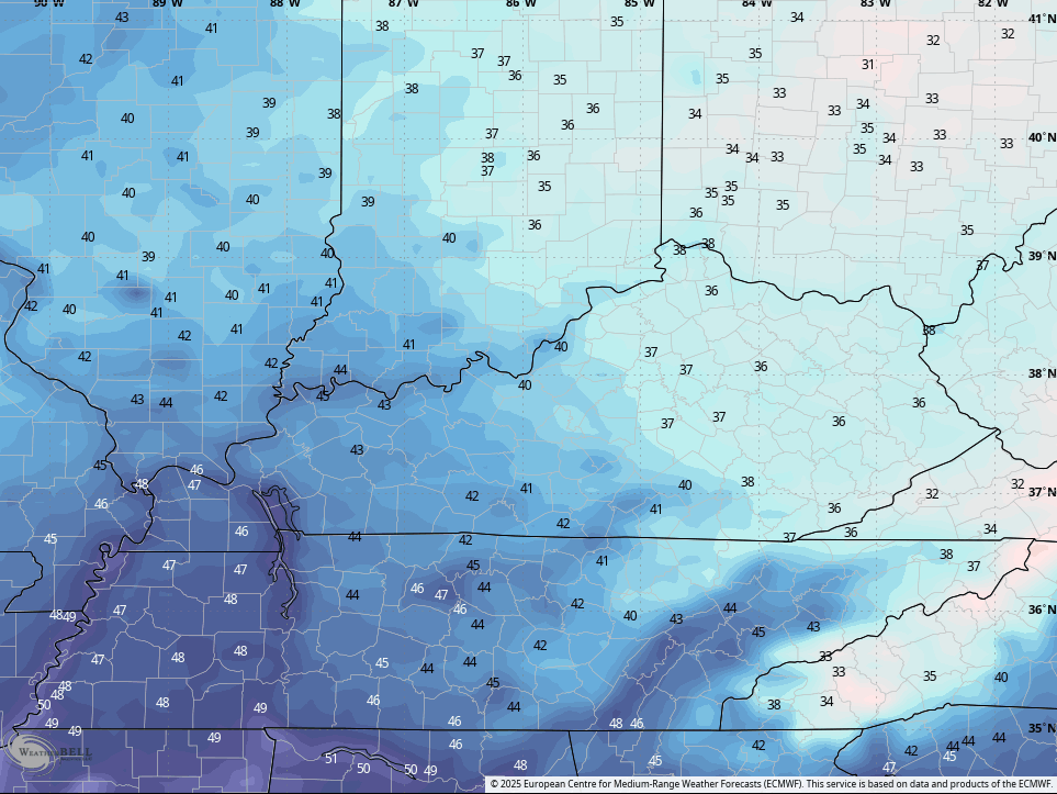
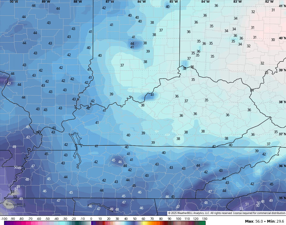
Can we get some patchy frost during this time? I think that’s been talked about as a possibility, but I can’t remember where I read that.
The EURO Ensembles are also showing the chillier than normal numbers…
I leave you with your Thursday thunder trackers…

Make it a great Thursday and take care.

Still not buying it.
Dogwood Winter ? If it doesn’t rain in the next several days, an early dry spell may develop. This Spring, so far severe weather threats for our area of the Country have been down. We shall see what happens next month ?
ENSO / neutral conditions are at play according to NOAA.