Good Friday, everyone. We are making our way into the final weekend of April on a stormy note as scattered boomers roll through. These will usher in a much cooler setup for the weekend, but the focus continues to be on an active Kentucky Derby Week.
Let’s begin with today and hit the fast-forward button. Highs are in the 70s with scattered showers and storms around through tonight. Some of these showers and storms may put down enough rain to cause some local high water issues.
A cold front sweeps through tonight and early Saturday with some lingering showers giving way to partly sunny skies. Temps will be noticeably cooler with low and middle 60s for many. With clearing skies Saturday night, lows can drop into the upper 30s and low 40s by Sunday morning…
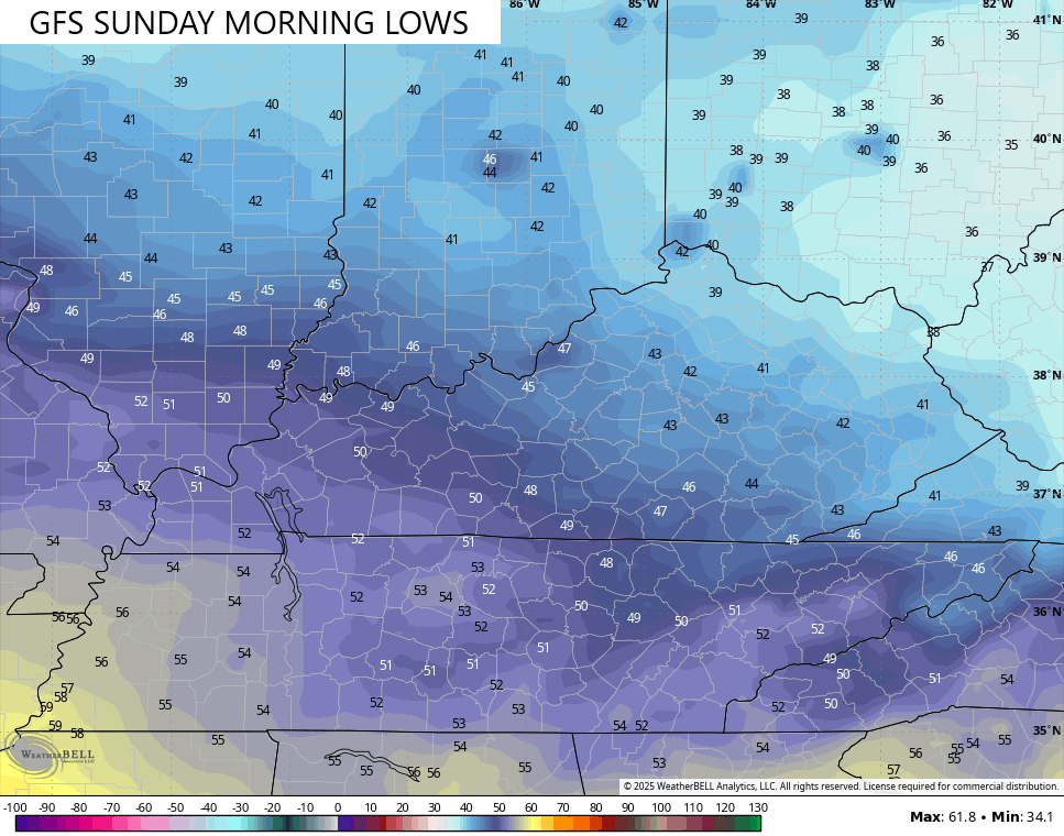
Sunday looks really good with lots of sun, but temps are only in the 60s.
The overall pattern looks rather blocky across North America as we end April and move into the first week and change of May. This is a pretty busy upper air setup…
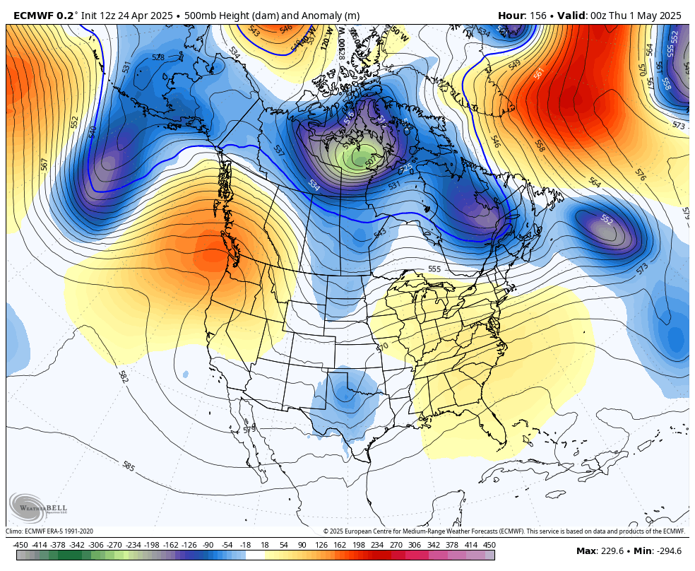
The end result around here is for an increase in showers and storms for Kentucky Derby Week. The models are still trying to figure out if we can calm this down a bit by Derby Day, but the EURO suggests it’s a close call.
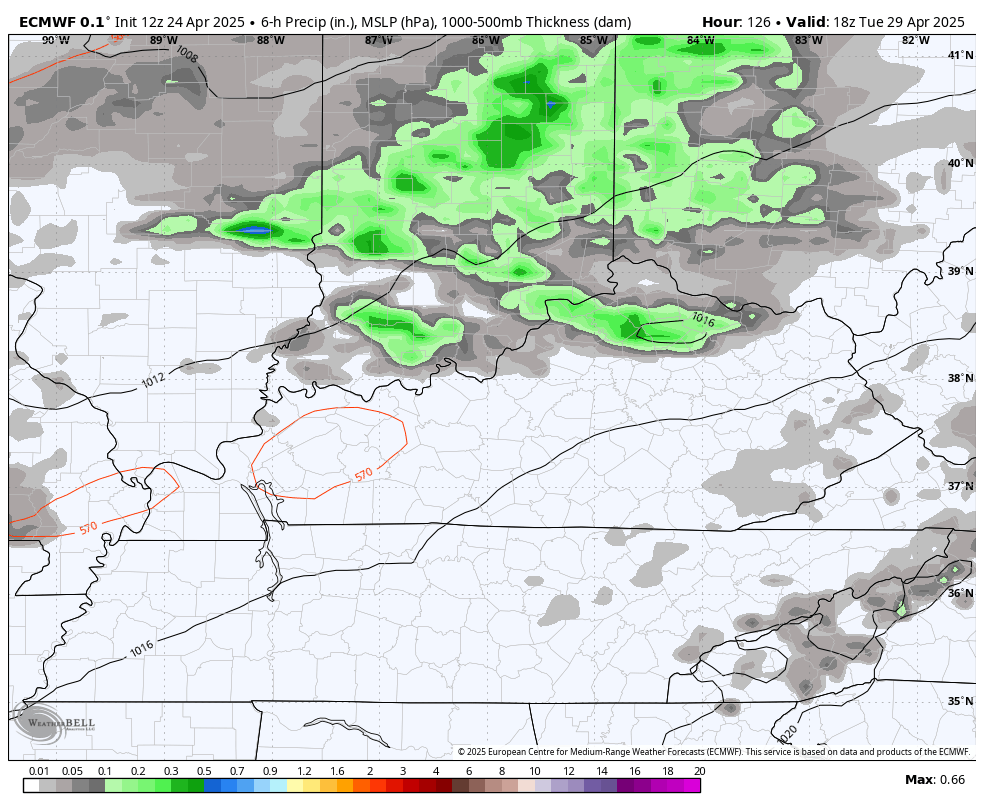
This animation starts Tuesday and ends on Kentucky Derby Saturday…
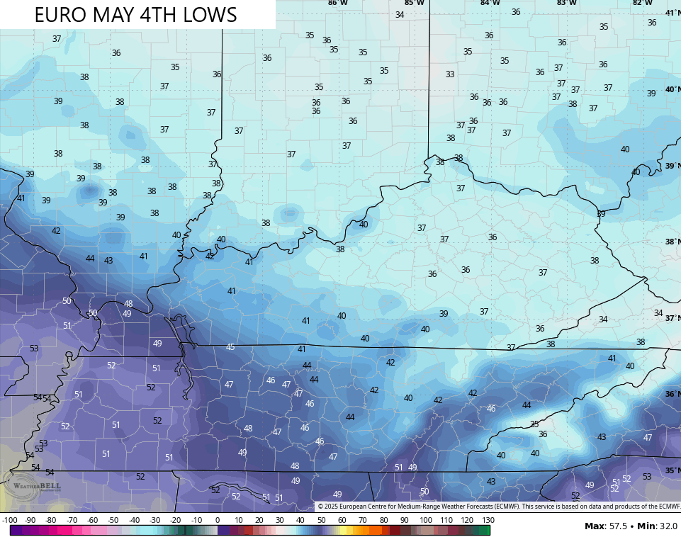
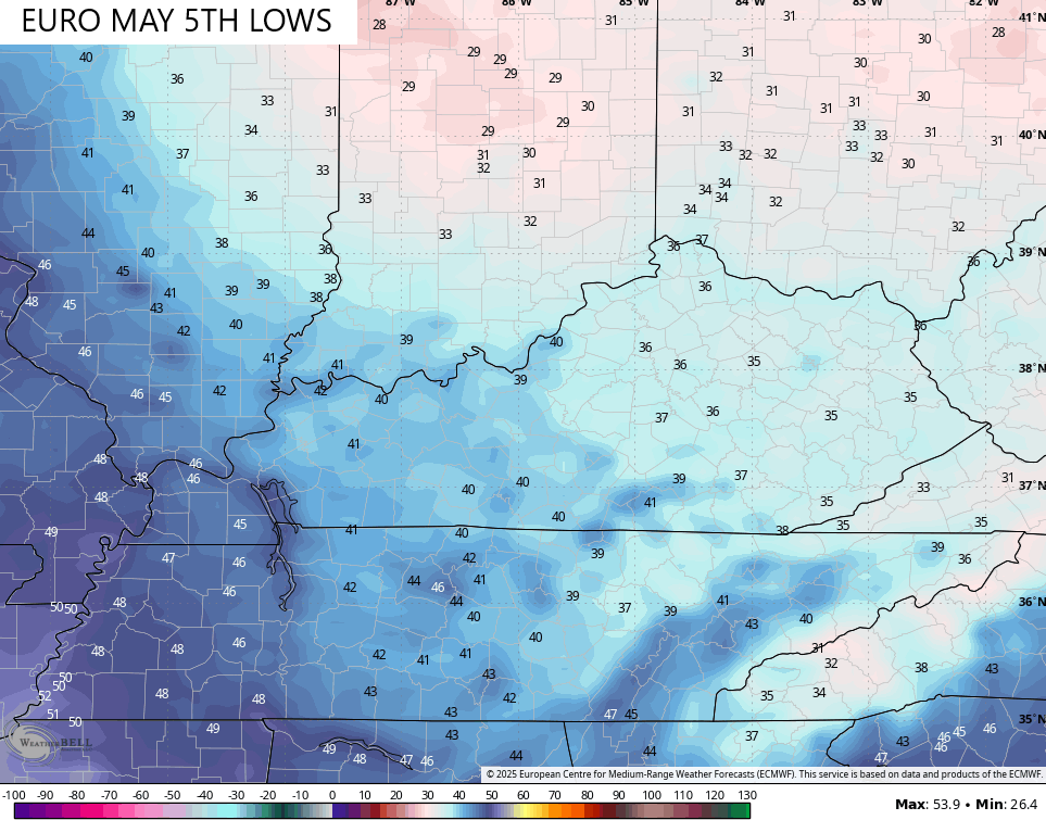
That front moving in around Derby Day means business in terms of potential below normal temps. The EURO isn’t shy with temps going well below normal from Derby Weekend through the end of the run on May 9th…
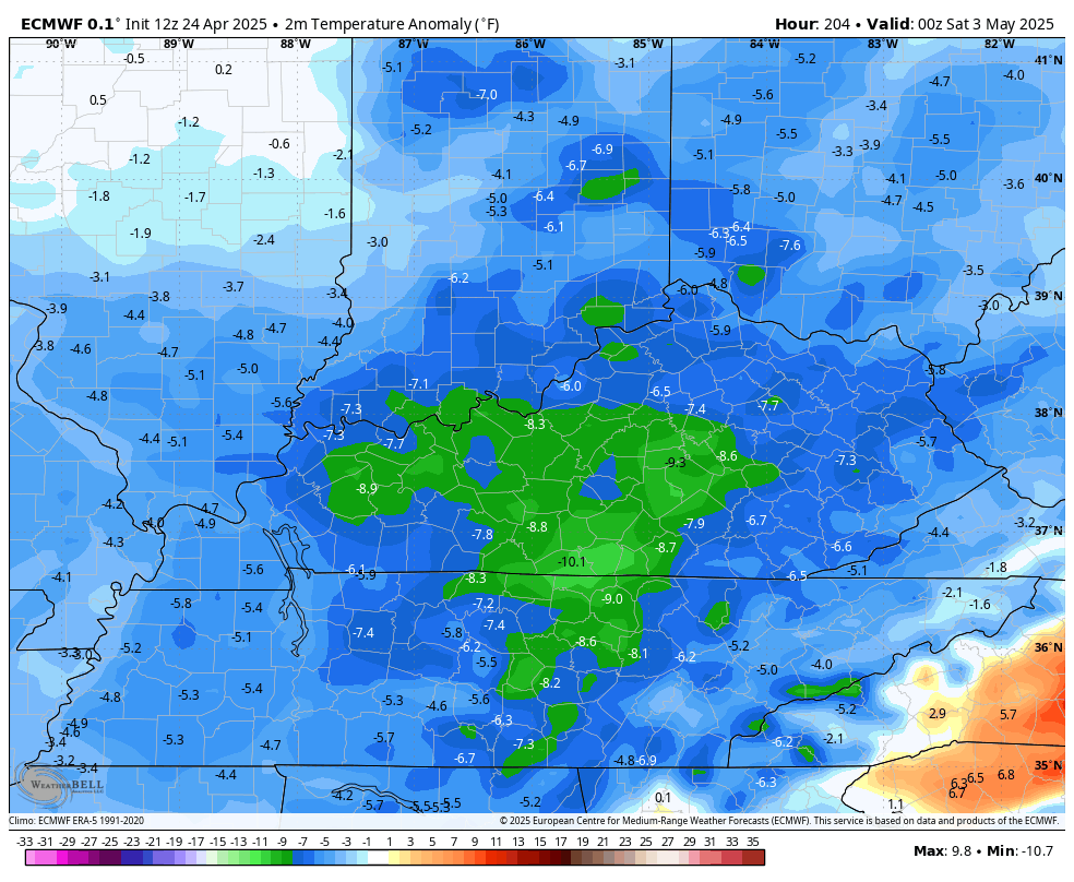
Can we get some patchy frost out of this? That’s a possibility with the EURO showing back to back mornings with lows into the 30s…
Blah, blah, blah.
I leave you guys with your Friday storm tracking tools…

Have a fantastic Friday and take care.

fine for me.. anything that’s not HOT and humid… or frigid either. I like the cool temps but not bitterly cold. Staying warm is easier than cooling off when it’s hot. I do like summer…don’t get me wrong.. I like all of the seasons… I just feel like summer lasts the longest.. so anything that cuts into that is fine with me.
I’ve put on my air conditioning and heat more times this month than I can remember.
The warmer months are when my mind and body relax, so that’s why they are better than winter.
It’s a health thing Jeff. After this Winter I feel the same way. I need the warmth too.