Good Monday, everyone. Warm, moist air is surging into the region today and will combine with a cold front to bring severe weather to the region. This severe threat is greatest Tuesday into Tuesday night with additional showers and storms through the end of Kentucky Derby Week.
Temps today reach the 80s on a strong southwest flow. There’s the chance for an isolated shower or storm to go up, but most stay dry.
A cold front sags toward the region Tuesday, providing the trigger for thunderstorms go to up. These storms are scattered early on but rapidly increase along and ahead of the cold front Tuesday afternoon and evening.
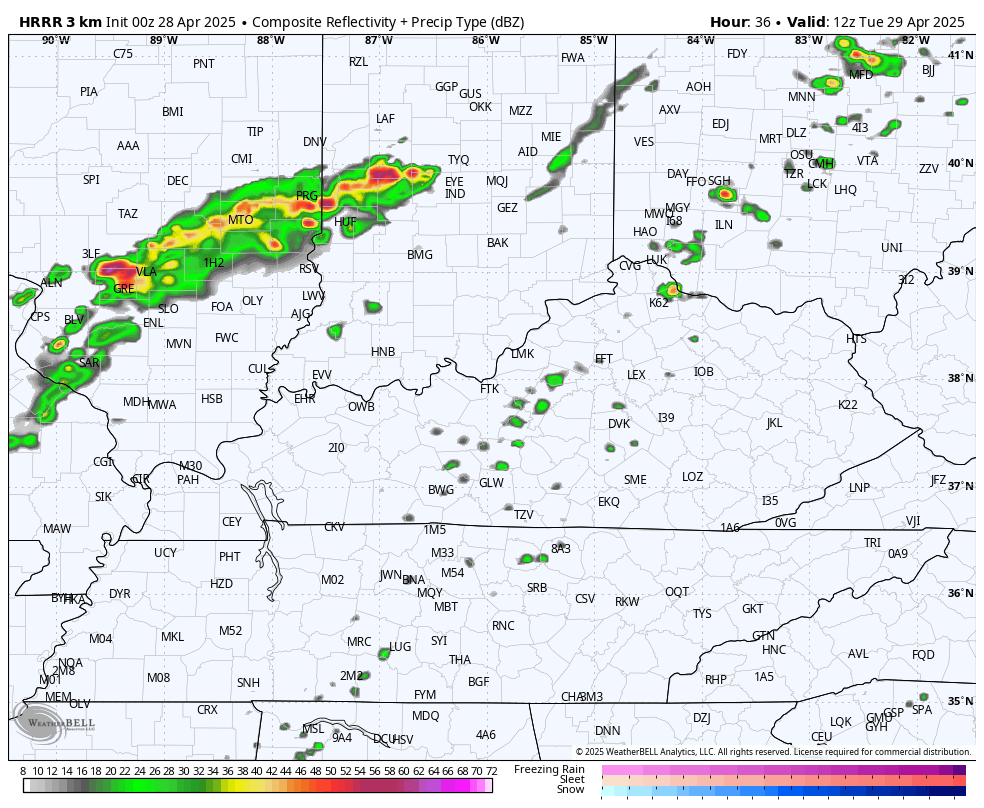
The future radar from the HRRR shows some big-time storms cranking during the afternoon. This animation goes from 8am Tuesday through 8pm Tuesday…
The Storm Prediction Center continues to highlight the state and region in the Tuesday Severe Weather Outlook…

In terms of the individual severe threats, there is a low-end risk for a few tornadoes…

Damaging winds and large hail are a much greater risk for Kentucky and surrounding areas…


Some very large hail is possible with some of these storms!
This cold front slows down on top of us and keeps more in the way of showers and storms going into Wednesday. Low pressure develops along this boundary and rolls through Thursday into early Kentucky Oaks Day Friday. If this low tracks just to our west, it would bring another severe threat along and ahead of it Thursday and Thursday night.
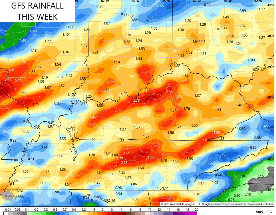
This animation from the GFS shows this whole scenario from Tuesday morning through Kentucky Derby morning…

The models will struggle with the rainfall forecasts with this setup, so keep that in mind. A general 1″-3″ of rain with locally higher amounts are a good bet through Friday night…
I’ll have an update later today and I’ll be on WKYT-TV starting at 4pm. As always, I leave you with all the tools you need to track storms in our region…

Current watches

Possible Watch Areas

Make it a magnificent Monday and take care.

I will be glad when the period of severe weather threats end. Hoping that May is more Spring like, with just normal rainfall.