Good Wednesday to one and all. It’s another day featuring the potential for a few strong or severe storms as this similar setup rolls into Thursday. Beyond that, the chance for rain looks to linger into Kentucky Derby Weekend for some areas.
Temps today reach the upper 70s to low 80s in most areas with a mix of sun and clouds. The chance is there for another cluster of strong to severe storms, especially across central and northern Kentucky. This shows up on the future radar from the HRRR…
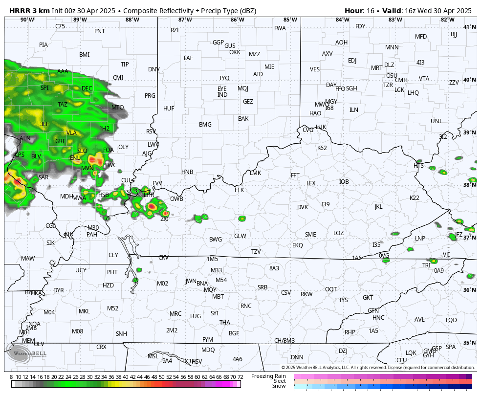
Because of this, the Storm Prediction Center has a low-end risk for a few severe storms in this part of the region…

The threat for strong to severe storms should increase a bit for the entire region as we go into Thursday and Thursday evening. The Hi Res NAM shows these storms going up and rolling from west to east…
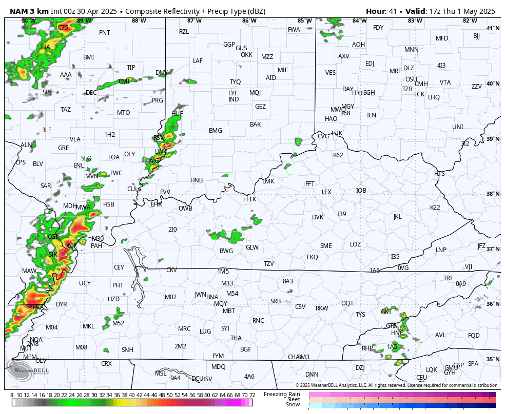
That’s likely to bring another damaging wind threat across much of Kentucky and the Storm Prediction Center is highlighting this potential for Thursday…

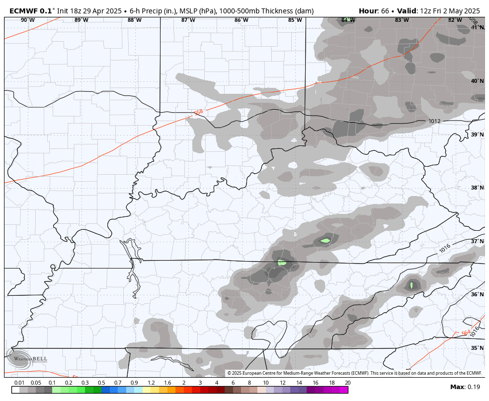
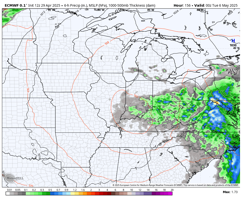
Kentucky Oaks Day looks very warm with the potential for more showers and storms firing up later in the day. This is ahead of a low pressure pushing in from the southwest to start Kentucky Derby Weekend.
Since the weekend, I’ve talked about the potential for this thing to slow down on top of us, keeping some rain chances into the big weekend. Unfortunately, the EURO is taking this potential to a whole new leverl.
Watch how showers and some thunder spin around this cut off low from Derby Day through Monday…
If that’s the case, ugh.
The AI version of the EURO is showing something very similar…
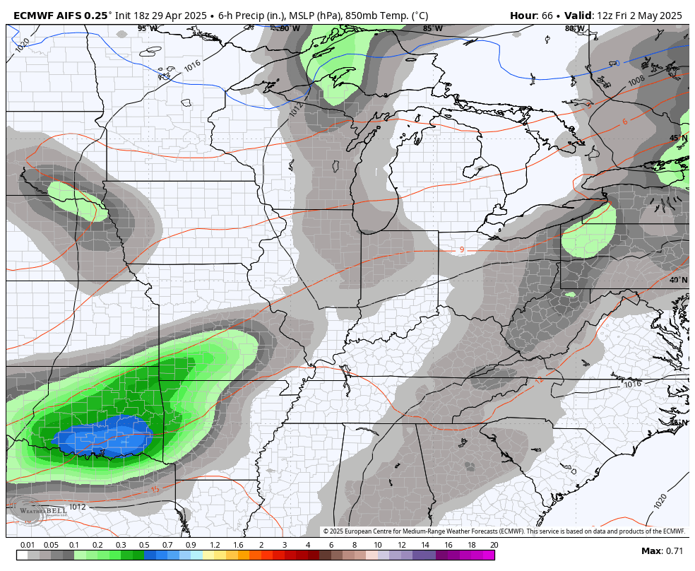
The operational run of the EURO then keeps this cutoff low spinning around here all of next week into next weekend…
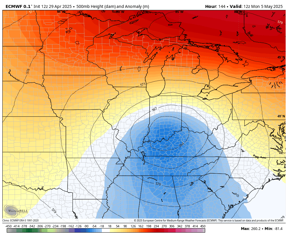
That setup would mean a daily threat for showers and storms during that same time…
Here’s hoping the EURO is overreacting with that whole scenario, but a blocky pattern can produce some ugly days.
As usual, I have all your storm tracking needs for the day…

Current watches

Possible Watch Areas

Make it a wonderful Wednesday and take care.

A rainy Spring is usually followed by a hot, dry Summer and late Fall weather. This happens almost every year in our part of the country. Not the best climate compared to other parts of the CONUS.
It’s crazy to think that (lexington, as an example) could go through this point right now through the entire month of may with ZERO rain… and by the end of May the year would still be ABOVE normal! LOL
It seems that areas near large bodies of water, like the east side of the Great Lakes have a more balance in temperatures and precipitation. Modification of the climate due to temperatures of the Lakes water. Also being at a high elevation will produce a balance.
Last night was vivid lighting for sure and it seemed heavy rain but in waves. I have had enough rain to last a lifetime. Hopefully it slows down in May. I wonder to if we have a very hot summer I can’t remember if it was in the 80s last April or not??
I remember some of the hot Summers, because I had to keep my plant nursery irrigated. Nineteen seventy six, and 1987 -88. Temperatures over 100 degrees in July and August, and part of September. We didn’t have a very long Fall. Went right to a Snowless Winter.
2002, 2007, 2012, 2019 and 2024 (not a tame summer despite popular opinion) all had highs near or over 100 at various points.
Thanks for the information Jeff. I didn’t realize there were that many hot Summers here in Kentucky. I made a bold prediction that we may be in for a long and hot Summer. NOAA is also indicating the same. We shall see.