Good Saturday and Happy Kentucky Derby Day. Rounds of heavy rain and a few strong storms are rumbling across the Commonwealth on this big day. Obviously, that’s not ideal and neither is the ugly stuff coming in behind it for Sunday and Monday.
Rain and thunderstorms increase from west to east across the state today and a few of these storms may be strong or severe. The greatest chance for any severe storm action will be across eastern Kentucky. Here’s today’s Severe Weather Outlook from the Storm Prediction Center…

The setup today may produce quite a bit of rain, especially across central Kentucky. Some areas may see 1″-3″ of rain today, causing local high water issues.
The upper low spinning in here today will slow down right on top of us, spinning through early next week. This will keep all kinds of spiraling showers and a few rumbles of thunder going for Sunday and Monday with lingering stuff into Tuesday.
The models agree on all this…
GFS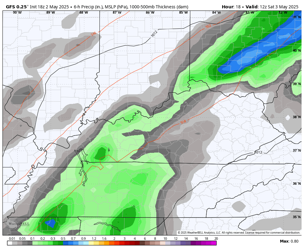
EURO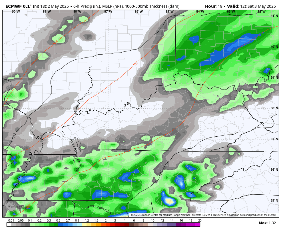
Cold air funnel clouds may even show up at times this weekend. These generally don’t become tornadoes, but that’s something to keep an eye out for.
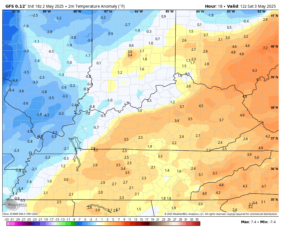
Temps turn downright now cool with highs that may not get out of the 50s for some on Sunday and Monday. Some serious Barney colors show up and that indicates some well below normal temps…
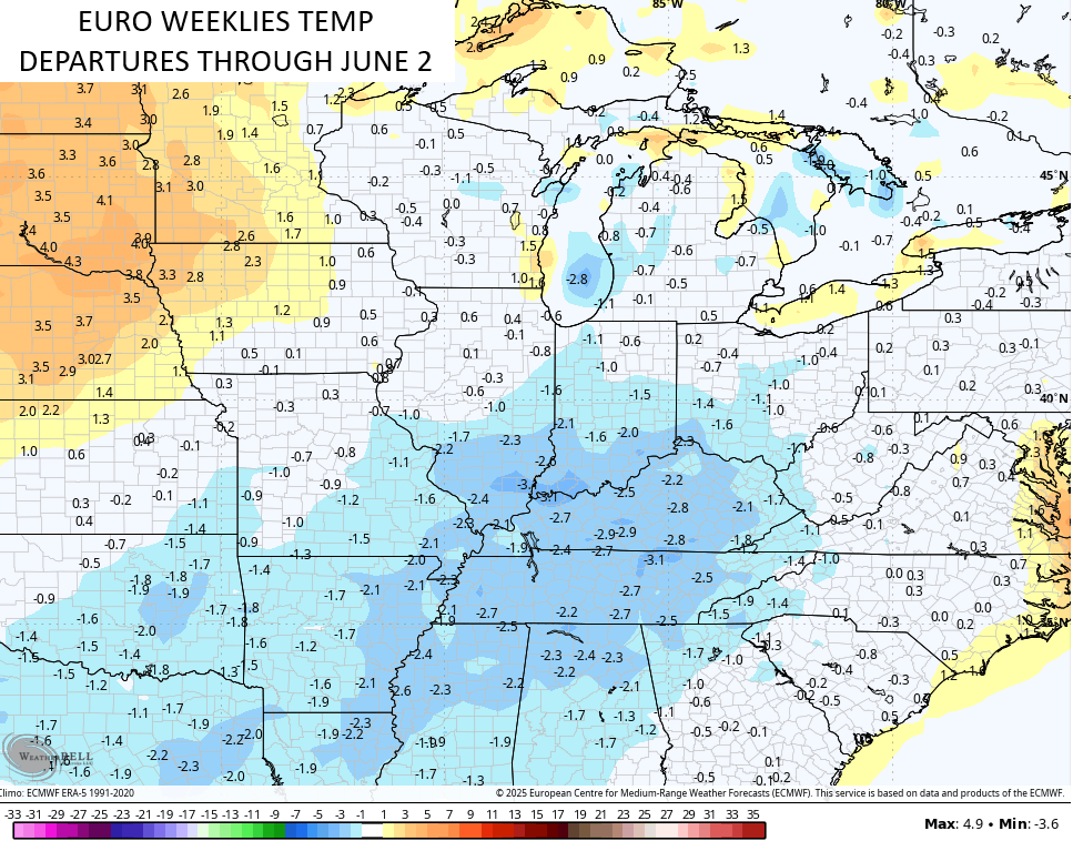
This is cool air in May has been something showing up on the EURO Weeklies for a long time and the new run has the next 32 days showing up cooler than normal…
With so much water in the ground, it’s going to be tough to get a lot of true heat around here this upcoming summer.
I leave you guys with your severe weather tracking tools…

Current watches

Possible Watch Areas

Make it a darling of a Derby Day and take care.

The other day was low 80’s with relatively high humidity. Outside, working all day. It wasn’t terrible, but it will be just fine if our temps never climb into the 90’s this summer.
I’d be happy with that.
I wouldn’t
Never ever experience a Summer where the high temperatures didn’t exceed 90 degrees.
In 2004 I think Lexington didn’t officially hit 90.
https://www.google.com/search?q=did+lexington+ky+ever+not+reach+90+degrees+fahrenheit&sca_esv=1dda3acef72a6239&sxsrf=AHTn8zrGTy6zluBrC5-v0FvxP2pzoGPnOQ%3A1746356160441&source=hp&ei=wEcXaNKxGY3fwN4PhP-BiQQ&iflsig=ACkRmUkAAAAAaBdV0Bo-VXpmoQ9nI7GbzvO1W8E6T7J6&oq=did+Lexington%2C+Ky+ever+not+reach+90&gs_lp=Egdnd3Mtd2l6IiNkaWQgTGV4aW5ndG9uLCBLeSBldmVyIG5vdCByZWFjaCA5MCoCCAEyBRAhGKABMgUQIRigATIFECEYoAEyBRAhGKABSNO5AlAAWJ6dAnABeACQAQCYAXmgAdgcqgEFMTYuMjC4AQHIAQD4AQGYAiWgAtEewgIOEAAYgAQYsQMYgwEYigXCAg4QLhiABBixAxiDARiKBcICCxAAGIAEGLEDGIMBwgIOEC4YgAQYsQMY0QMYxwHCAgsQLhiABBjRAxjHAcICERAuGIAEGLEDGNEDGIMBGMcBwgIOEC4YgAQYsQMYxwEYrwHCAggQABiABBixA8ICCBAuGIAEGLEDwgIEEAAYA8ICBRAAGIAEwgIFECEYqwLCAgcQIRigARgKmAMAkgcFMTUuMjKgB_PBAbIHBTE0LjIyuAfMHg&sclient=gws-wiz