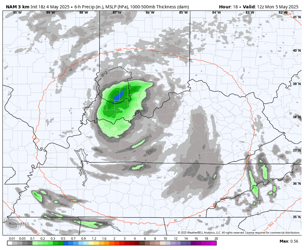
Good Monday to one and all. Our potent upper low continues to sit and spin right on top of the Bluegrass state. This means a very ugly start to what is a very cool first full week of May as temps continue to run way below normal.
Temps today only reach the low and mid 50s in many areas and that’s roughly 20 degrees colder than the normal highs in the middle 70s.
Gusty showers and a few thunderstorms continue to spiral across our region and some of these may throw some small hail at us again. This will start to pull away on Tuesday, thankfully.
Even though this is ugly in terms of the actual weather, it’s really cool to see on radar and the models…
Temps Tuesday are in the 60-65 degree range with upper 60s to near 70 for some by Wednesday.
The setup later this week into the weekend continues the colder than normal look as another upper low impacts our weather. Just how much of an impact remains to be seen, but there’s still the chance for some scattered showers and storms.
This animation from the EURO starts Wednesday morning and ends next Monday morning…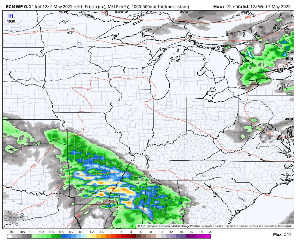
Regardless of how much of an impact it has on us with possible showers and storms, it’s a continuation of this stupid colder than normal pattern. The EURO has numbers way below normal during this period…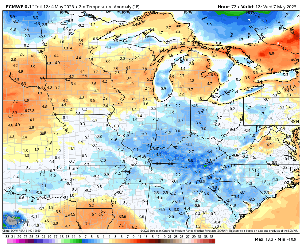
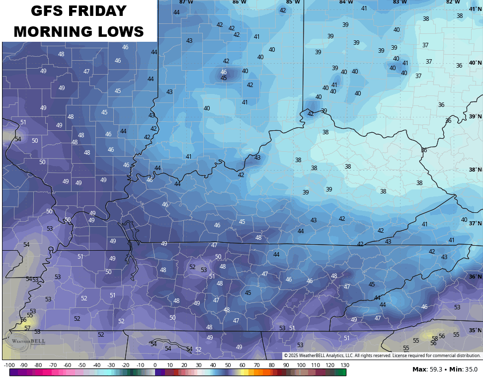
The GFS is also seeing the colder than normal look…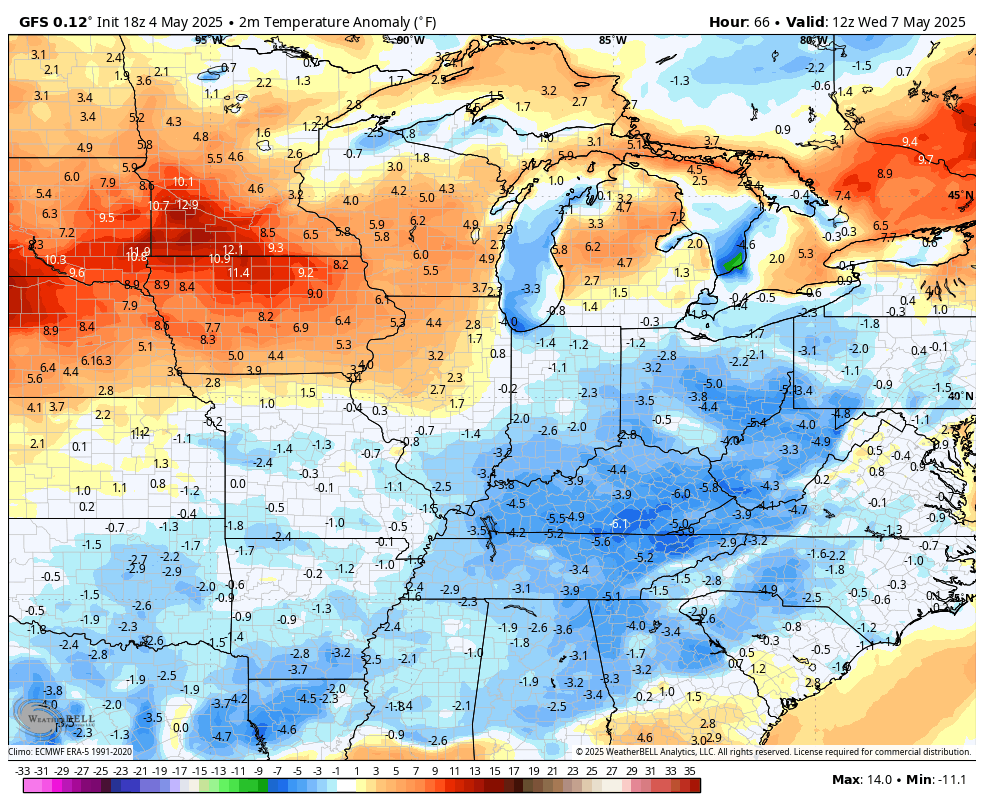
If skies clear Friday and Saturday mornings, temps may drop into the 30s and give us a kiss of frost…
We may very well come out of this pattern, but not until into the middle of the month. The EURO shows our trough slowly being replaced by that blossoming ridge to the northwest…

The EURO Ensembles show the numbers going above normal once past the 15th…

I leave you with your shower and storm tracking tools for this Monday…

Have a magnificent Monday and take care.

The Mesonet recorded 1.89 ” of rain in my area of Taylor County in the past 48 hours. I just dumped out 4.5 ” out of my rain gauge. Apparently, the Mesonet rain gauge is considerable distance from where I live. Maybe in Campbellsville, don’t know for sure.
If we had this weather system in the months of Feburary or March we could have had a record breaking heavy wet Snowstorm. The upper layers of the atmosphere are very cold to support this scenario.