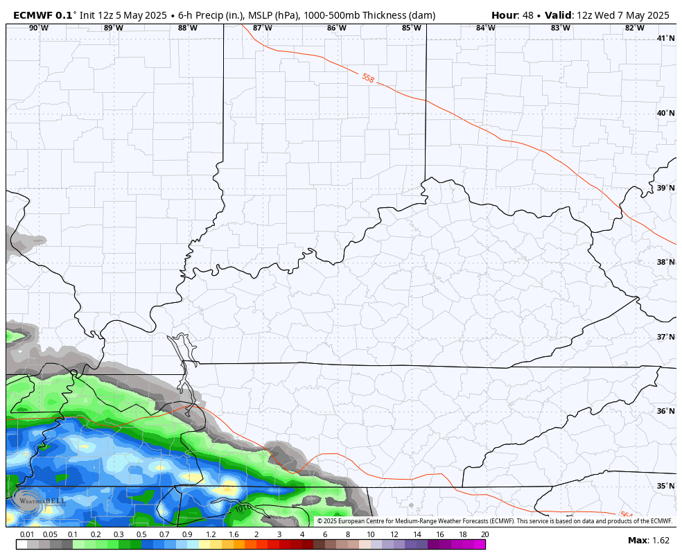
Good Tuesday, everyone. It’s a much better weather day taking shape across Kentucky as our slow-moving upper low begins to pull away. Temps get closer to average the next few days before a cold front drops in and cuts it off at the pass.
Temps out there today reach 65-70 degrees with a mix of sun and clouds with just a small shower chance in the north and northeast.
Temps on Wednesday should hit 70-75 with a slight chance for a shower or storm, especially in the south. A better chance for a few storms shows up with a Thursday cold front. That front drops the numbers for Friday, but brings more in the way of dry weather for the Mother’s Day weekend…
That comes with a shot of chill for Friday with lows in the upper 30s to low 40s and highs only in the low to mid 60s. Highs by Saturday make a run at 70 with 70s for highs on Mother’s Day… All with partly to mostly sunny skies.
The pattern next week does try to break warmer than normal for a bit, but just how long that lasts is the question.
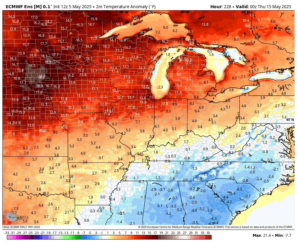
The EURO is the most robust on warmth through the end of the run on May 20th…

The EURO Ensembles hints at cooler air coming back in at the end of the run…
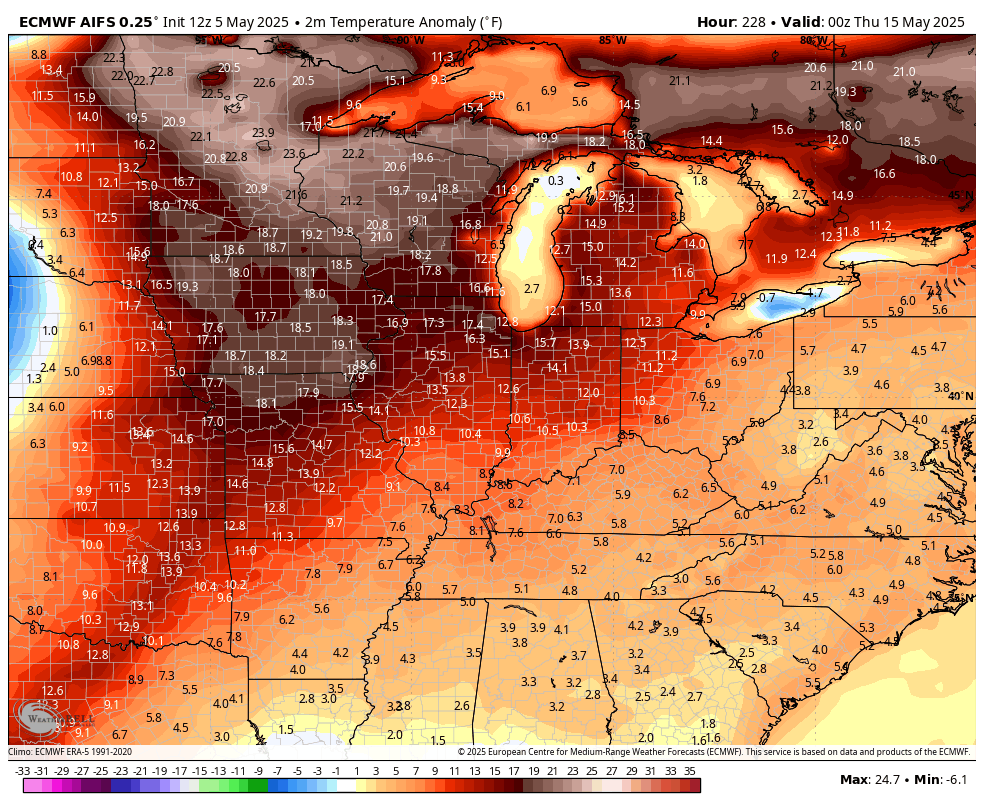
The AI version of the EURO sees another cold shot behind that warmth…
The GFS is also seeing this possibility…
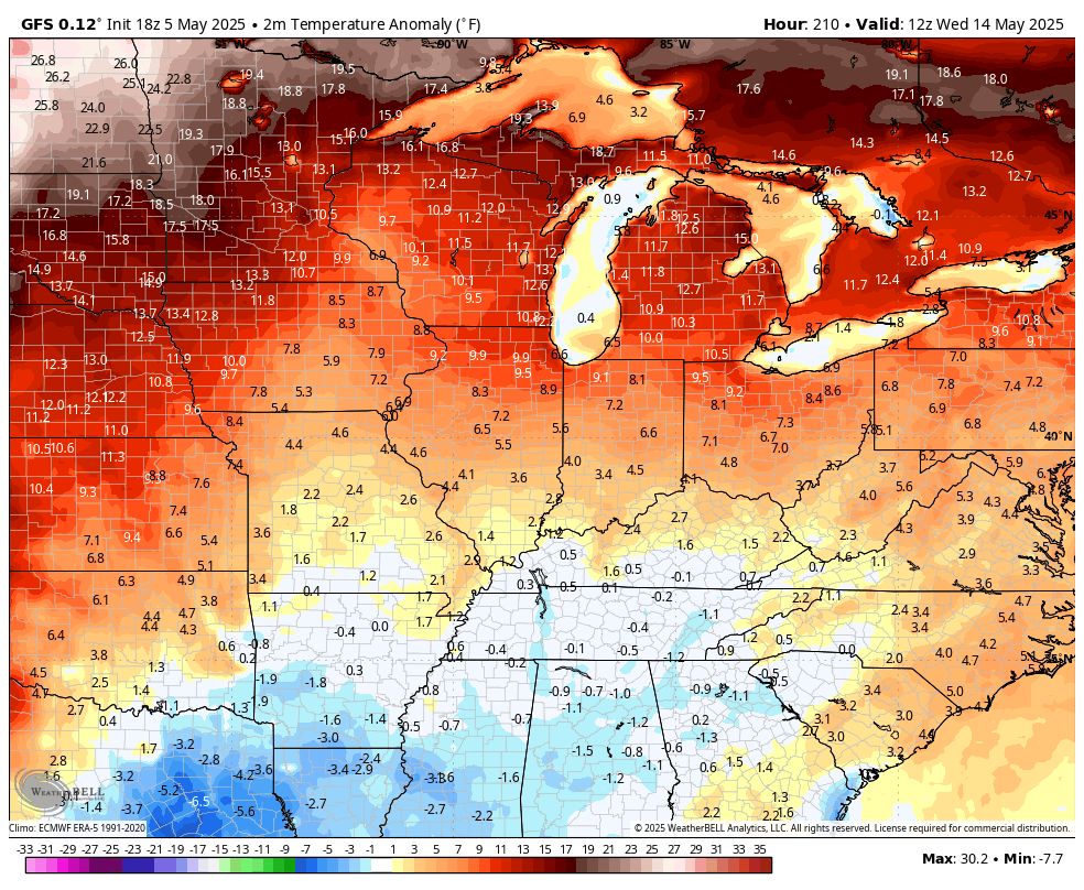
That would certainly fit the pattern we are in, but I’m really hoping it’s wrong. I’m done with spring cold, y’all!
I leave you with your Tuesday tracking toys…

Have a terrific Tuesday and take care.

I agree, ” I’m done with Spring cold too. ” Ready for the warmer and drier days ahead, but the two models that are agreeing on below normal temperatures is a possibility. That’s all it is.