Good Friday to one and all. We have a much better pattern taking shape as we head into Mother’s Day Weekend. This awesome weather will quickly give way to rounds of showers and storms moving in here by Monday, setting the stage for a stormy look.
Let’s begin with today and roll forward.
Highs are in the 60s today with a early day clouds giving way to lots of afternoon sun. Highs in the low to middle 60s for many areas.
Clear skies tonight will allow temps to drop into the upper 30s to low 40s in many areas. There’s even the chance for a touch of frost in some of the colder valleys. Saturday hits the upper 60s and low 70s with partly sunny skies.
Mother’s Day looks amazing with temps hitting 75-80 in several areas. Soak it up, moms!
A slow-moving low spinning across the Gulf states this weekend will begin to lift to the north, bringing rounds of showers and storms with it. These settle in here on Monday and look to take us through Wednesday…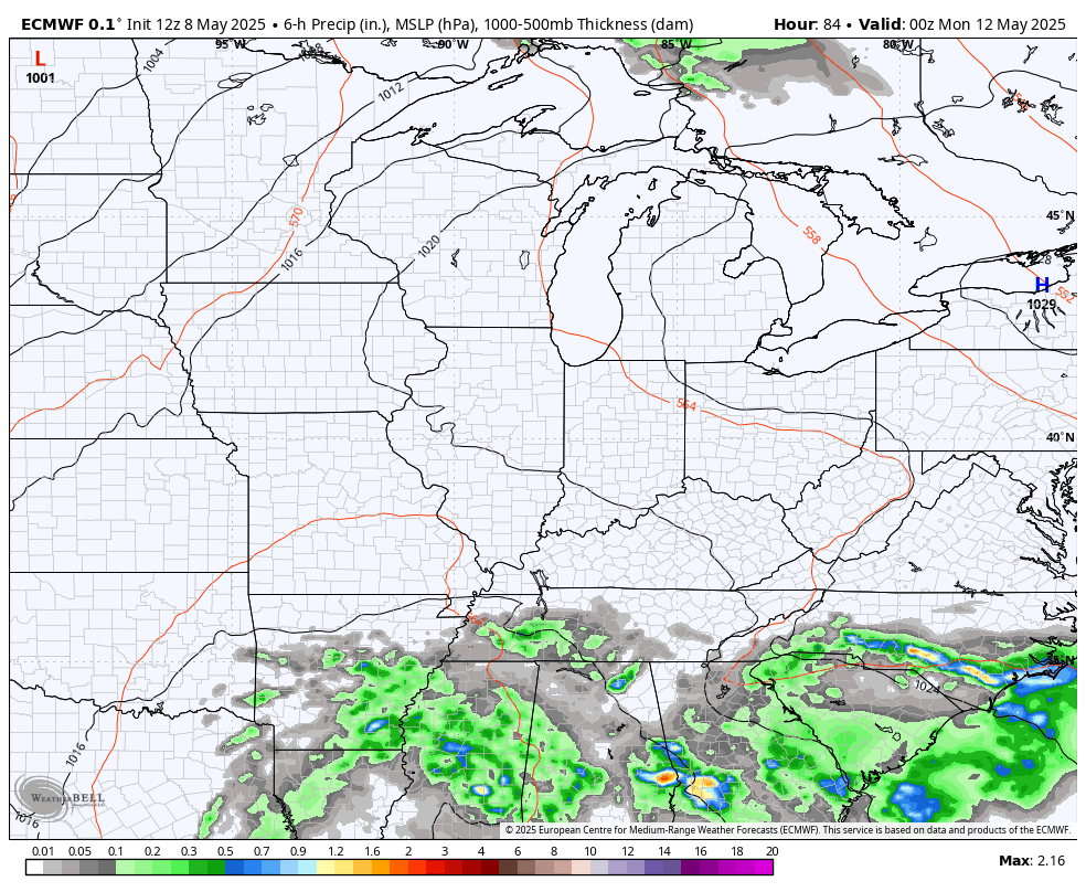
A few strong to severe storms can’t be ruled out.
I think the severe threat is greater with the systems that follow that up late next week into the following week. This has the look of bringing several rounds of severe storms into our part of the world…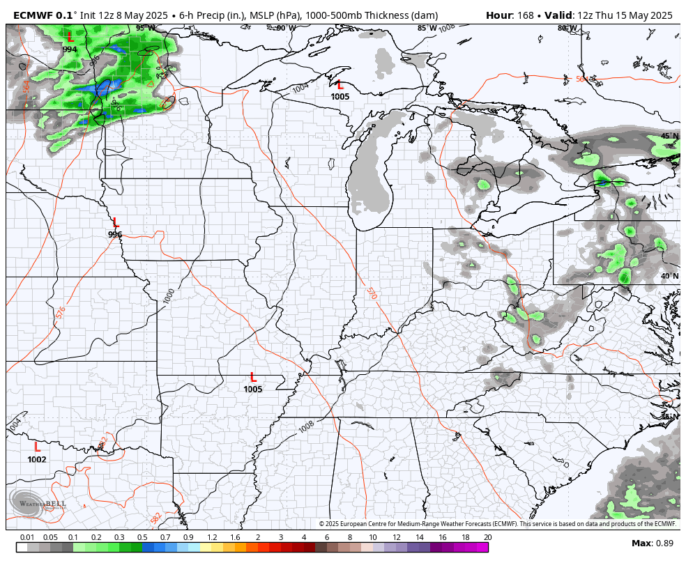
The severe weather setup during this time is definitely one to watch.
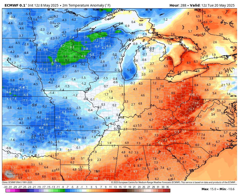
The models continue to point toward this leading us back into a pattern of below normal temps. Here’s the EURO for the week of May 19th…
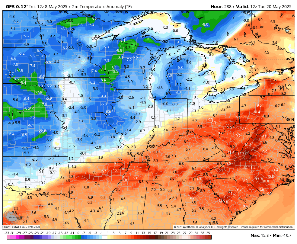
The GFS during the same time…
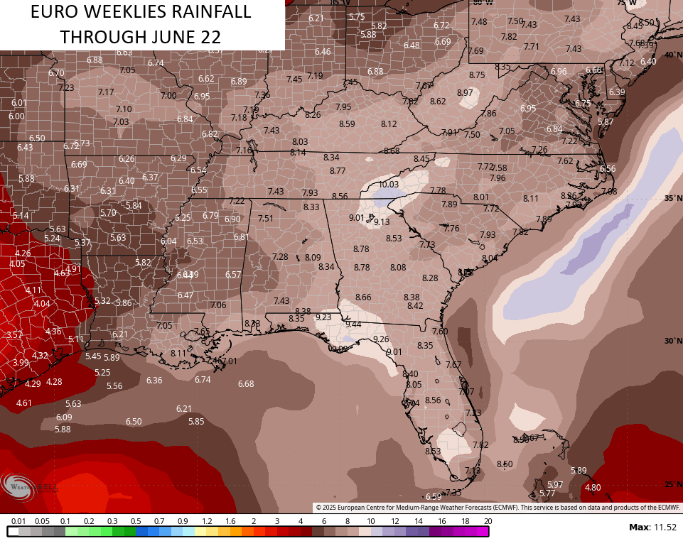
Yesterday, I shared the EURO Weeklies that keep the temps averaging below normal through much of June. This typically comes with ample rainfall and that still appears to be the case on the average of the EURO Weeklies…
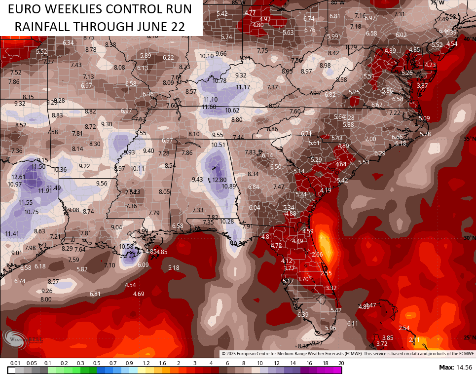
The Control Run is even more amped up…
I’m also looking at the pattern and wondering if we can get some early season tropical troubles from the Gulf of Caribbean.
Enjoy your Friday and take care.

Glad we will receive Sunshine finally. This has really been a gloomy Spring. The plant life out there looks great, and my Catawba Rhododendron has many blooms to enjoy.
About the Tropics becoming active early. One indicator would be that we are currently in a very weak ENSO / neutral, and as we head through the Summer months this is forecast to slowly phase back to ENSO / La Nina, which would increase Tropical activity later this Summer and Fall. We shall see.
Totally agree on the plant life, Schroeder. My azaleas blossomed more completely then I’ve seen in years, which is a complete turnaround from last year’s freeze disaster. My hydrangea is getting ready to flower, and the initial blooms on a rhododendron that I planted last year are amazing.
I’m not buying the junk the models are selling.
Models, seem to be all wrong lately. AI interference in my opinion.
The Climate Prediction Center has released the May ENSO discussion, and it indicates a 74% chance that ENSO-neutral conditions will continue during the June-August period, with chances exceeding 50% through August-October 2025. The likelihood for an El Nino to develop during the Fall-Wiinter are less than 15%.
https://www.ospo.noaa.gov/products/ocean/sst/anomaly/
Joe, glad your plants are preforming well. I wonder what is causing that cold water off the west coast. It has been that way since 2019 ? This will certainly hinder any formation of ENSO / El Nino. Climate change or just a cycle ? AI will have trouble with making accurate long ranged forecast.