Good Saturday to one and all. It’s a gorgeous weather day across Kentucky as temps get a little closer to normal just ahead of Mother’s Day. Once into the big day, the threat for a few showers and storms starts to show up with rounds of storms lurking for much of next week.
Temps today reach the upper 60s and low 70s for many with some sun and some clouds.
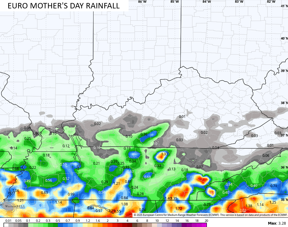
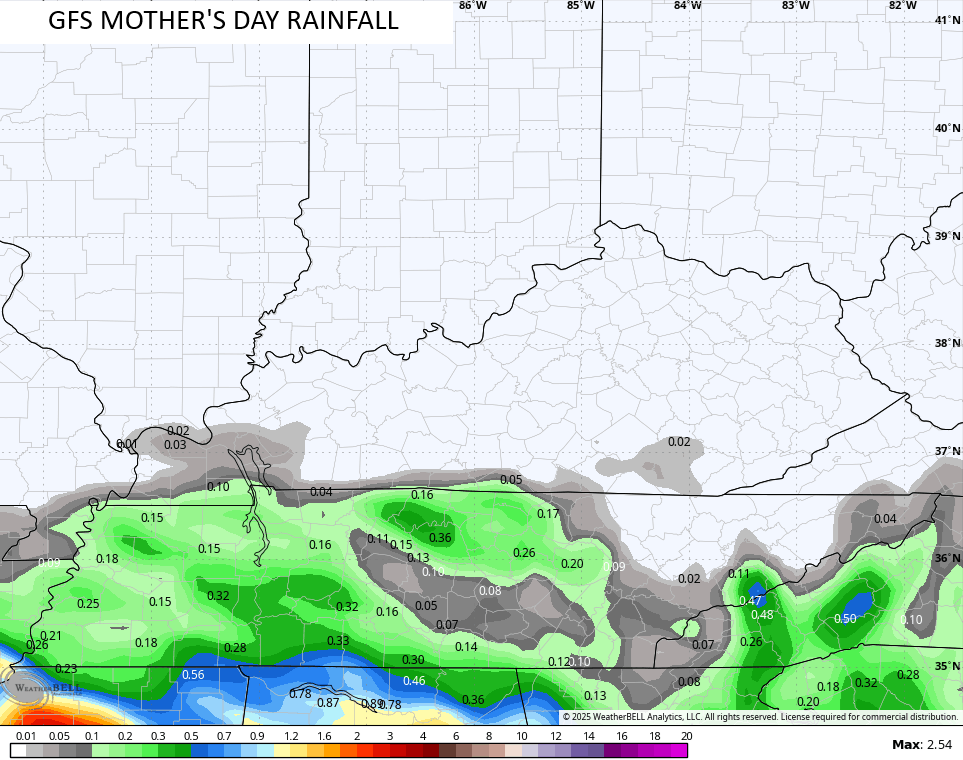
Clouds and sun do battle again on Mother’s Day with 75-80 in many areas. The chance for some scattered showers and storms creeps into the southern half of the state, but the models disagree a bit on how far north this gets.
The EURO has a little better coverage of the scattered storms…
The GFS is a bit more suppressed with only far southwestern Kentucky seeing any action…
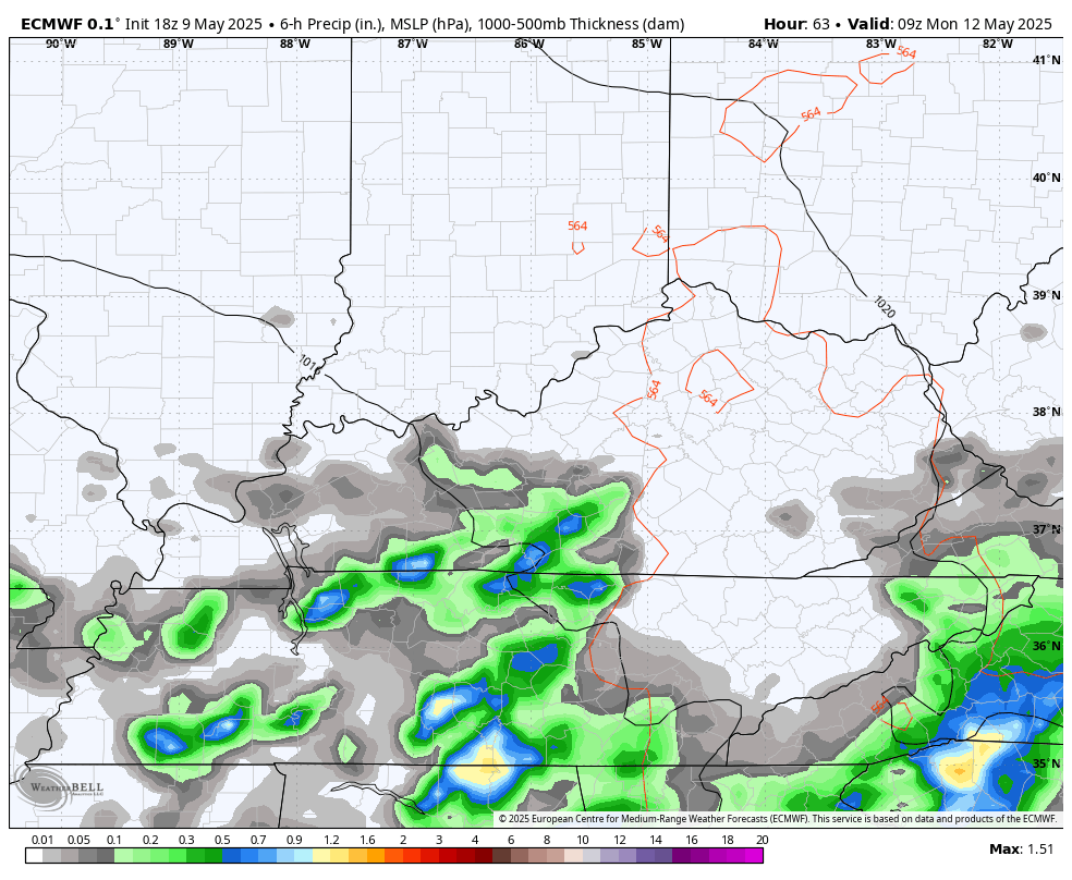
Regardless, showers and thunderstorms spin in from the south Sunday night and Monday and they look to stick around through Wednesday. This is when low pressure from the south spins across the region…
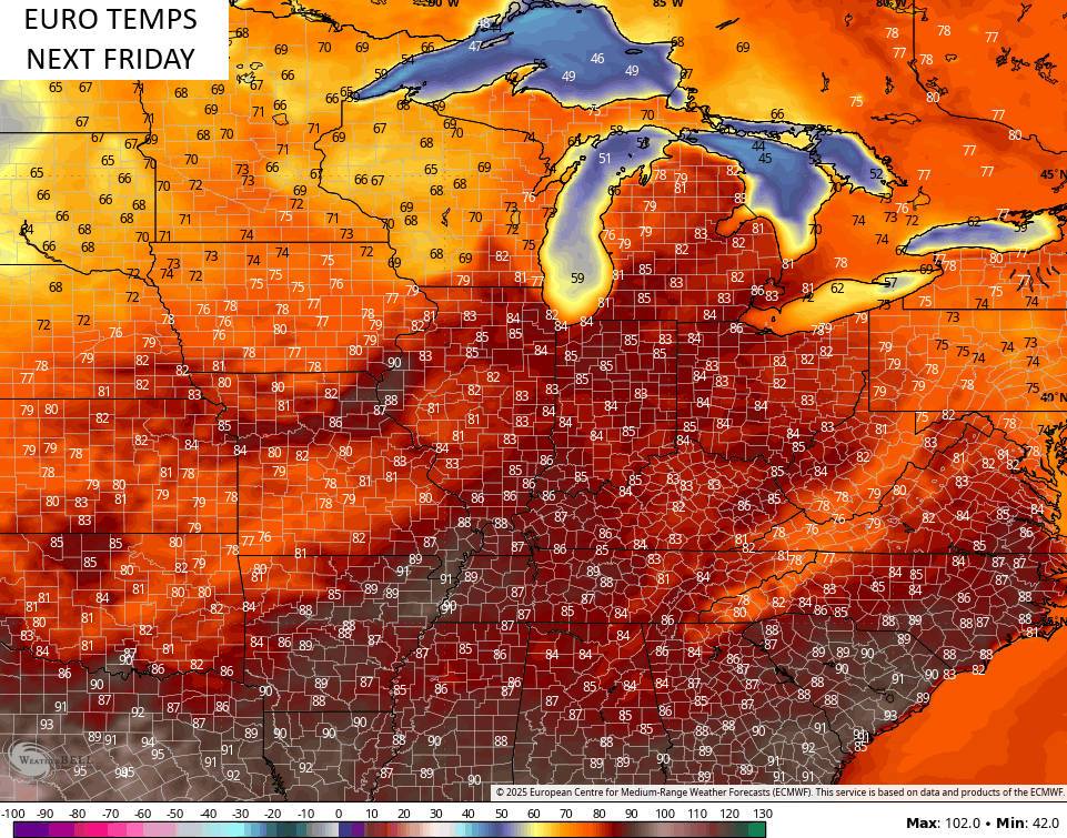
As that pulls away, temps shoot up into the 80s for the second half of next week…
Those warmer temps will be ahead of a series of systems dropping in from the northwest, bringing the increased threat for rounds of big thunderstorms. This setup may take us all the way through the week leading up to Memorial Day Weekend…
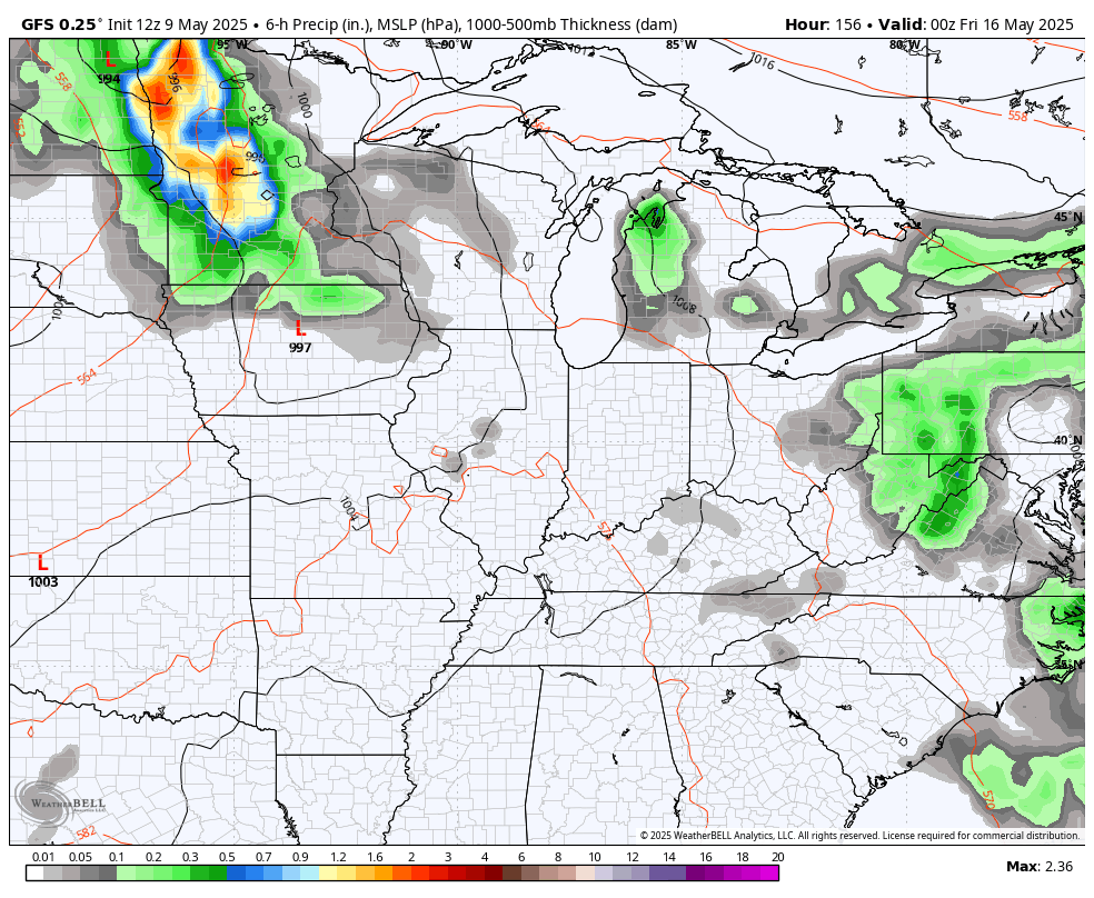
The end result for all that would be for rounds of strong to severe storms with some cooler than normal shots following those up.
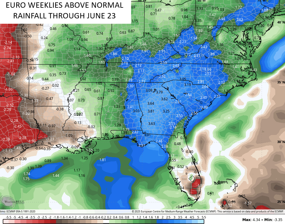
The wet pattern of the spring shows no signs of letting up as the EURO Weeklies show well above normal rains through much of June…
Make it a sensational Saturday and take care.

The EURO weeklies are wrong.
Jeff, that first 90 degree temperature may happen at the end of next week, but I don’t put much stock into model forecast. I wouldn’t call 1.90 ” of rain through June above normal for my area.
I believe the 1.90 inches of rain represents how many inches above normal the rainfall is going to be for that particular area.
Mike, I realized that after I posted the comment.
Chris, I enjoy viewing the weathercams on your blog, but is there ways you could have scenes without the highways. Kentucky has many beautiful scenes in many areas of the state that could be shown on the weathercams.