Good Sunday and Happy Mother’s Day to all the moms out there. For the most part, today is a pretty good weather day but a few showers and storms will try to sneak into the southern half of the state. This is ahead of what looks like a rather stormy pattern for the upcoming week.
Temps today reach 75-80 in most areas with the aforementioned scattered showers and storms in the south.
Another slow-moving low spins our from the south, leading to waves of showers and storms from Monday through Wednesday. This action won’t be constant, but some of the storms may be on the strong side and put down torrential rains at times.
You can see all the showers and storms spinning around this low pressure through Wednesday…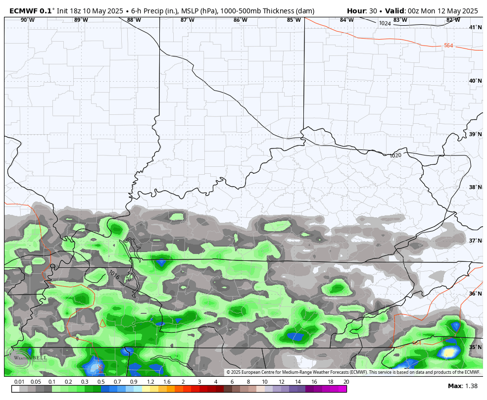
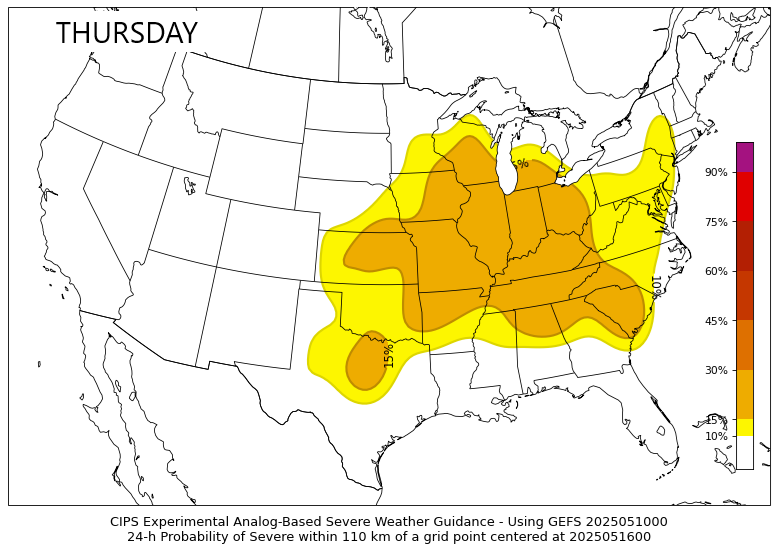
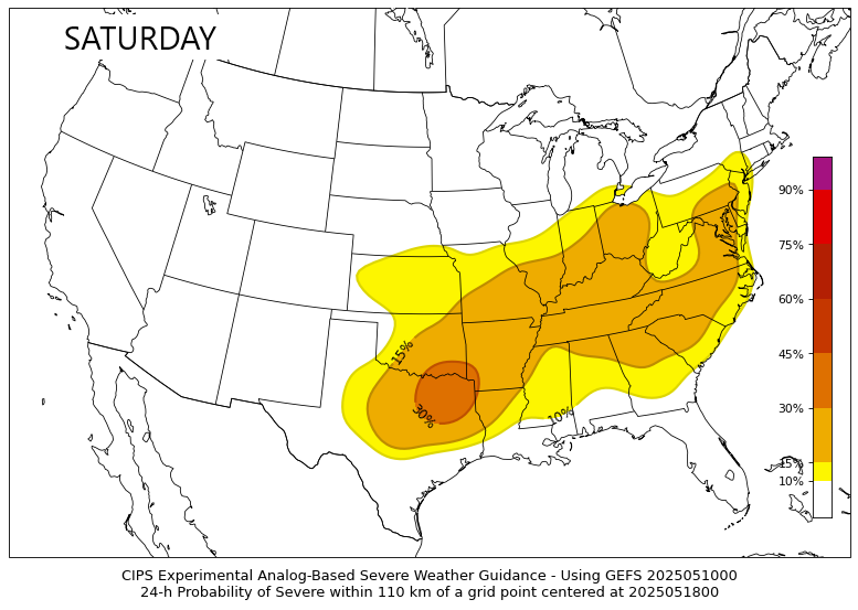
The setup for later this week into the upcoming weekend is one that looks really warm with increased humidity levels. A potent system works slowly toward us from the northwest during this time, setting the stage for the potential of severe storms rolling in from the west and northwest.
Some of the analog based guidance is showing the severe potential from Thursday through Saturday…

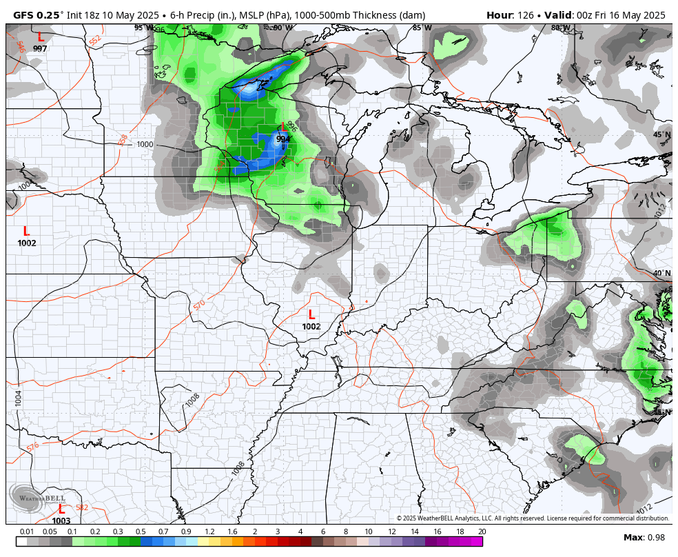
The GFS argues for additional clusters of strong to severe storms into the following week. This animation starts Thursday and goes all the way through Memorial Day…
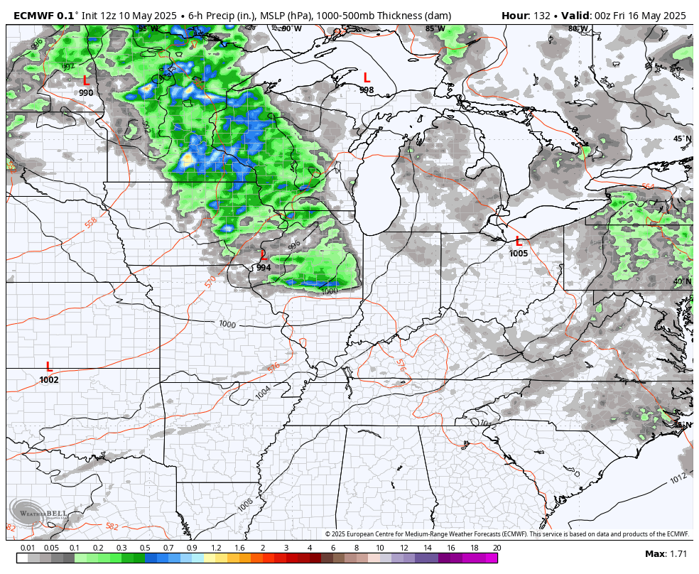
The EURO isn’t quite as stormy as the GFS, but has a similar overall theme through roughly the same time period…
I leave you with your Sunday shower and storm tracking tools…


Make it a great Mother’s Day and take care.
