Good Monday, everyone. Rounds of showers and storms continue to spin into the region today, kicking off what’s likely to become a very active pattern over the next few weeks. This active pattern brings about the increasing potential for severe weather.
Before we get into the local weather, let’s take a look at historic heat across the Dakotas and Minnesota. Mother’s Day highs hit 100 degrees to darn near the Canadian border…
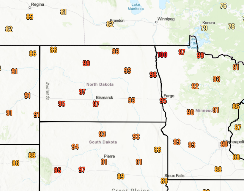
Similar temps will continue for these areas over the next several days. Ouch.
Around here, we have a low pressure spinning in from the south today through Wednesday, bringing spiraling bands of showers and thunderstorms with it. A few of these storms can be locally strong or severe and put down enough rains to cause local high water issues.
The Storm Prediction Center hasn’t had any kind of a Severe Weather Threat for Kentucky today, but there’s a chance they upgrade to a Marginal Risk for some parts of the state…

Scattered showers and storms hang around into Tuesday and Wednesday, bringing additional heavy rains to a few areas.
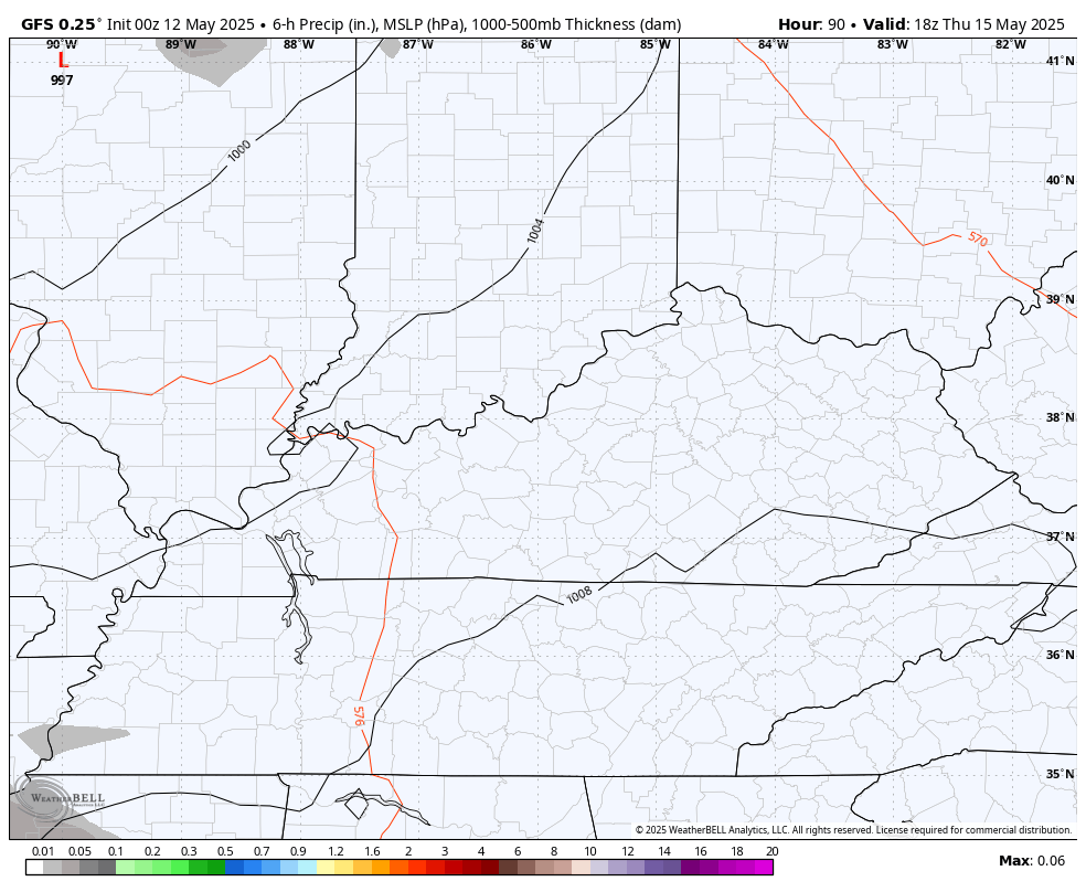
The setup later this week into the weekend is one that will likely feature the potential for strong to severe thunderstorms rumbling through here. The models are in pretty good agreement on this.
Here’s the GFS from Thursday through Saturday…
The EURO during the same time…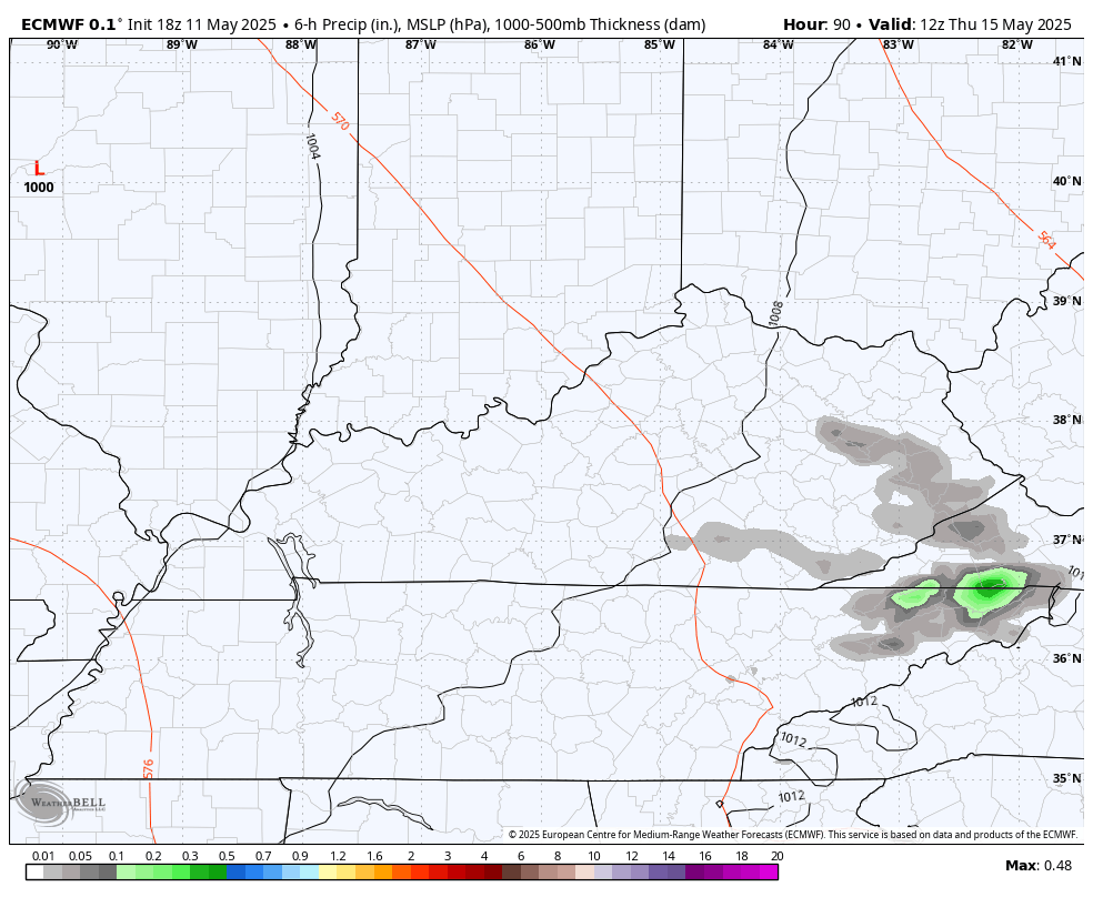
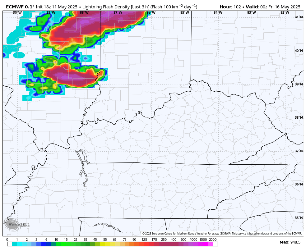
Here’s the lightning forecast from that run of the EURO…
This stormy setup continues into next week with waves of strong to severe storms likely appearing during this time…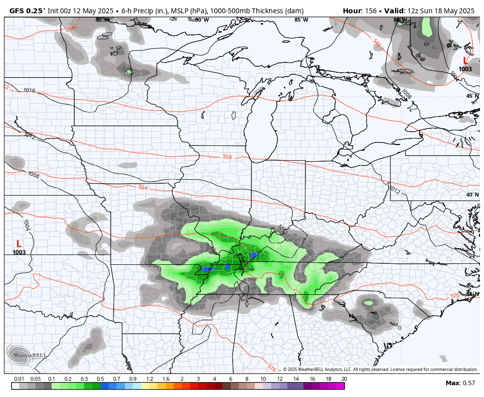
Speaking of showers and storms, I have you guys all set to track what’s out there today…

Make it a great Monday and take care.

Hopefully it won’t be that stormy. I sure that heat in the upper Midwest will work it’s way here in the next few months.