Good Tuesday, everyone. It’s another day with scattered showers and storms under a low pressure spinning through the region. As this passes by, we turn our attention toward the potential for late week strong to severe storms.
Temps today are in the 70s with a few showers and storms going up. These won’t be constant or terribly widespread, but, locally heavy rains will show up from time to time.
Temps hit 75-80 in most areas Wednesday with a storm or two going up in the afternoon and evening.
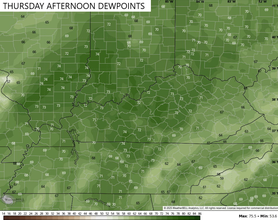
Very warm and very humid air pushing in for Thursday and Friday. Highs reach deep into the 80s with dewpoint temps hitting the 70s…
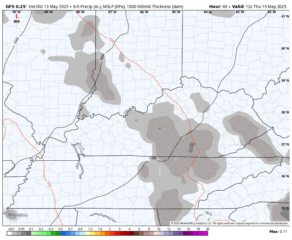
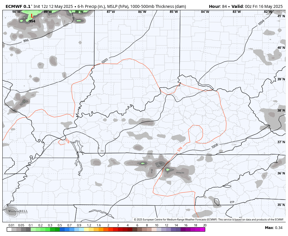
This warm and muggy air is ahead of a storm system dropping in from the northwest. This will fire off rounds of thunderstorms set to roll across the state from late Thursday through Saturday…
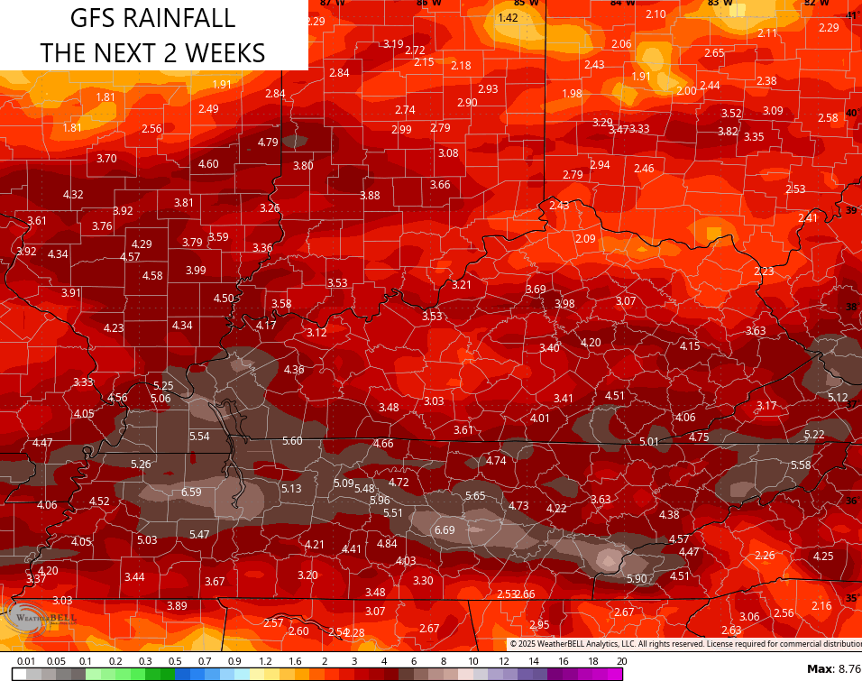
GFS
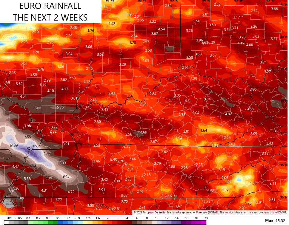
EURO
Some of these storms may be strong or severe and the Storm Prediction Center is highlighting the potential.
Here’s the Thursday Severe Weather Outlook…

Here’s the general Severe Weather Outlook for Friday…

In addition to the severe weather potential, these storms can put down torrential rains, leading to local high water issues.
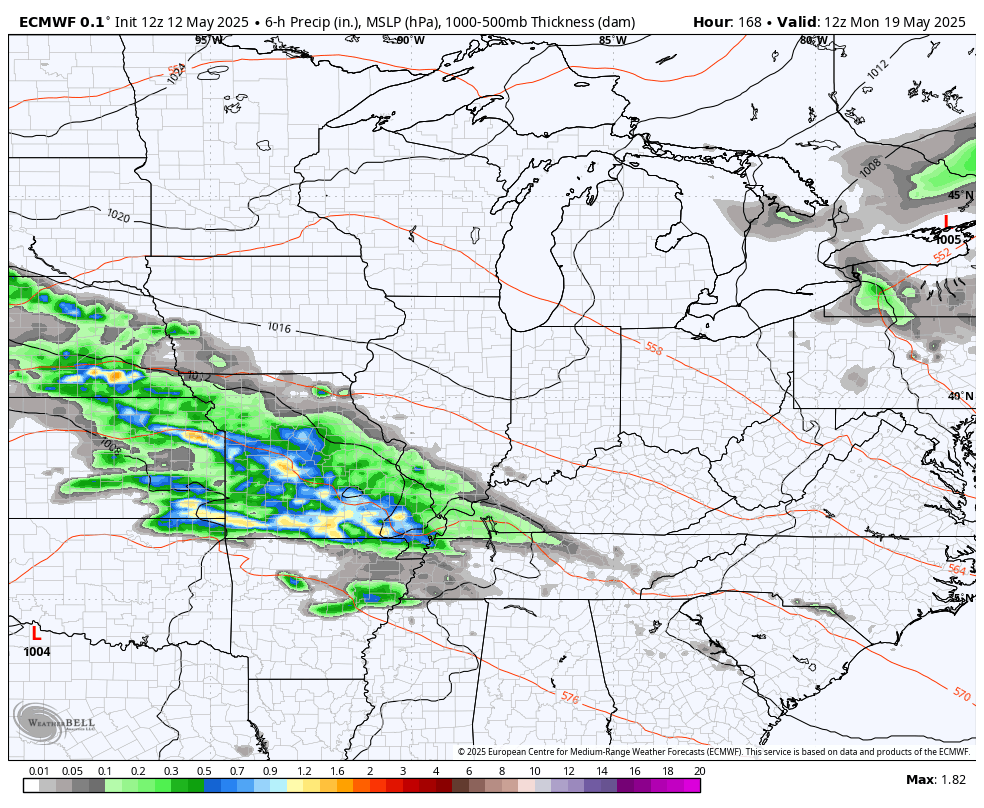
The pattern calms down for a moment as cooler drier air fights in late Saturday into early Sunday, but the pattern looks really bumpy after that. It’s a pattern ripe for waves of severe weather next week into Memorial Day Weekend…
The operational models are seeing a lot of rain from these storms over the next few weeks…
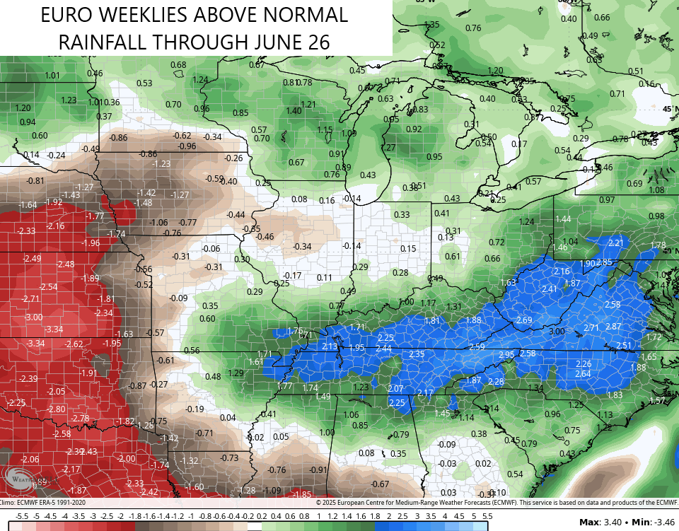
The latest EURO Weeklies suggest this wet pattern rolls into the start of Summer…
As usual, I leave you guys with your storm tracking tools for the day…

Make it a terrific Tuesday and take care.

The EURO weeklies will be wrong again..
I hope the Euro weeklies are wrong, as we don’t need any more rain or severe weather, but we will need timely rains in July and August. Will we receive the rains then ? Most likely not.