Good Monday, everyone. Another stormy setup is upon us as rounds of showers and storms move in over the next few days. Some of these storms may be severe and put down enough rain to cause flash flooding issues.
Let’s begin with the headlines for today:
- Clusters of showers and thunderstorms roll in from northwest to southeast.
- The greatest concentration will be across western and southern Kentucky with some of central Kentucky getting in on the act.
- A few of these storms may be strong or severe. Damaging winds and large hail are the main issues. The tornado threat is low, but not zero.
- Torrential rains may cause local high-water issues.
Today’s Severe Weather Outlook from the Storm Prediction Center focuses on the west and south…

Here’s a look at today’s low-end tornado risk…

Pockets of damaging wind and large hail will be possible…


Here are the headlines for tonight and Tuesday:
- Later tonight through Tuesday night is the time to watch as low pressure rolls into the Ohio Valley from the west.
- A warm front lifts in from southwest to northeast ahead of this low and that may spawn some strong or severe storms along it overnight into Tuesday morning.
- With the low passing to our west and north, it puts our area in the region to watch for supercell thunderstorms and a few bowing storm clusters.
- Damaging winds, large hail and a few tornadoes will be possible during this time.
- The flash flood threat will be increasing as storms drop a quick 1″-3″ of rain.
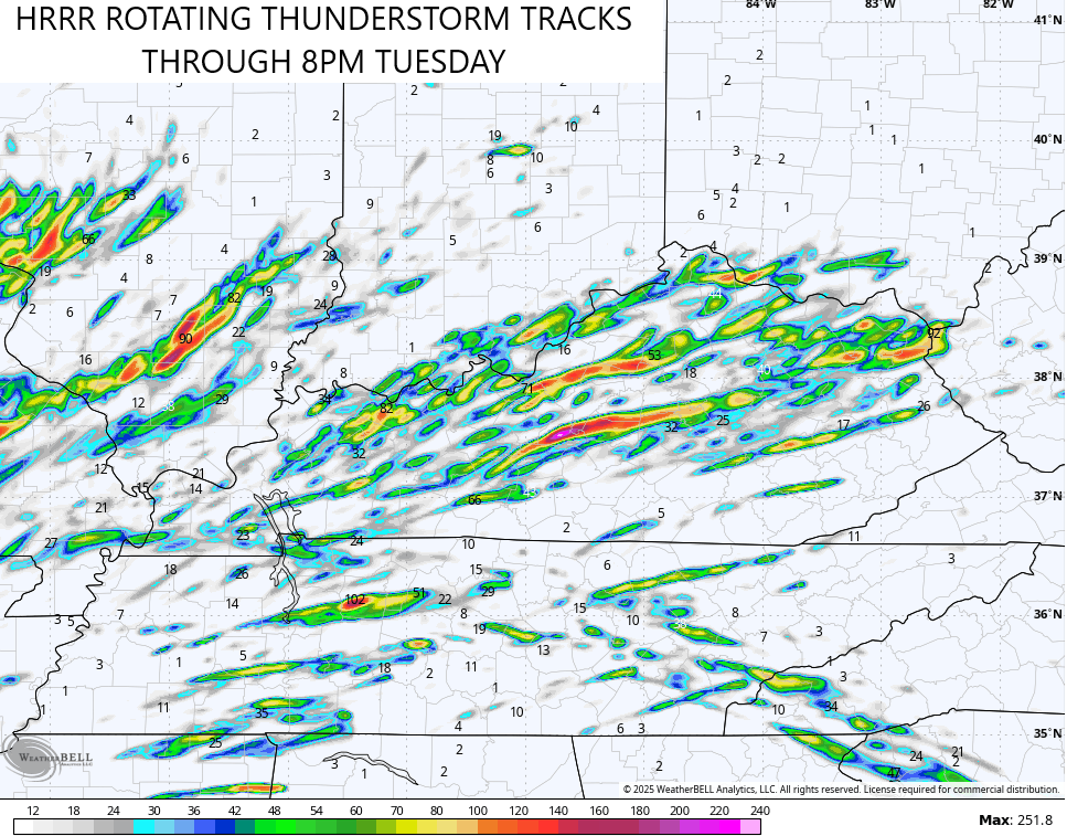
You can see all this on the future radar from the HRRR. This animation starts at 2am Tuesday and goes through 8pm Tuesday…
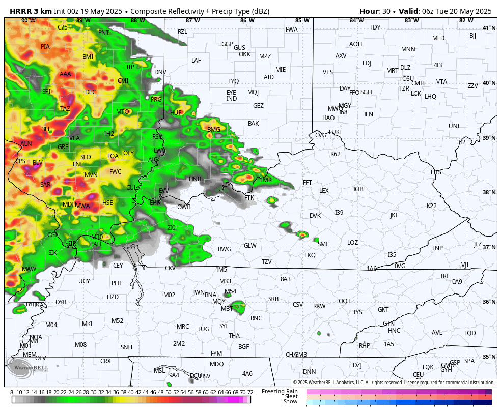
The HRRR is showing the potential for many rotating thunderstorms rolling across Kentucky…
The Storm Prediction Center continues to grow more aggressive with the Tuesday Severe Weather Outlook…

The tornado risk continues to increase…

Once again, the threat for damaging winds and large hail is pretty sizeable…


Wednesday features cooler weather with gusty showers and a few storms. This may add to the flood threat in many areas.
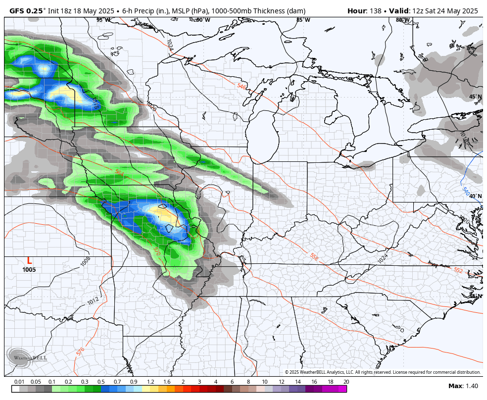
Cooler and drier weather rolls in for the end of the week, but the Memorial Day Weekend may not be as lucky. Rounds of showers and thunderstorms may fire right back up in a similar fashion to what we’re seeing now.
The GFS is most aggressive with this potential…
The EURO has been struggling with the recent severe weather and heavy rains, so I’m a bit skeptical of it keeping most of the showers and storms to our south…
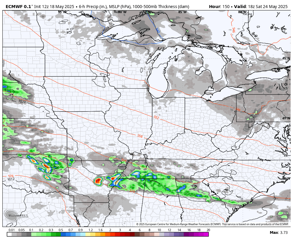
The AI version of the EURO looks more like the GFS…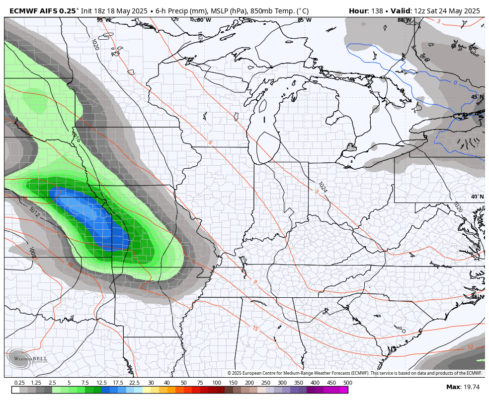
I’ll have another update later today and I’ll be on WKYT-TV starting at 4pm. Until then, here are all the storm tracking tools you need to start the week…


Current watches

Possible Watch Areas

Make it a magnificent Monday and take care.

Here’s why it’s so stormy lately :
https://www.google.com/search?q=why+is+it+so+stormy+lately&sca_esv=521bcc6d89434124&sxsrf=AHTn8zrBOUIX3wnngakQUH39VTeLriF6-A%3A1747655247507&source=hp&ei=TxoraLHVHIjDp84PzO6B4AU&iflsig=ACkRmUkAAAAAaCsoX2R5QBwVVB8WwQ0oK3ZjKBAqwWm1&oq=why+is+it+so+stormy+&gs_lp=Egdnd3Mtd2l6IhR3aHkgaXMgaXQgc28gc3Rvcm15ICoCCAAyBRAAGIAEMgUQABiABDIGEAAYFhgeMgYQABgWGB4yBhAAGBYYHjIGEAAYFhgeMgYQABgWGB4yBhAAGBYYHjIGEAAYFhgeMgYQABgWGB5IurABUABYjI4BcAB4AJABAJgBiwGgAZsSqgEEMC4yMLgBAcgBAPgBAZgCFKACwRPCAgsQABiABBiRAhiKBcICCxAAGIAEGLEDGIMBwgIREC4YgAQYsQMY0QMYgwEYxwHCAg4QLhiABBixAxjRAxjHAcICBBAAGAPCAggQABiABBixA8ICERAuGIAEGJECGMcBGIoFGK8BwgIUEC4YgAQYsQMY0QMYgwEY1AIYxwHCAg4QABiABBixAxiDARiKBcICCBAuGIAEGLEDwgILEC4YgAQY0QMYxwHCAgYQABgDGArCAg4QABiABBixAxiDARjHA5gDAJIHBDAuMjCgB7uLAbIHBDAuMjC4B8ET&sclient=gws-wiz
Here in Union,Co one touchdown Friday night did destruction damage to some homes, but luckily no one was seriously hurt or loss of life. I think it’s time mother nature to let up the state of Kentucky sure has endure so much pain and agony from mother nature.
Very well said !