Good Wednesday to one and all. It’s a much calmer and cooler weather pattern taking shape across Kentucky. The calm is really good news as many areas are still trying to pick up the pieces from recent tornadoes and severe weather.
This cool pattern continues to look pretty active, though, with a lot of rain still on the way.
Cooler than normal temps are out there today with highs ranging from the middle 60s to middle 70s from north to south. Gusty winds will be out there with an upper level low spinning through the region. This will bring a mix of sun and clouds and the chance for a shower or storm going up.
The same can be said for Thursday as temps come down even more.
Just how cool are we talking? The Barney colors are with us through Saturday…
Additional showers and storms will likely drop in from northwest to southeast Saturday night through Memorial Day with lingering showers likely into the middle of next week…
Heavy rains have the chance for cause some high water concerns during this time, so keep that in mind.
Temps continue to run well below normal with more Barney colors…
That’s just absolutely nasty looking.
All of this comes from a couple of upper level lows that slowly spin across the eastern half of the country in the closing few weeks of May…
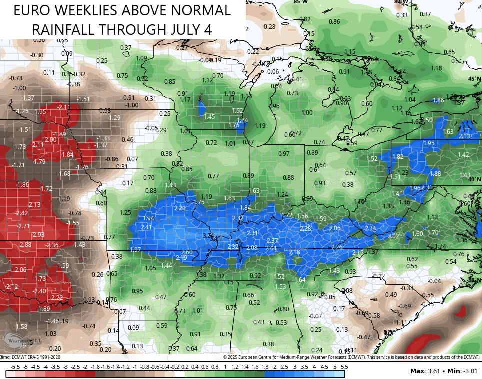
The latest EURO Weeklies now take us through the 4th of July and they see a continuation of this very wet pattern with well above normal rains…
Here are your scattered shower and storm tracking tools for the day…


Make it a wonderful Wednesday and take care.

May the EURO weeklies fail miserably. We need sunshine and heat.
Don’t worry Jeff, the HEAT is coming.
My power bill the last two months has been around $120… like $60 less than it usually is
Mark, my electric bill this past month was right at $ 115.13. I don’t care for all the cloudy days. I want blue skies, and warm days, and cool nights, and no more of these storm threats.
A perfect summer day for me is lows in the 50s and a high in the mid to upper 90s.
In the past 48 hours we had 2.19 ” of unwanted rain. Yesterday evening, I spotted a large rotating funnel cloud just to my west. Very frighting !
There is a lot of cool Mesonet historical data that you can view via the following steps.
Open the Mesonet app and click the 3 lines at top-right. Select Data, then select Maps. Click the 3 lines to the left of Search. Click the down arrow next to the desired Category and scroll down. The map displays your data.
At my PWS near Bowling Green a supercell thunderstorm dropped 1.95 inches of rain in 25 minutes, produced a peak wind gust of 32mph, and dropped pea to marble-sized hail.