Good Friday to one and all. We’ve made it to the end of the week with the unofficial kickoff to summer just about upon us. Your Memorial Day Weekend looks really cool compared to normal and we have some late weekend showers and storms to track.
Temps today are mainly in the mid and upper 60s with some low 70s west and south. Skies are mainly dry skies will be noted with partly sunny skies.
Saturday looks really good with highs reaching the upper 60s to low 70s for most of the state.
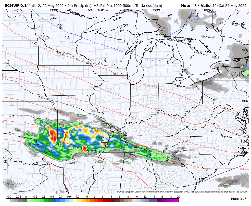
Clouds will increase late Saturday with the increase of showers and thunderstorms showing up by Sunday. This comes from a low pressure working into the region by Memorial Day and Tuesday. That keeps some showers and storms going with the greatest concentration across the southern half of Kentucky.
Here’s the EURO from Saturday through next Wednesday…
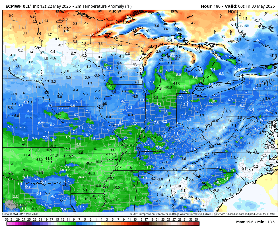
Temps will continue to be below the normal high temps which are nearing 80.
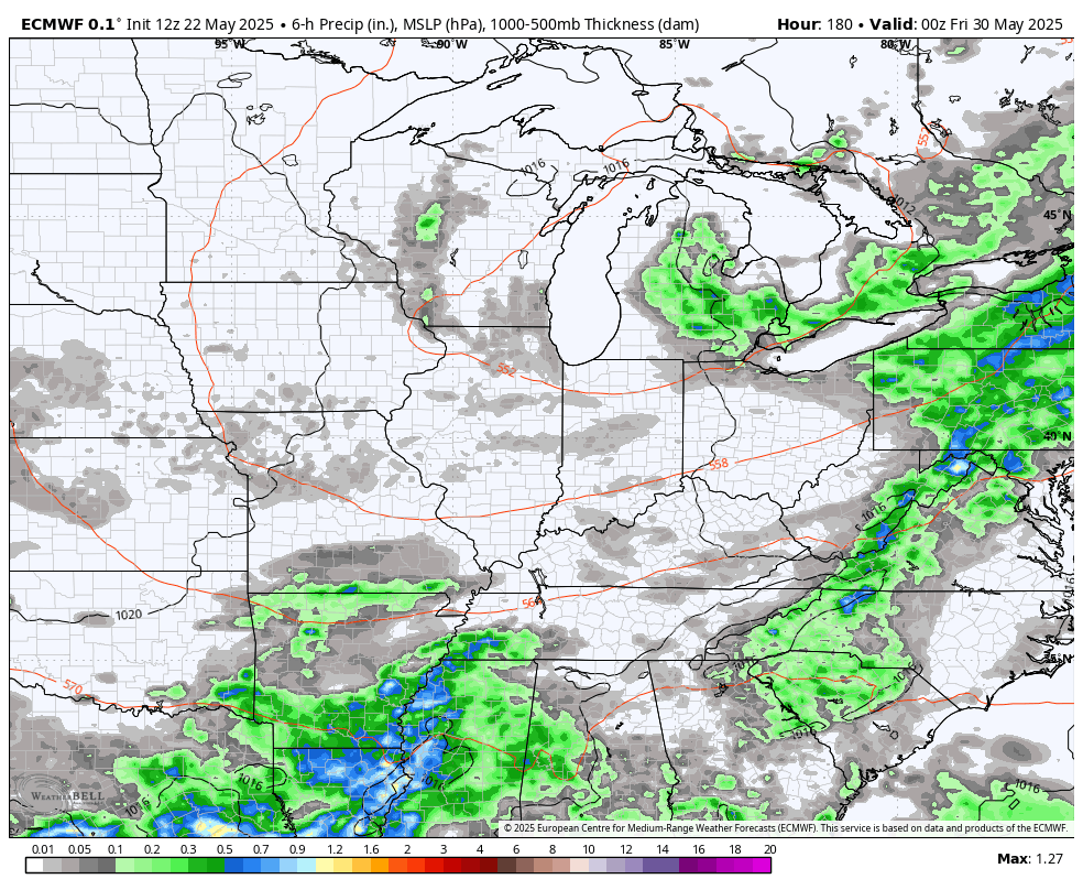
The threat for additional showers and storms to drop in from the northwest are with us later next week into the first week of June. Check out the Euro during this time…
The EURO also keeps those below normal numbers going during the same time…
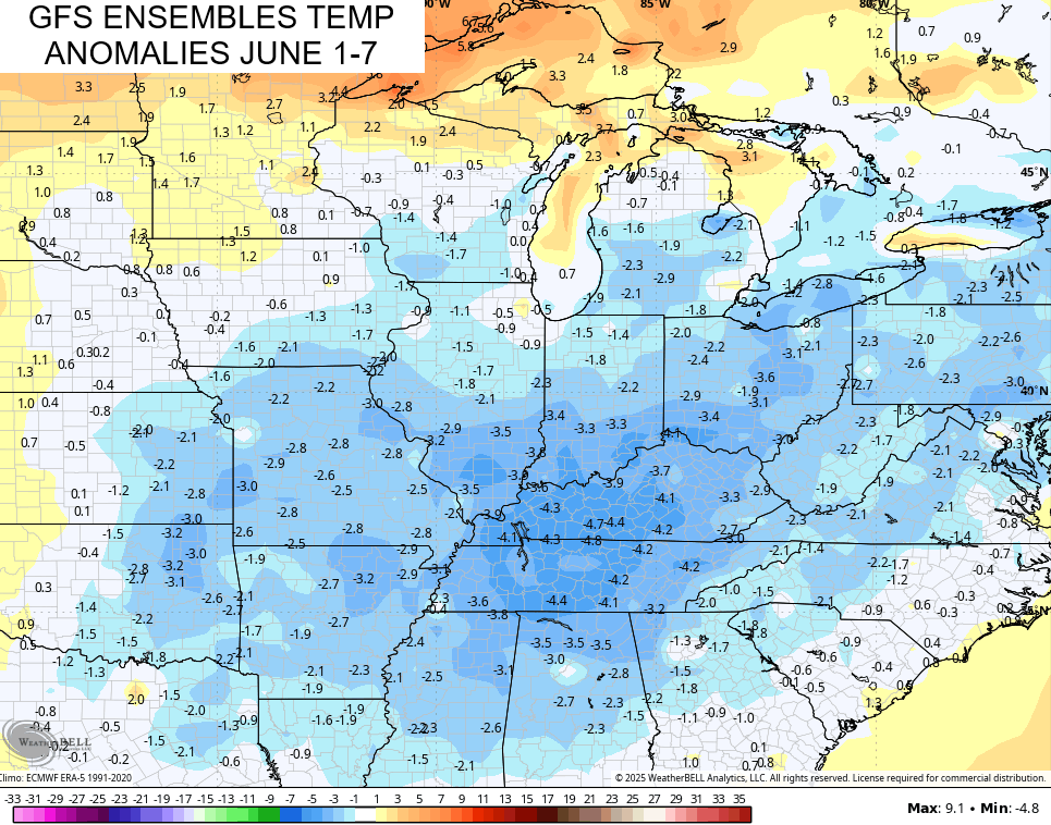
The GFS Ensembles are also on board with a cooler than normal first week of June…
Yippee… Said no one.
Give me some summer warmth!!! Grrrr.
Enjoy the day and take care.

Good morning, Chris, our faithful weather dude!
Do you have a map that shows our precip totals since March 1?
Thanks for all you do for us!
Steve
https://www.kymesonet.org/yearly_summaries.html?choice=prec_accu&year=2025&system=english
These models will soon fail. Thank goodness.
Hot and dry weather will be here soon enough.