Good Saturday to one and all. It’s a pretty nice day overall across the Commonwealth as temps continue to come in cooler than normal. The cooler than normal numbers continue for the next several days as showers and storms get set to return. The pattern goes back to stormy as we close out May and say hello to June.
Today features temps in the upper 60s and low 70s for most of the state. There’s the chance for a shower or storm across the west and your Kentucky Weather Radars will have those for you at the bottom of this post.
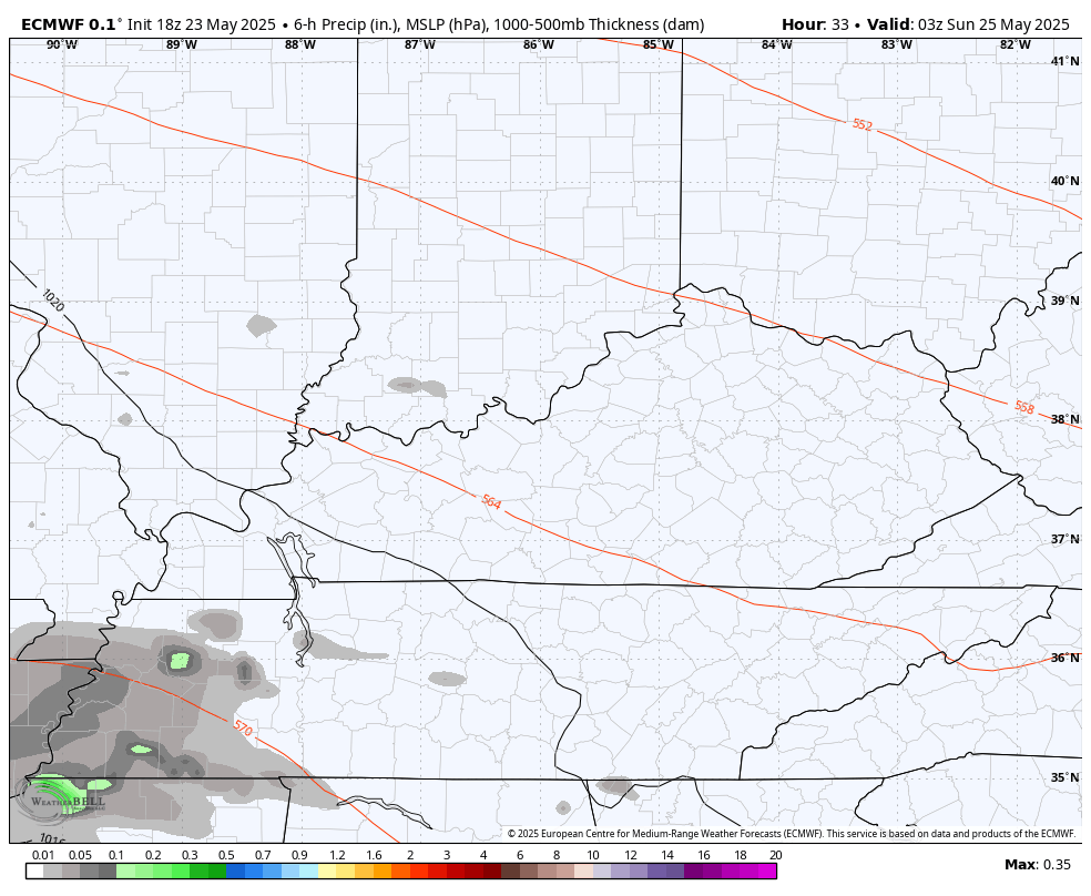
Scattered showers and storms look to be a little more common for Sunday, but this isn’t washout stuff by any means. You can see this action on the EURO from late tonight into Sunday…
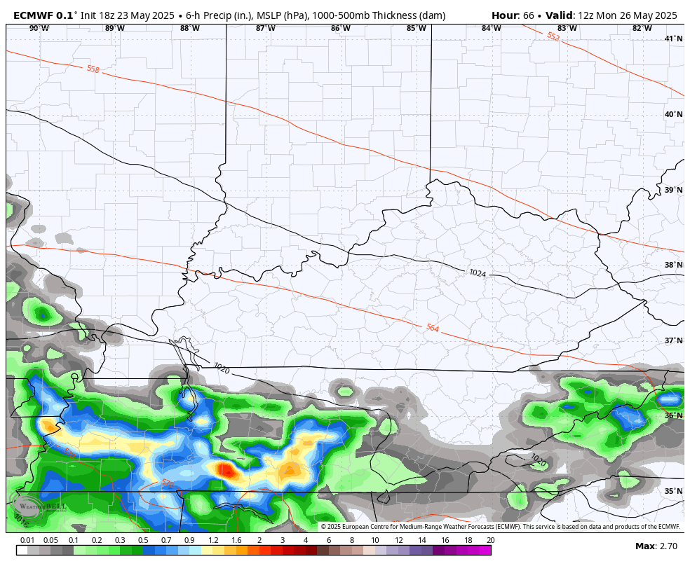
Memorial Day Monday sees similar temps in the upper 60s to low 70s with a few storms in the west. The slower movement looks to bring the greatest threat for showers and storms area wide Monday night and Tuesday with lingering action into Wednesday.
The EURO is spitting out some heavy rains during this time…
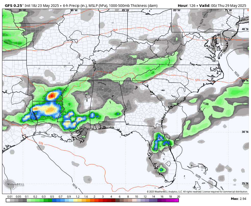
The GFS is seeing that and following it up with another big slow-moving low late next week into early June…
Here’s hoping that’s not the case, but it’s really hard to argue with anything showing a lot of rain and storms this spring and year.
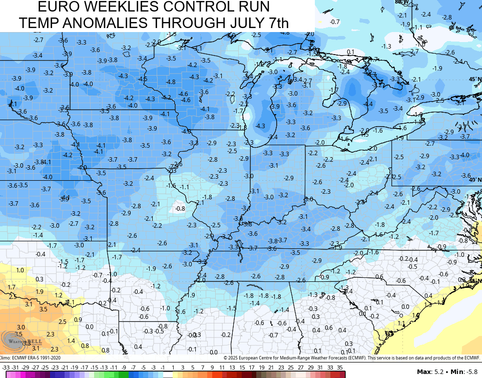
The EURO Weeklies continue to point toward a cooler than normal setup from today through July 7th…
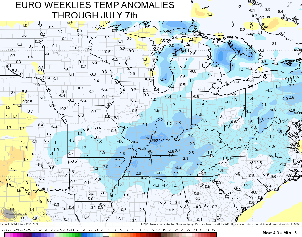
The Control Run of the Euro Weeklies is even more widespread with the cooler than normal air…
I’ll start looking more at summer with updates over the weekend, so check back.
I leave you with your regional storm tracking tools to start this holiday weekend…


Make it a great Saturday and take care.

I hope the EURO weeklies crash and burn.
LOL… me too Jeff.
Geez, what happened to summer? I’m thankful to have had some temperate spring temps for a change this year but it’s definitely been chilly & gray & gloomy & no end in sight to this!