Good Tuesday, everyone. Rounds of showers and storms continue to target much of the region today, bringing a local high water threat for some. This action comes as low pressure spins in from the southwest and moves right on top of us.
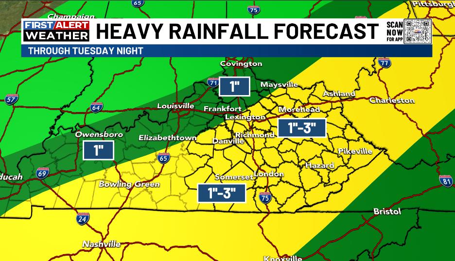
These showers and storms will target central and eastern Kentucky through tonight, putting down quite a bit of rain. A general 1″-3″ of rain is likely to show up with the chance for some locally higher amounts.
Here’s the area with the best chance of seeing the most rain through tonight…
This rain comes in waves with dry hours in between, so you can still get some outdoor activities in today. Highs generally hit 70-75.
Scattered showers and storms linger into Wednesday with temps again in the 70s.
There’s another system working our way from the west and southwest for the end of the week. This brings the chance for more heavy rain producing showers and storms from late Thursday into Friday. Behind this comes the chance for some scattered storms over the weekend as we wrap up May and jump into June.
Here’s how the GFS sees this…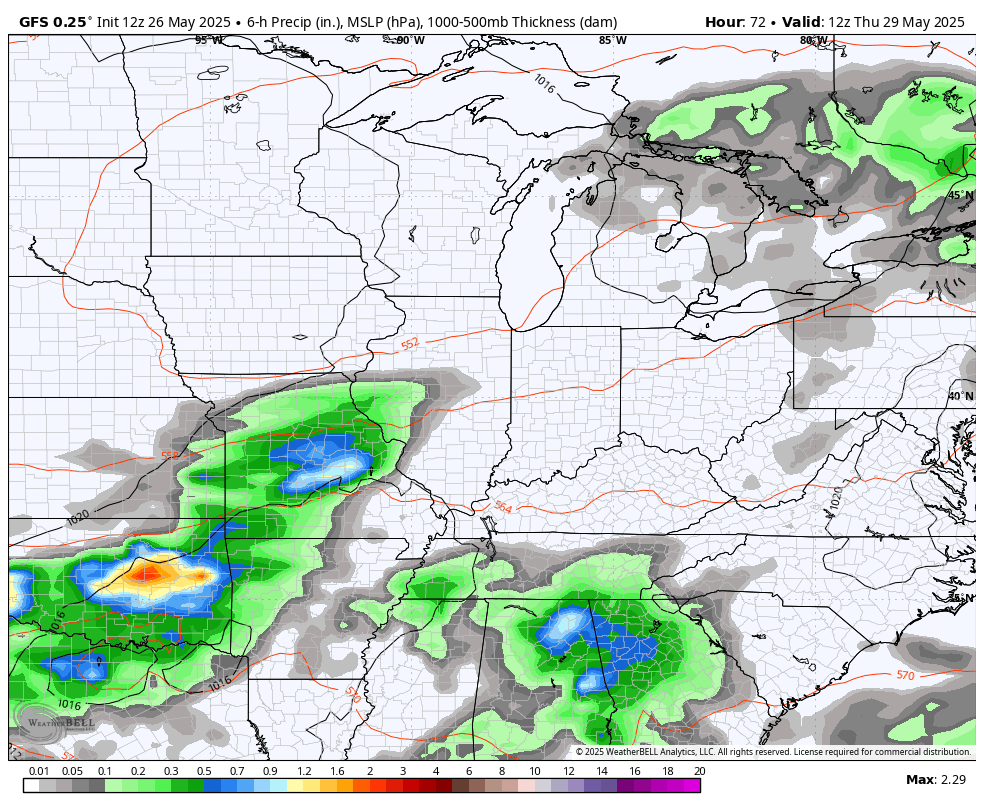
Temps remain below normal during this time but should jump up to normal by the middle and end of next week. That could set the stage for some big storm clusters to drop in from the northwest as the Gulf and Caribbean try to get a little active…
I’ll have the latest on WKYT-TV this evening. Until then, I leave you with your storm tracking tools for the day…

Make it a terrific Tuesday and take care.

Hoping the stormiest doesn’t return late next week. Still waiting for that first 90 degree temperature to usher in Summer.
We really don’t need all this rain. Sunshine and heat are best for business.
Right, bring on the Sunshine and normal Summer heat !
Key word is normal for sure. Nobody wants a drought.
Timely rains for agricultural purposes.
but that never happens… it’s either one extreme or the other… so which do you choose?
Mark, I choose Summer high temperatures in the mid to upper 80’s, and lows in the 50’s and 60’s, with good rains once a week.