Good Wednesday, everyone. It’s another day of, at least, scattered showers and thunderstorms across the Commonwealth. This has been all too familiar for our region, and we have more on the way for the next few days.
Low clouds, fog and some showers and storms are around to start this middle of the work week Wednesday. Skies become partly sunny this afternoon with a few showers and storms firing right back up.
Thursday features scattered showers and storms with isolated showers and storms. This is ahead of another low pressure bringing another round of heavy rain producing showers and storms in here Thursday night and Friday morning.
That low spins through with cooler winds coming behind it from the northwest. That keeps some showers going through Friday evening with lingering showers and storms into Saturday and Sunday.
The GFS and EURO are in pretty good agreement with this overall setup…
GFS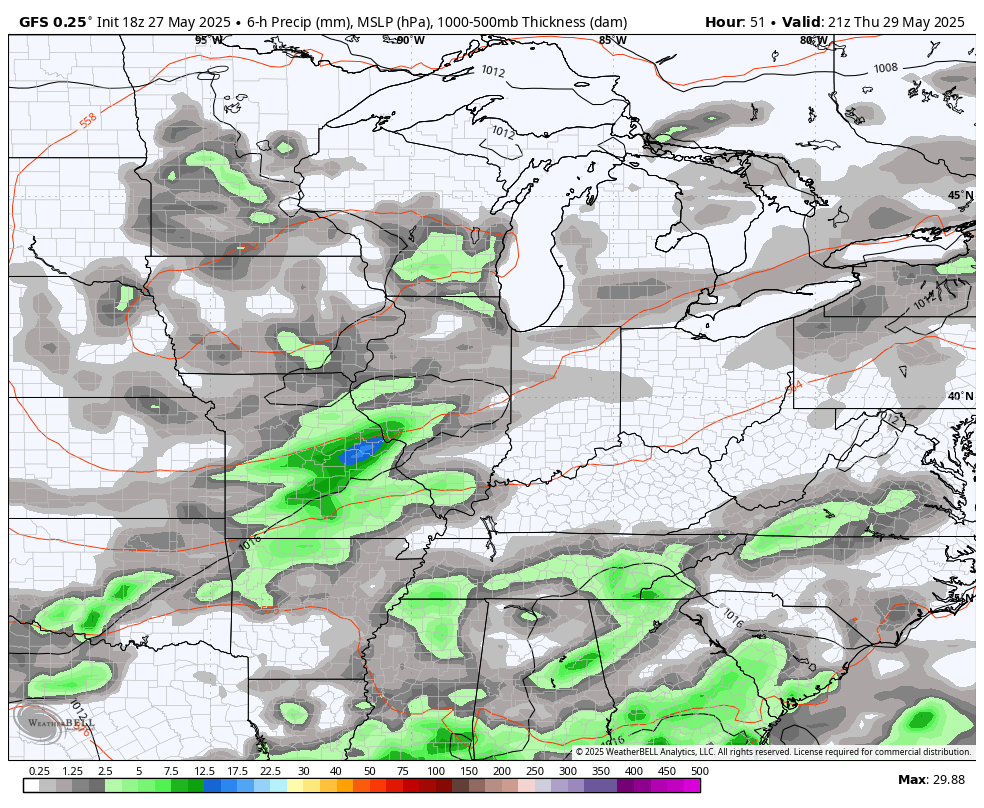
EURO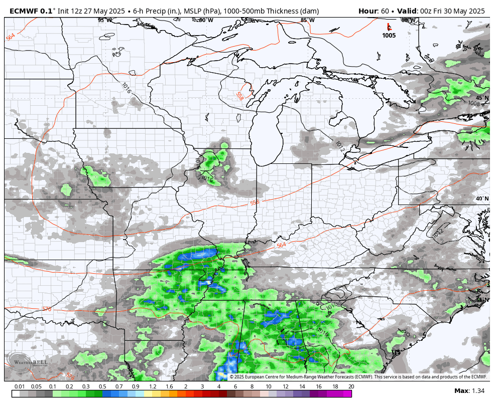
Temps start to climb next week and we should finally be back into the 80s. This may come with a price as the pattern may very well throw some pretty good thunderstorms at us later next week into the following week…
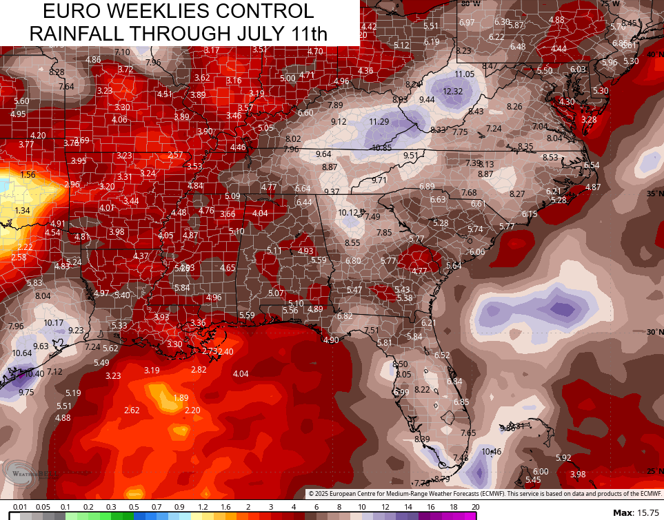
As you know, flash flooding can occur any time of the year around here, but summer is our traditional flash flood season in Kentucky. The latest EURO Weeklies are giving me the vibe of trying to start things a little early.
Notice the highest rain totals showing up across the eastern half of Kentucky through July 11th…
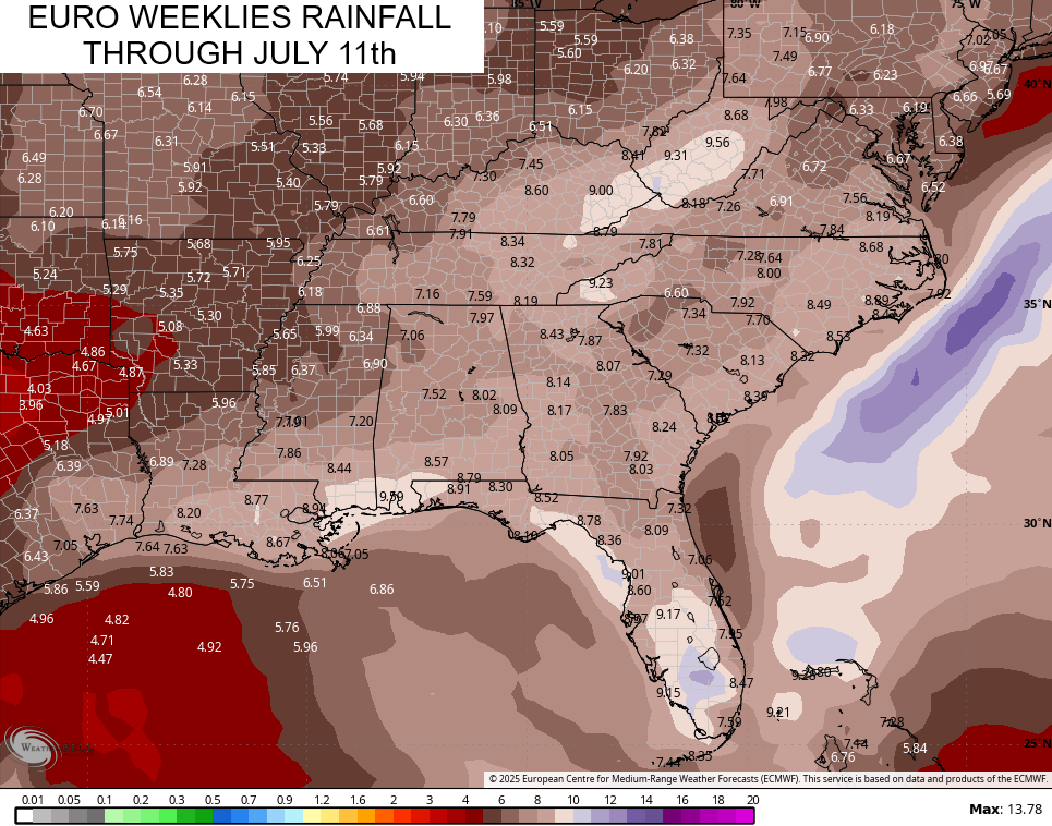
The Control Run has an even stronger signal for heavy rain producing storms in the mountains…
Ugh.
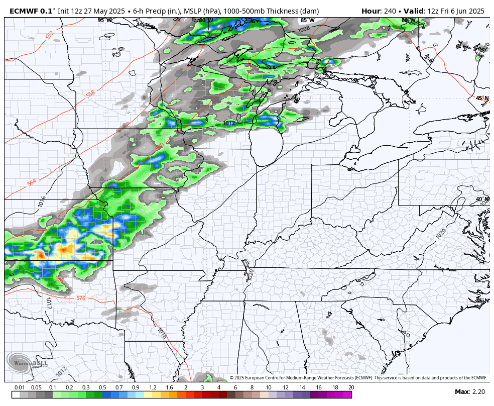
I leave you with your daily dose of storm tracking tools…

Make it a wonderful Wednesday and take care.

UGH ! is what I say too Chris. At least the Summer temperatures will happen next week. I hope.
The weeklies continue to perform weakly.
All models preform weakly now days.
We don’t need more rain.
Yeah, but we will in July and August.
Not too much.