Good Thursday, everyone. The month of May is slowly winding down and we continue to track additional rounds of showers and storms. Heavy rains are a good bet here in the closing days of May, meaning Meteorological Spring will go down as one of the wettest on record for Kentucky.
Temps today are deep into the 70s and may even hit 80 in the west and south. A couple of showers and storms will show up, but much of the state looks to be dry during the daytime hours.
Low pressure then works in here from the west tonight and Friday, bringing another round of heavy rain and some thunderstorms. Wraparound showers and some storms show up behind the departing low Friday afternoon and evening as temps turn chilly.
A few more storms will flare up from time to time on Saturday with temps still below normal.
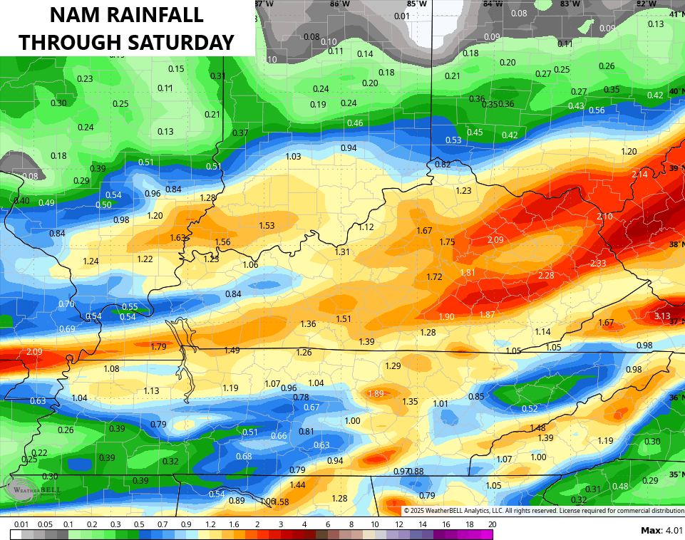
Much of Kentucky will likely pick up 1″-3″ of rain through Saturday. The NAM is most aggressive…
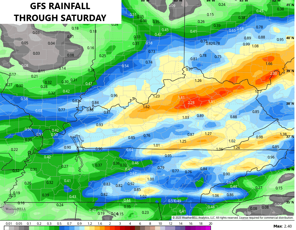
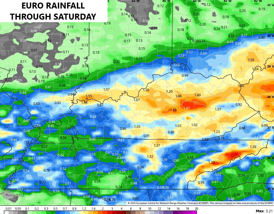
The GFS and EURO aren’t too far behind…
Local high water issues are possible yet again, especially with the main round of storms tonight and Friday morning.
The severe storms threat remains low, but it’s not zero. The chance today is low-end and across the west this evening…

Any early Friday threat is also low. Here’s the Friday Severe Weather Outlook from the Storm Prediction Center…

A storm or two fires up on Sunday as June starts with warming, but still below normal, temps.
The setup later next week into the following week is starting to look more and more active…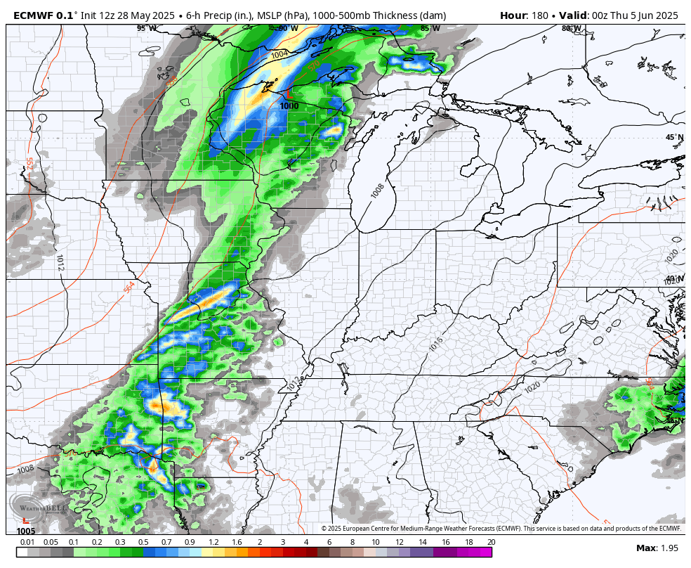
That could bring some severe weather threats to our region.
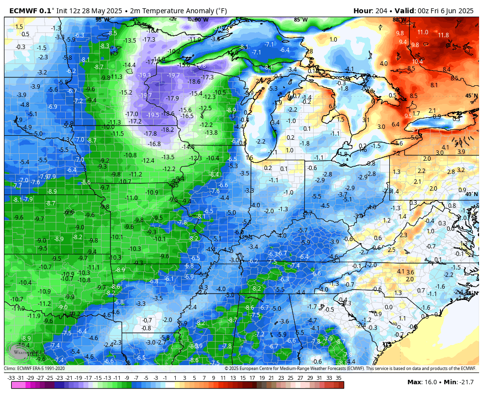
While temps should be in the 80s into the middle of next week, the EURO is knocking the temps right back down to below normal late week into the following week…
True summertime temps should show up at some point… Right?
I leave you with your Thursday thunder trackers…

Make it a wonderful Wednesday and take care.

I certainly hope so Chris, but the question still remains. When will true Summer weather arrive ?
They will come with a vengeance before you know it.