Good Friday, everyone. Heavy rain and strong storms are pushing through the region early today as low pressure passes through. This setup isn’t very kind for the closing days of May as chilly temps join the lingering showers and storms to finish out Meteorological Spring.
The low passing through here today will have spiraling showers and storms spinning around here. I’m going to watch the southern half of the state early this morning for a few strong to severe storms. Here’s the area in question…
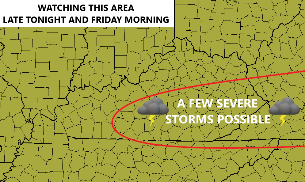
Local wind damage is the primary player. That said, I’ve seen a few similar cases spawn a brief spin up.
The Severe Weather Outlook from the Storm Prediction Center looks like this…

Additional showers and storms will be noted this afternoon and evening, especially across central and eastern Kentucky.
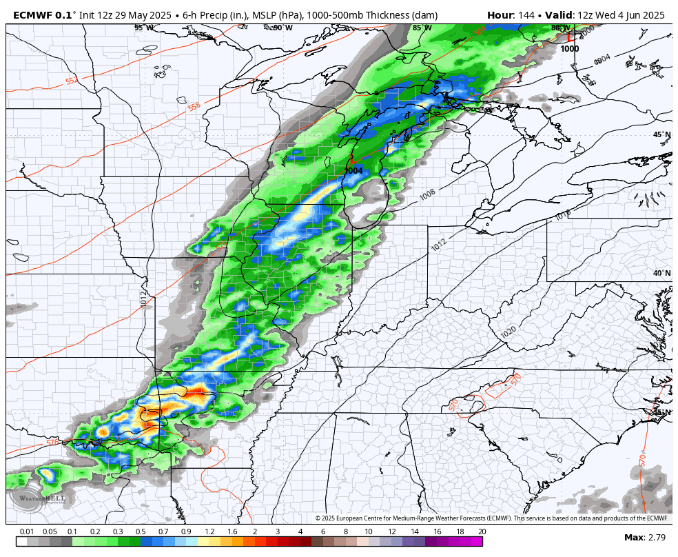
Heavy rains are a good bet today with a general 1″-3″ of rain showing up for much of the state. Local high water issues are possible, so keep that in mind.
Temps today drop into the low and mid 60s with some mid and upper 50s showing up this afternoon for areas getting in on the low clouds and wraparound showers. Overall, this is a really ugly final Friday of May.
Saturday finds temps reaching the upper 70s in the west with upper 60s to low 70s for the rest of the state. A few showers and storms go up in a line from northwest to southeast. This isn’t all day stuff.
June starts on Sunday and does so with the chance for a stray storm as temps reach 70-75 in the east and low 80s in the west. Those low 80s then surge eastward for Monday with mid 80s a good bet by Tuesday and Wednesday.
This is ahead of what looks to be a very active setup kicking in for the second half of next week into the following week. Rounds of strong to severe storms and heavy rains look to become common once again…
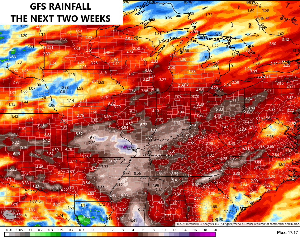
Check out the corridor of heavy rain setting up from the Plains States through the Lower Ohio Valley over the next few weeks…
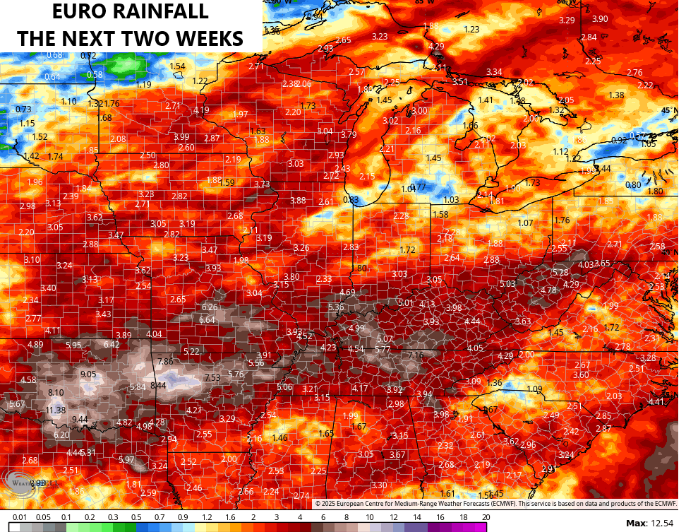
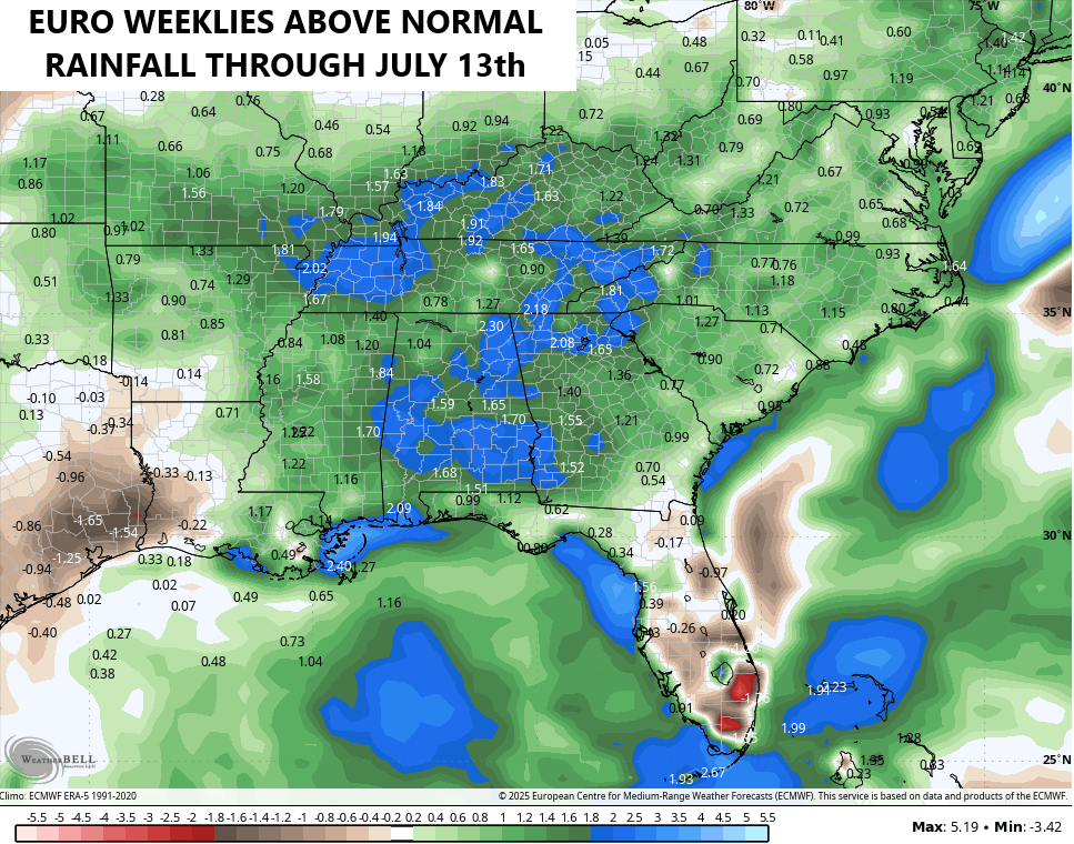
This wetter than normal pattern doesn’t really show any signs of letting up into the first half of summer. The latest EURO Weeklies show Kentucky 1″-3″ above normal into the middle of July…
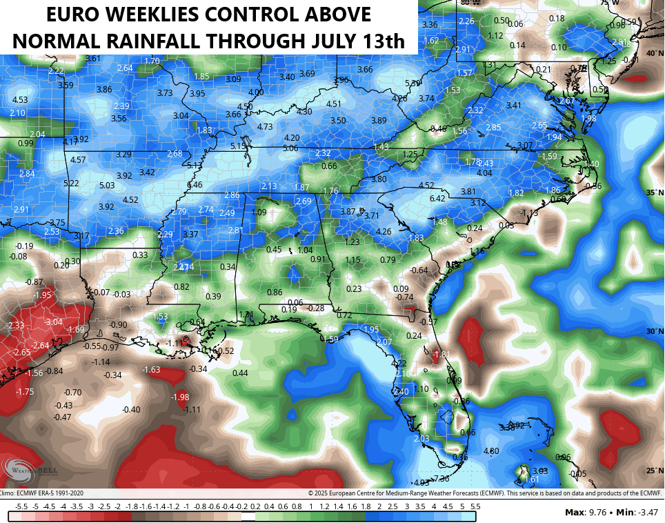
The Control Run of the EURO Weeklies are even wetter…
I have you all set to track today’s rounds of showers and thunderstorms…


Current watches

Possible Watch Areas

Make it a fantastic Friday and take care.

My very words ” I just want it to stop. “
I hate this excess rain. We need a two week dry spell.
Right On ! Jeff
Hey Chris I found something new on the GOKY map. In KYTC box there is new selection called Roadway Weather it has new camera the icon looks like a cloud and sun check it out
Very interesting. Here’s the link :
https://goky.ky.gov/