Good Saturday, everyone. A front is dropping into the region today and bringing a few more showers and storms with it for this final day of May. Better weather rolls in for the start of June, but another stormy setup is lurking later in the week.
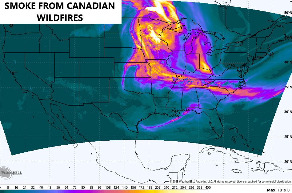
Before we get into the weather part of the program, guess what’s back? Smoke from Canadian Wildfires will be showing up in the coming days…
Today features a northwest to southeast oriented boundary that’s firing up a few showers and storms. These won’t be constant and not everyone sees them, but one or two may be on the strong side. There’s even the low-end threat for a severe storm…

This boundary continues to straddle the state into Sunday and this sets up a very large temperature spread tonight and Sunday. Lows by Sunday morning are likely in the low and mid 40s to start June across areas of central and eastern Kentucky…
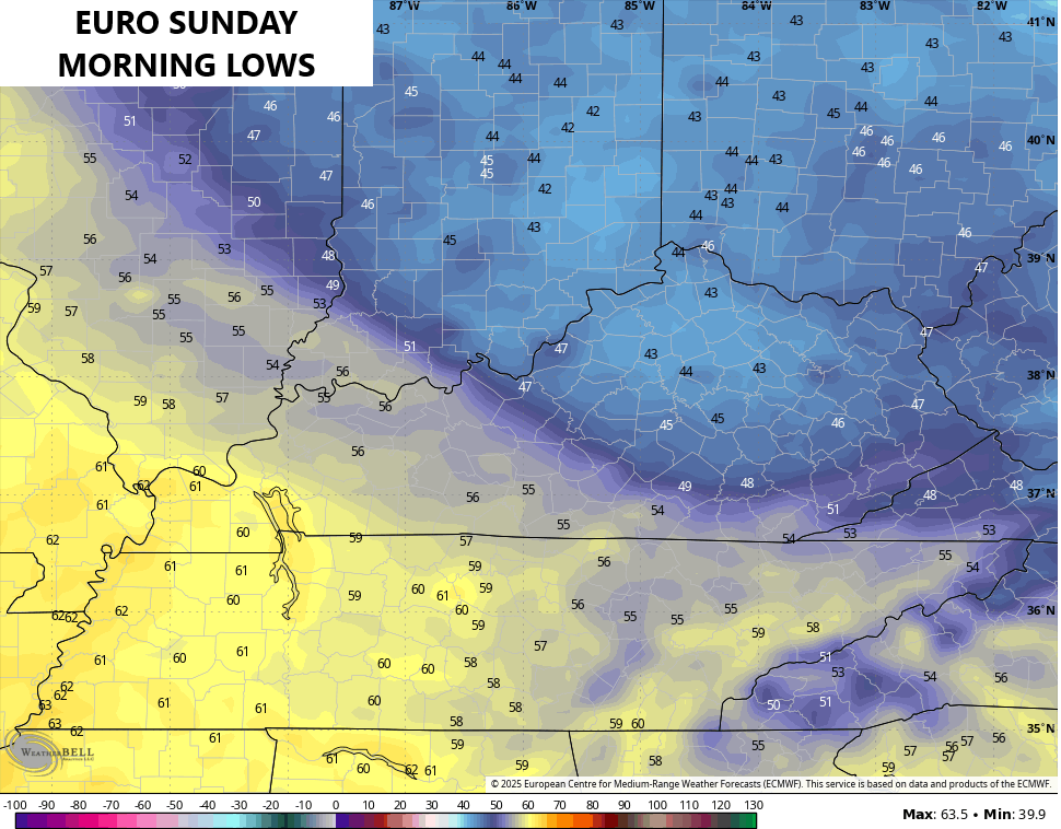
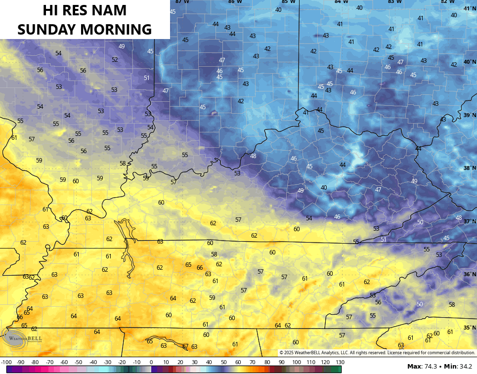
That’s pretty darn cool for the first morning of Meteorological Summer.
It’s going to feel the part of early summer with highs on Monday reaching the mid 70s to low 80s. Highs Tuesday and Wednesday are deep into the 80s with dry skies a good bet.
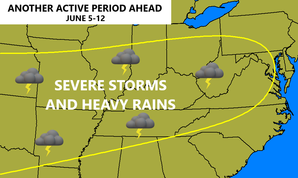
That dry sky looks to relapse back into a familiar pattern later next week into the following week. It’s one that can bring severe storms threats and heavy rains back into our part of the world…
The EURO Weeklies continue to indicate above normal rainfall taking us all the way through the middle of July. The bullseye of heaviest rains is right on top of us…
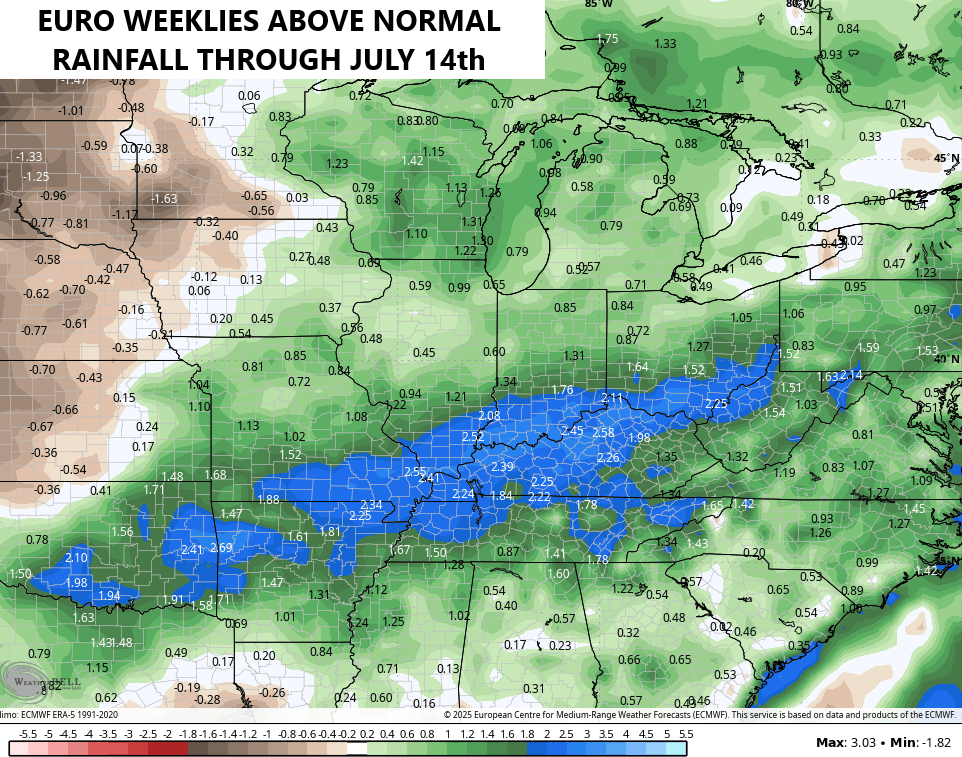
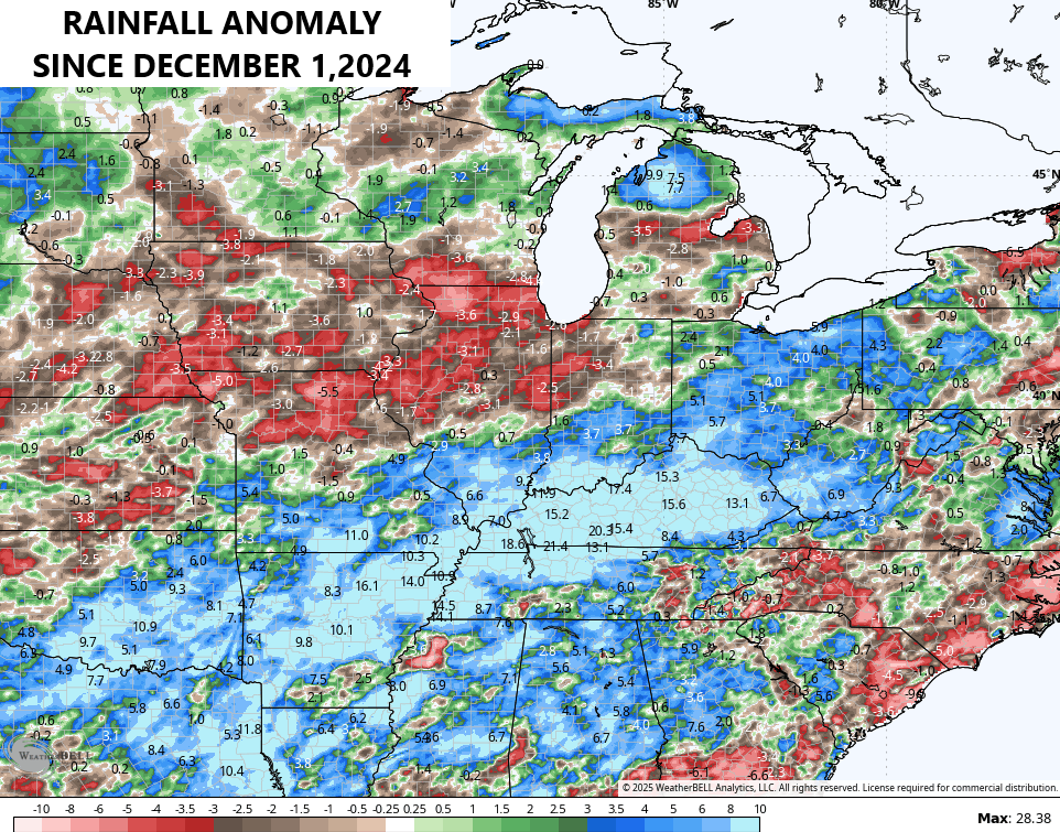
If that sounds familiar, it should. It’s essentially a continuation of the pattern we’ve been in for the past 6 months. Rainfall across Kentucky is roughly 15″-20″ above normal for this 6 month period…
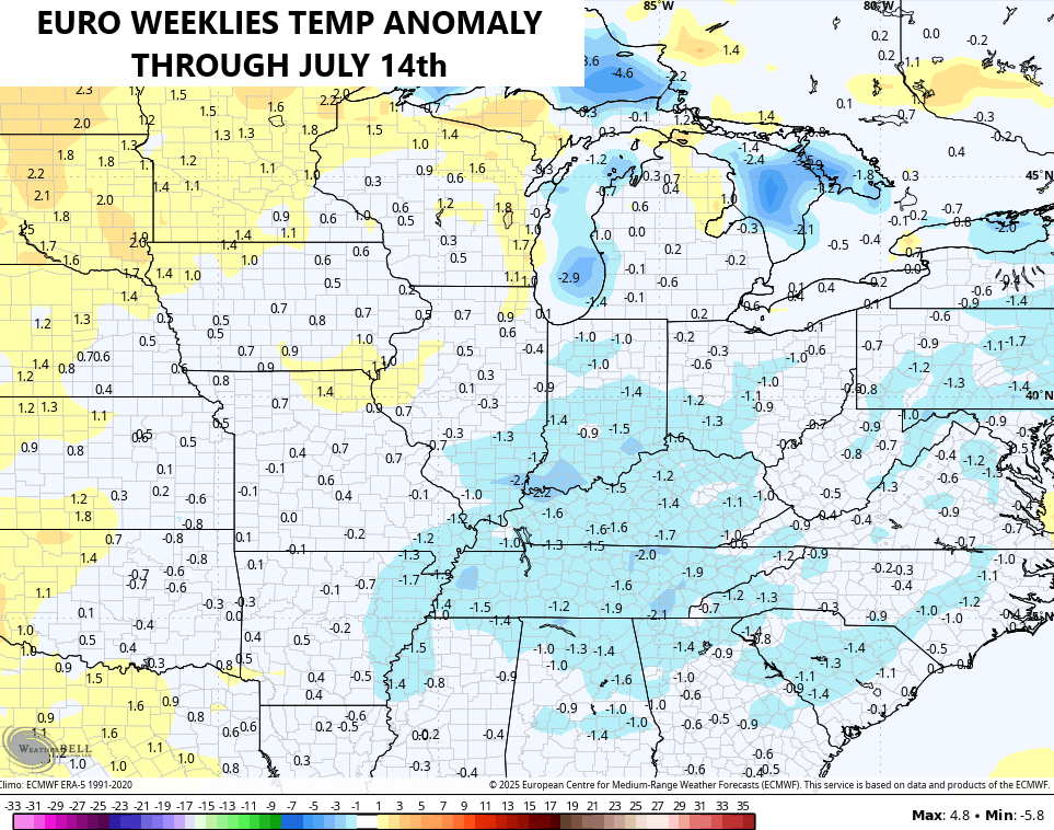
With a VERY wet ground, VERY lush vegetation and the forecast for continued above normal rains, it becomes difficult to get sustained REAL DEAL summer heat.
The EURO Weeklies are seeing all this playing out for the first half of this summer. Look where the model has the core of the cooler than normal numbers…
I leave you guys with your scattered shower and storm tracking tools…

Current watches

Possible Watch Areas

Make it a sensational Saturday and take care.

Looking at the mesonet year to date precip under the new maps section…..looking at the state as a whole.. two places stick out… One is in the southeast and the other is between louisville and frankfort…. One only has over 9 inches for the year and the other 18 inches for the year… that has to be an error or missing data… I don’t know.
There is definitely something mysterious about the smoke ? We never heard of this happening when I was growing up. Taylor county is finishing out the month with 10 inches of rain, which brings our yearly total to 40 inches. The plant life loves it.
We really need a dry spell soon. Way too much rain.
A very much needed DRY SPELL !
But only about two weeks