Good Sunday and welcome to the month of June. This is also the start of Meteorological Summer and things are about to feel the part as warm air surges in. Unfortunately, this will lead us back into another stormy pattern with temps likely coming way back down.
Temps this morning start in the low and mid 40s across the north and east with 50s and 60s west. This temperature swing also shows up this afternoon with upper 60s and low 70s in the eastern half of the state with mid and upper 70s west.
Monday features temps in the low and mid 70s east with 80s in the west. Those 80s then surge eastward across the state for Tuesday and Wednesday. 85-90 may even show up in some areas…
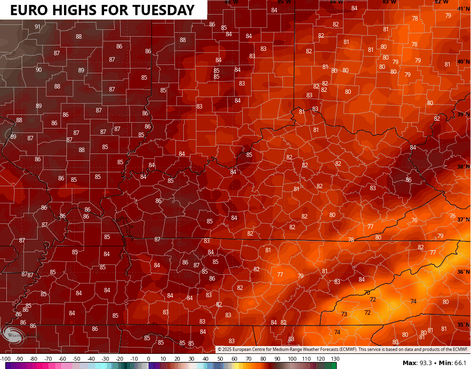
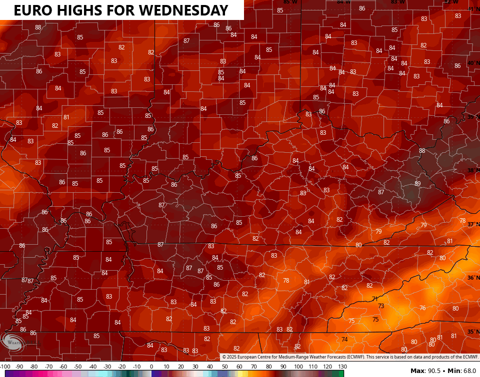
THAT is more like it!
Unfortunately, the pattern turns really active after this with several systems set to impact the region from late this week into the following week. Rounds of showers and thunderstorms may cause some issues during this time.
The EURO shows this active pattern through June 15th…
That same run of the EURO also brings more in the way of well below normal temps during this time…
The GFS is also active, but it doesn’t have as cool of a look to it. Why? Cause run after run, this model keeps developing something tropical in the Caribbean and then bringing it into the Gulf, potentially impacting us…
Now… Keep in mind this IS the GFS and that’s still a ways out there and no other model shows anything like this. That said, the Ensembles have been hinting at early season development in this region.
Considering there’s still a chance for a stray shower or storm out there today, I leave you guys with your tracking tools…


Have a great day and take care.

YEA, for the Summer temperatures. BOO, for the rain. When July and August come around it will be the opposite. LOL…
at this point I do not think it matters if July/August are opposite because by the time the end of August comes and if there’s been no rain, I think we’d still be ABOVE normal for the year but yet still would have drought conditions… crazy as that sounds.