Good Wednesday, everyone. Summertime air is back in the Bluegrass state and I don’t think too many people are going to complain. The complaints will likely show up in the coming days as rounds of showers and storms fire back up.
Temps today reach 85-90 in most areas with a mix of sun and clouds. There’s the chance for a shower or storm in the west and north.
The threat for showers and storms will then increase Thursday as a front approaches from the northwest and slows down. This brings repeat showers and storms into the first half of the weekend…
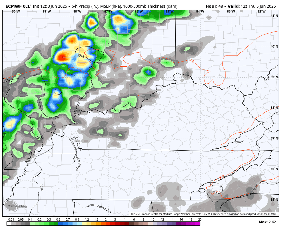
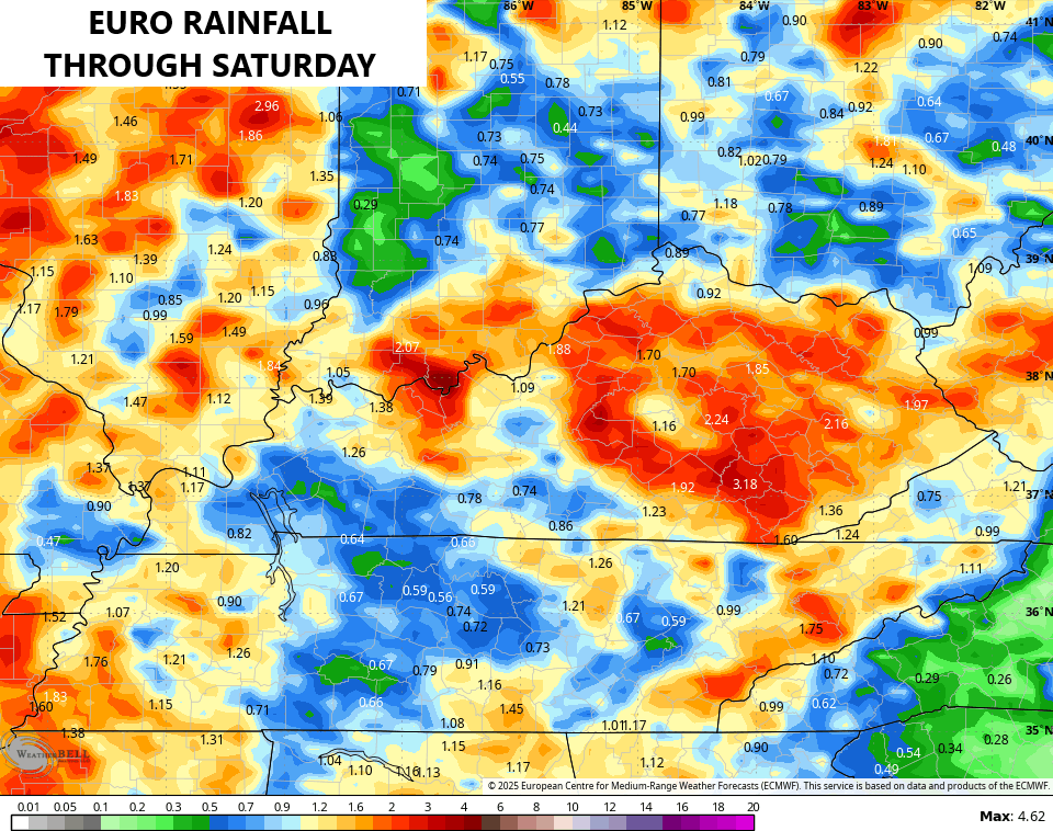
Heavy rainfall is a good bet with 1″-3″ of rain showing up, with the chance for locally higher totals. Here’s what the EURO is seeing through Saturday…
There’s also the chance for a few strong or severe storms. Here’s what the Storm Prediction Center is seeing for Friday…

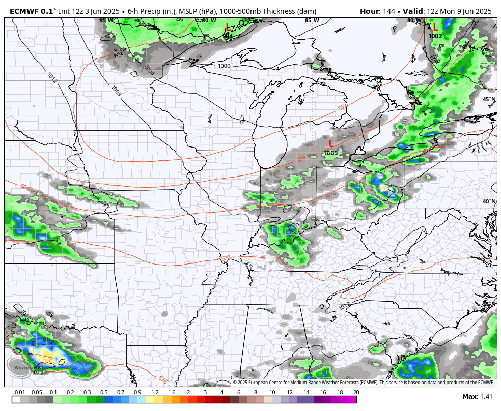
After a break on Sunday, more in the way of showers and storms look to kick in by Monday and the models suggest this pattern is with us for a while. This animation from the EURO shows this through June 18th…
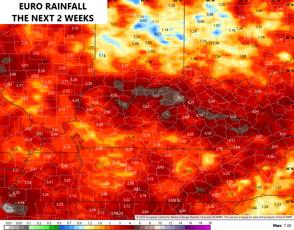
Here’s what this run of the EURO is seeing over the next 2 weeks…
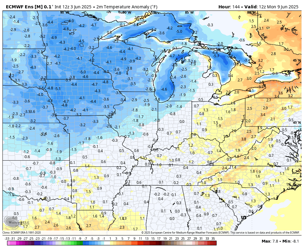
In terms of temps, we are seeing the EURO Ensembles trending toward the cooler scenario the GFS Ensembles have been showing…
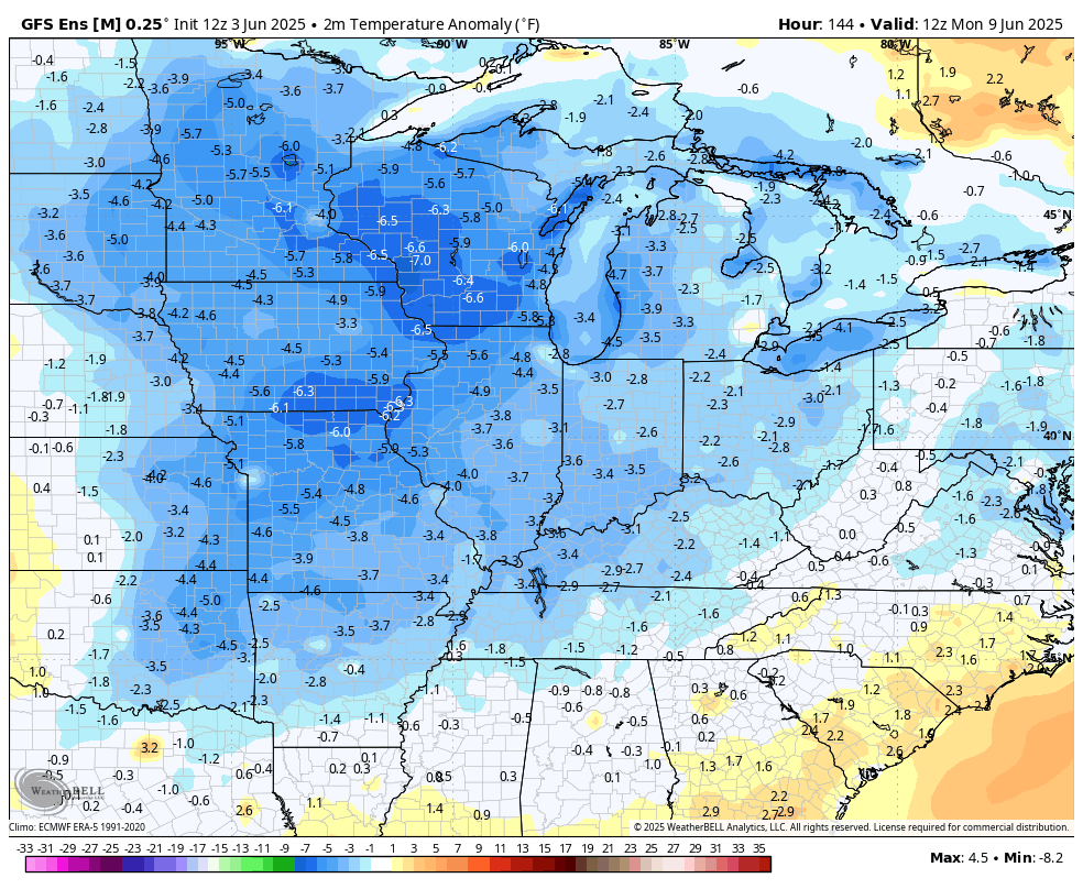
The GFS Ensembles…
I leave you with your tracking tools for the day…

Make it a wonderful Wednesday and take care.

Typical lying ensembles
Not buying into the severe weather threats.