Good Thursday, everyone. We have a front nearing the area from the west and it’s touching off a few storms out there today. This boundary slows down with a few waves of low pressure causing showers and storms to increase. Some of these may be strong or severe.
Temps today reach the 80s with a mix of sun and clouds. Humidity levels inch up just a bit as scattered showers and storms go up. There’s even the chance for a strong or severe storm across the west and north. This is a low-end risk from the Storm Prediction Center…

Friday is another warm day as humidity levels continue to creep up. Scattered showers and thunderstorms show up early in the day with the potential for a bigger complex or two of storms during the afternoon and evening.
These would be coming from the west and southwest and look to bring the best chance for severe storms to the state. The Storm Prediction Center has most of Kentucky in the Slight Risk for severe weather…

This doesn’t appear to be a widespread severe weather event at this point with damaging winds the primary threat.
Here’s a look at the individual threats from the Storm Prediction Center…


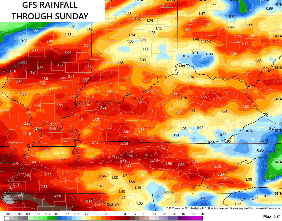
Scattered showers and storms linger into the weekend with most of the region picking up a general 1″-3″ of rain…
I’ll have the latest on WKYT-TV starting at 4pm today. As always, I leave you with your complete storm tracking tools of the day…


Current watches

Possible Watch Areas

Make it a great Thursday and take care.

Could happen, the dew point this morning was 69 degrees.
So when does serious heat arrive?
Hopefully soon, but it may be one of those Summers where the high temperature doesn’t exceed 90 degrees. I always like it hot the week of the 4th of July. Then when that’s over I want Fall like weather with cool morning temperatures in the low 50’s.
I think that increased humidity levels are going to make this a very uncomfortable summer, since our warming atmosphere can hold more moisture. Also, though the Atlantic and Gulf of Mexico hurricane season are likely to have fewer storms than normal, increased chances for major storms and mainland US landfall.