Good Tuesday, everyone. A gorgeous brand of air has moved into the region and makes it feel more like September than the middle of June. This hangs around for a few days before we go right back into a stormy setup by Friday and this weekend.
Temps this morning range from the mid 50s to low 60s with partly cloudy skies. Areas of fog are a good bet in some spots. Highs this afternoon hit the mid to upper 70s with a gorgeous sky, light breeze and low humidity.
If you look toward the sky, you will notice another milky look and that’s smoke dropping in from those Canadian wildfires…
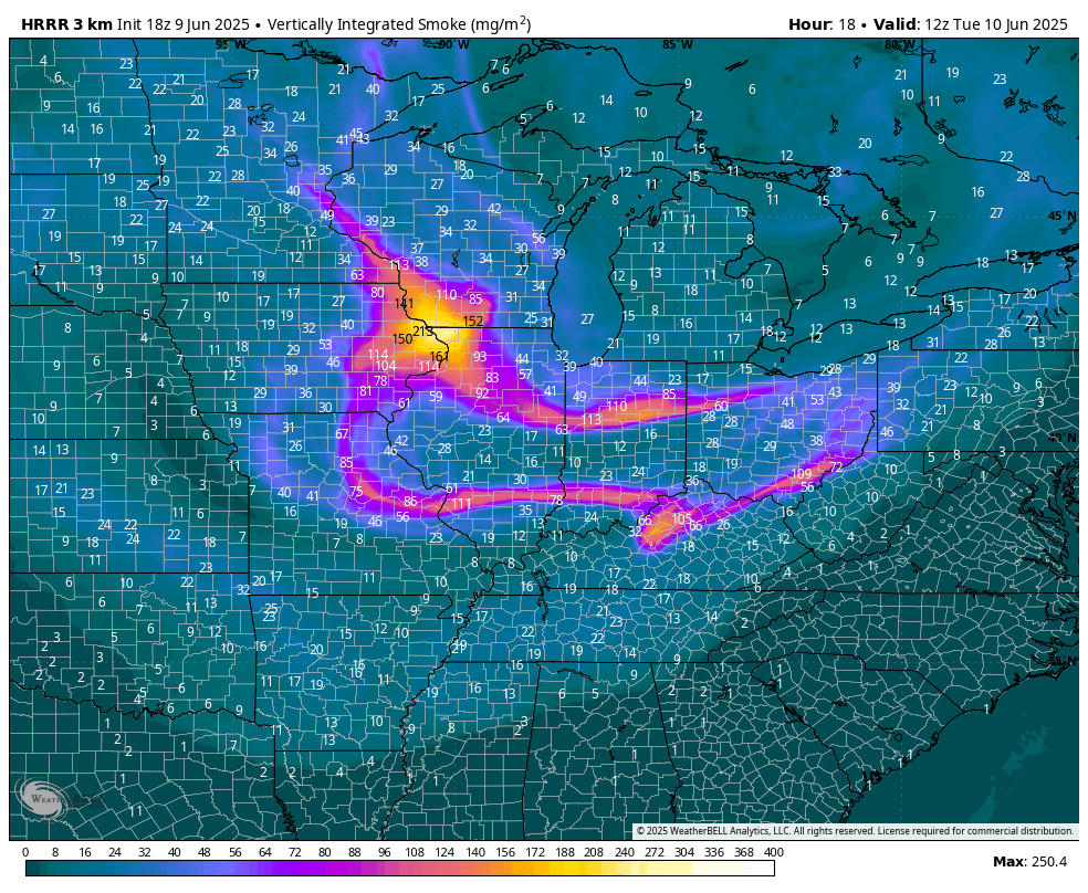
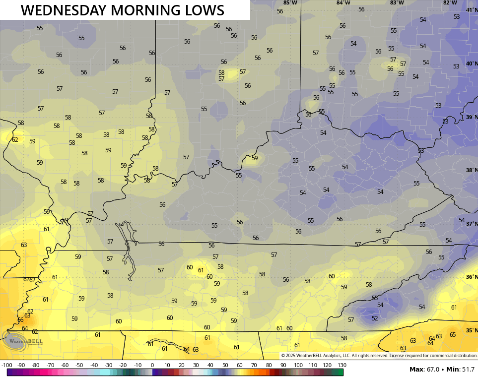
Some more of that will be noted on Wednesday as temps are deep into the 50s to start the day…
Temps slowly warm closer to normal from west to east by Thursday as we get set for more in the way of showers and storms to roll through. That starts Friday and looks to take us through next week…
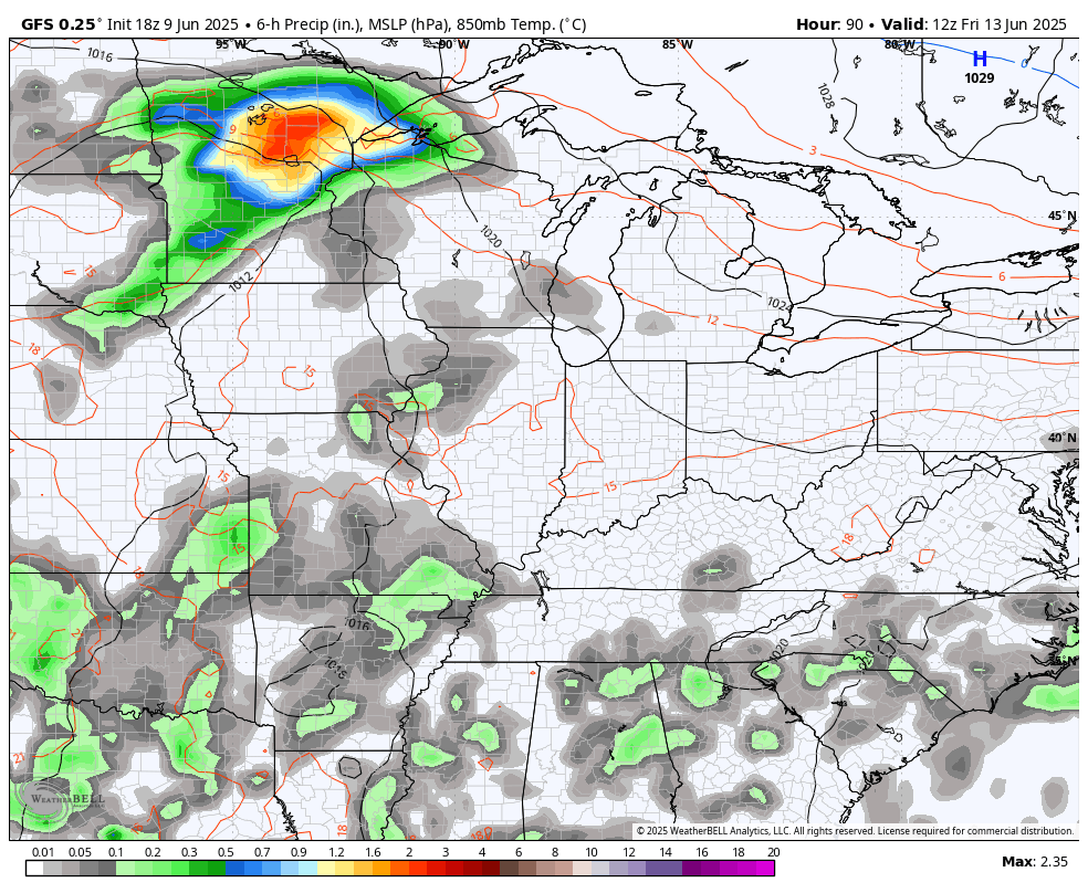
Some of those storms may be strong with the potential for some heavy rains. Watch this setup for local flash flooding.
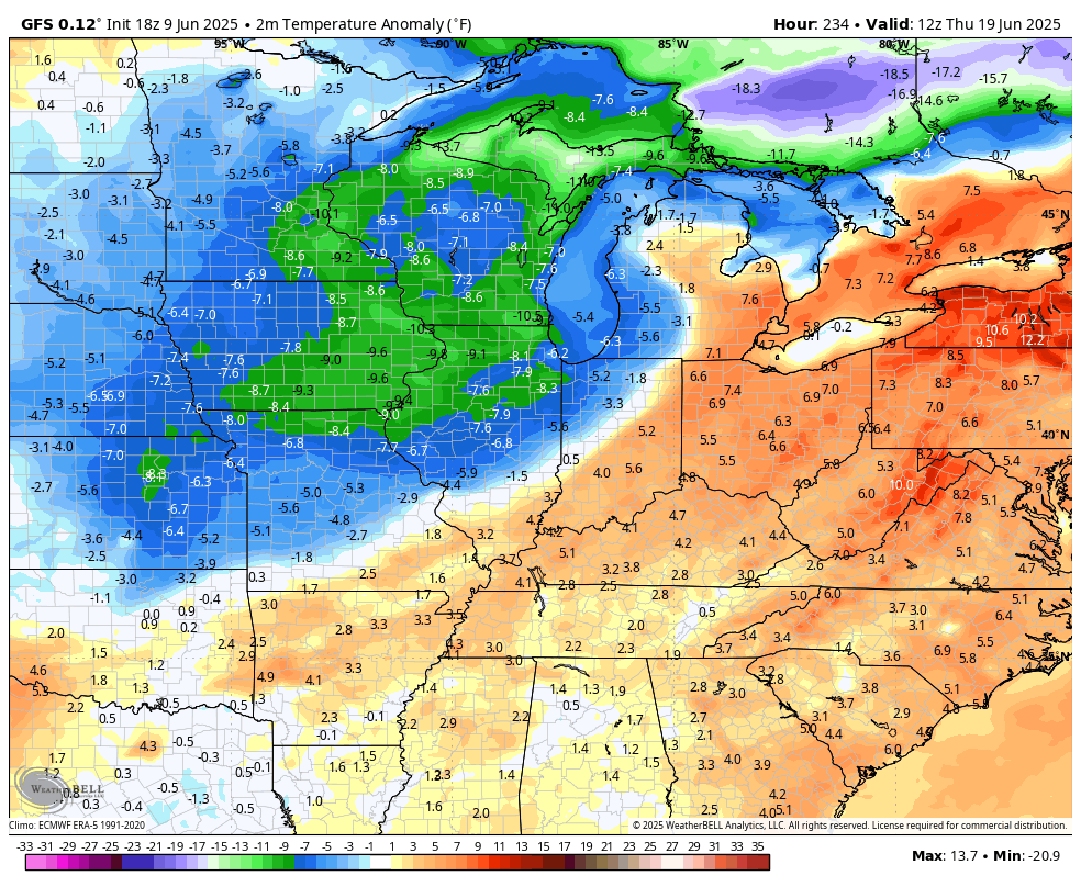
Temps are held in check again before another surge of below normal air tries to dive in later next week…
At this point, I’m wondering if many areas can go all the way through June without a 90 degree temp showing up. Hmm.
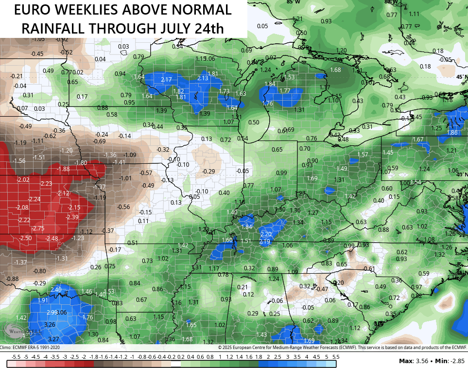
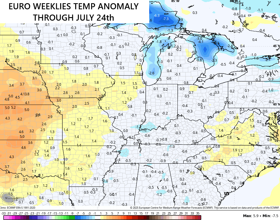
The pattern from the Euro Weeklies continues to show above normal rainfall and normal to slightly below normal temps into the second half of July…
The more things change, the more they stay the same.
Enjoy the day and take care.

Hoping the EURO weeklies crash and burn.
I’m hoping so too, Jeff. LOL…