Good Thursday to one and all. It’s a day very typical for the month of June as temps surge deep into the 80s with an increase in humidity levels. This is ahead of another stormy setup that begins to show up on Friday and, once it gets in, won’t be in any hurry to leave.
There’s the shot for a stray shower or storm in the west and south today but most of the state looks dry.
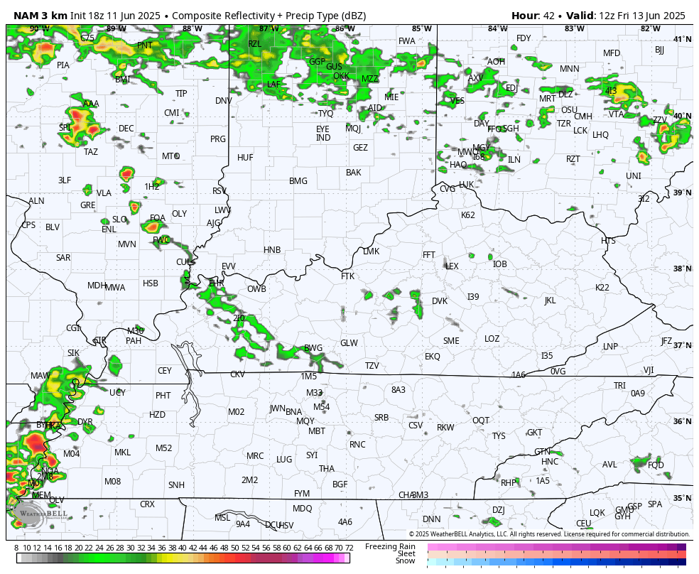
A few waves of showers and storms work across the state from southwest to northeast on Friday. This won’t be terribly widespread, but pockets of heavy rains will show up. Here’s the future radar from the Hi Res NAM for Friday…
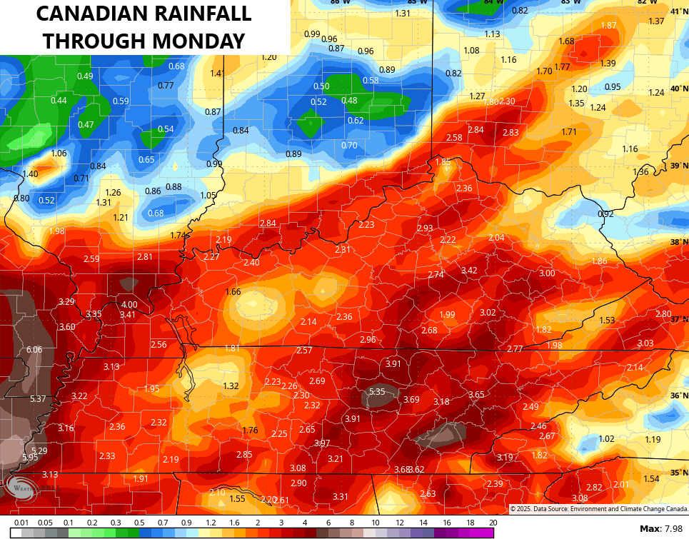
More showers and storms then roll across the region Saturday and Sunday. This won’t be all day stuff, but a few strong storms and heavy rains will likely show up. Additional action shows up into Monday and the models are seeing the possibility of another 1″-3″ of rain through this time…
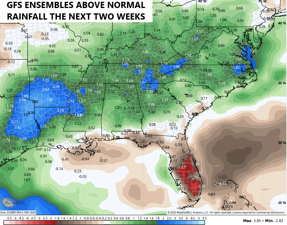
More in the way of showers and storms show up next week and that’s very likely to continue into the following week. The GFS Ensembles show above normal rainfall over the next two weeks…
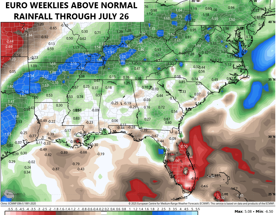
This is what the EURO Weeklies and GFS Extended have been showing for quite some time, and they continue to do so. Check out the Euro Weeklies through the final week of July…
I’ll have the latest on WKYT-TV starting at 4pm today. As always, I have you guys all set to track any of the popcorn storms that flare up in the west and south today…
…

Have a great Thursday and take care.

Bummer ! Reminds me of the weather pattern we had in the Summer of 1979. Lots of rain resulting in areas being flooded in Southern Indiana.
Link to ” the year of the rain ”
https://www.kyclimate.org/topic/8410192801945295007