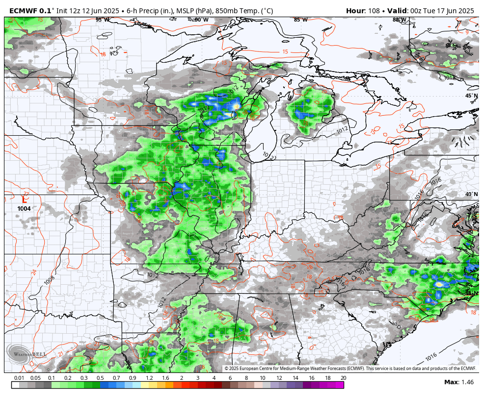
Good Friday, everyone. Tropical moisture is spinning into the region today and will continue through the upcoming weekend. This brings rounds of showers and storms that can put down heavy rains that kick off another stormy period.
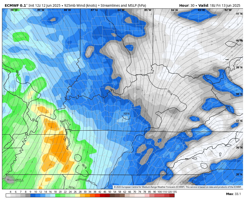
The low working into our region this weekend actually started down along the Gulf Coast, so it does have tropical moisture to work with. This animation shows the low spinning right on top of us through Monday…
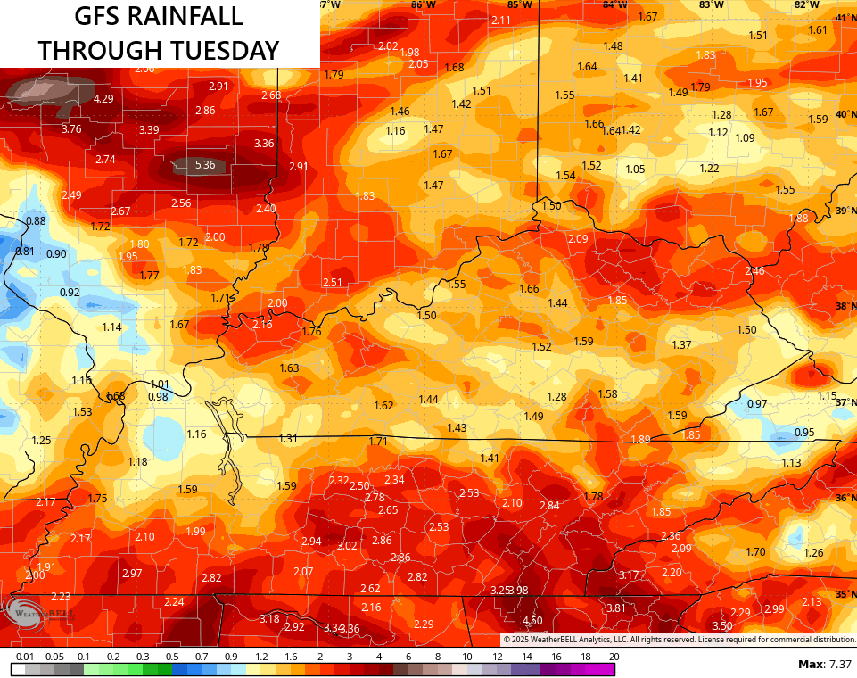
Models tend to underestimate the amount of rains systems like this can bring along for the ride. That said, all the models are seeing the potential for a general 1″-3″ rainfall from this…
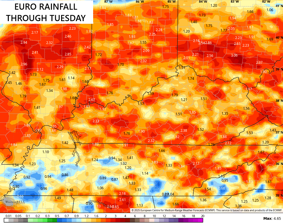
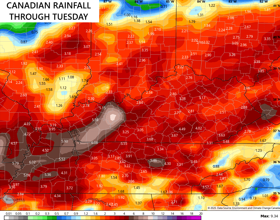
You can clearly see how the Canadian is more amped up with the rains, especially with showers and storms late in the weekend and early next week.
Areas of flash flooding are very possible, so stay alert.
Additional flash flooding is possible with a setup that continues to run on the stormy side of things. This setup may even throw some damaging winds in with clusters of storms dropping in from the northwest…
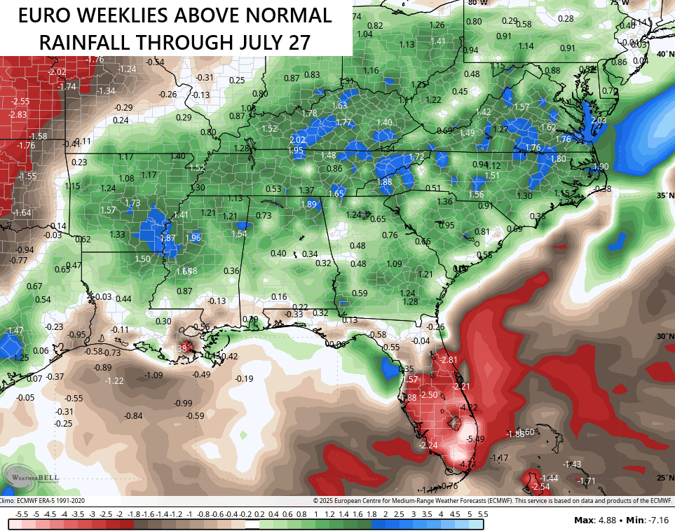
There’s no stopping this wetter than normal pattern as the EURO Weeklies continue to strongly suggest above normal rains through much of July…
Here are your storm tracking tools to end the week and kickoff the weekend…


Have a fantastic Friday and take care.

I call BS
Maybe it will turn to the opposite later in the Summer ?
The Climate Prediction Center’s ENSO discussion for June is out, and states that there is an 82% that ENSO-Neutral conditions will continue during the June through August period. There’s a 48% chance that it will persist into winter (Nov to Jan), although there is a 41% chance that La Nina will reappear at that time.
https://www.cpc.ncep.noaa.gov/products/analysis_monitoring/enso_advisory/ensodisc.shtml
What does that mean for our summer Joe? More of the same?
It’s a weak ENSO / neutral, as the PDO is moving deeper into the negative, which is indicating that ENSO / La nina is becoming more dominate. This is bad news, because with La Nina, we will have more severe weather longer. NOAA has predicted ENSO / El Nino maybe sometime late Winter into next Spring. With El Nino in charge, we will have less chances of severe weather, and an increase chance of late Snowstorms. We shall see.
I’m sorry Joe, the above reply was suppose to be after your comment. The more I get into this internet stuff, the more confused I get. This technology just isn’t for me. Dottie, I really don’t know how the Summer will turn out weather wise, and I don’t think anyone else does either.