Good Saturday, everyone. Rounds of showers and storms pulled back into the region Friday and caused a few issues. This is a sign of things to come as our pattern locks back into a stormy one that puts down quite a bit of rain.
Low pressure continues to spin eastward across the state this weekend, bringing rounds of showers and storms along for the ride…
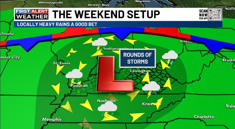
Areas of torrential rainfall will show up from time to time today and Sunday. This will be enough to cause local flash flooding issues.
The rains won’t be constant with a lot of dry times showing up. Daytime highs generally hit the upper 70s to low 80s with a pretty muggy environment.
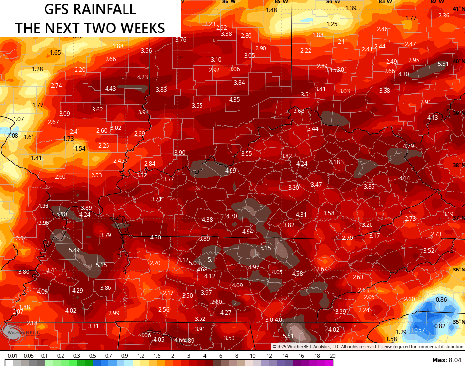
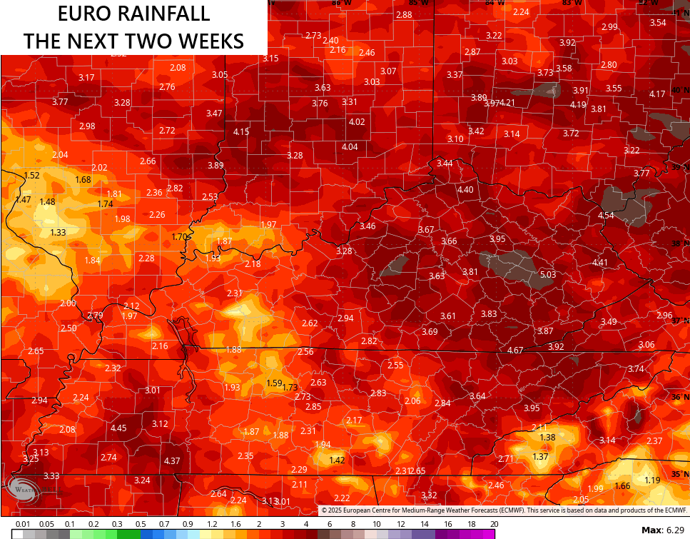
More in the way of showers and storms roll our way in the week ahead with clusters of big storms possible the following week. The models are pretty well locked in on the potential for several inches of rain during this two week period…
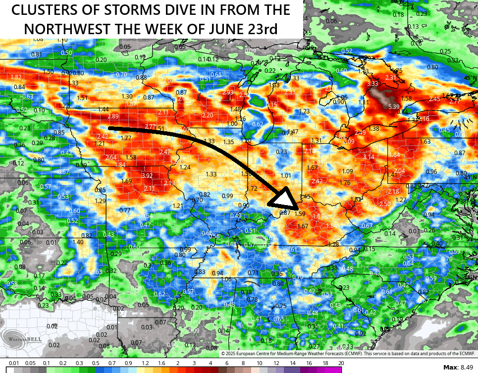
The setup for the following week may very well feature some damaging wind producing thunderstorms dropping in from the northwest…
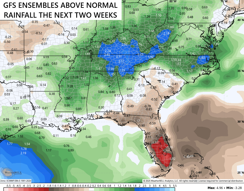
The GFS Ensembles continue to put the bullseye of heaviest precipitation right on top of our region…
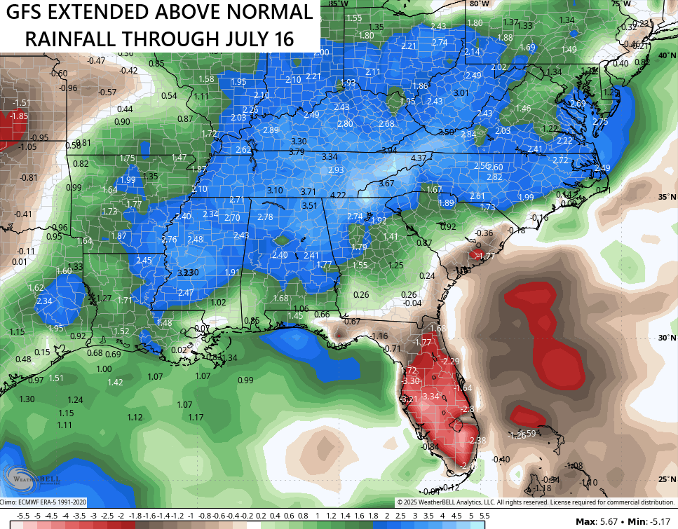
The GFS Extended that goes through the next month of so is well above normal for rainfall…
Summer is our flash flood season here in Kentucky and this summer would appear to be of particular concern.
I leave you with your Saturday storm tracking tools for the day…


Have a great Saturday and take care.

Not buying it.
.58 inches of rain recorded here in Maple yesterday afternoon. This negative PDO, we have now will have to change to positive ( El Nino ) to bring us a very warm and dry Summer. I found this out by looking at past PDO readings.
My PWS near Bowling Green recorded 0.70 inches of rain on Friday, bringing the week’s total to 1.25 inches. It’s been quite a few years since the foliage in Warren County has been this green in mid-June! With the water table at peak levels, the greenery won’t be withering any time soon, and should help keep temperatures at moderate levels through the first half of the summer.