Good Sunday, everyone. Spiraling bands of showers and thunderstorms continue to work across Kentucky as low pressure spins through. The setup for the week ahead changes, but the end result is the same as additional rounds of storms work in.
Today’s concentration of showers and storms will be across central and eastern Kentucky, especially this afternoon and evening. Just like we’ve seen in recent days, these showers and storms will put down torrential rains in a short amount of time. That keeps the local flash flood threat going.
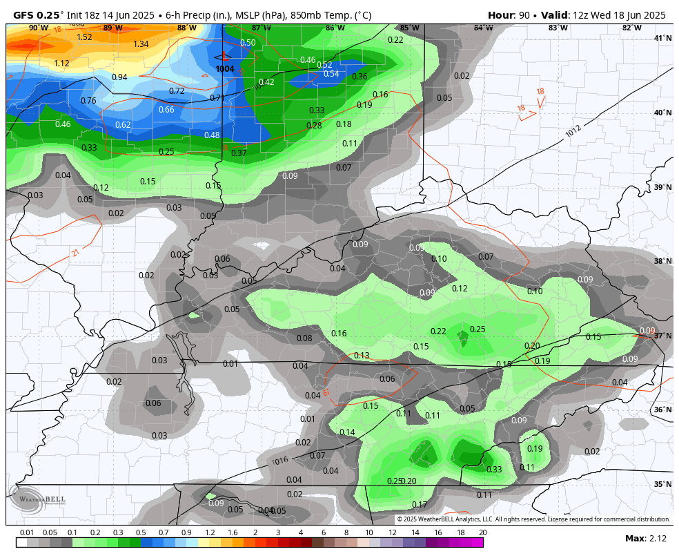
As this low exits the region tonight and early Monday, it leaves a weakness in the atmosphere that’s oriented from southwest to northeast. This allows for additional heavy rain producing showers and storms to go up Monday into part of Tuesday…
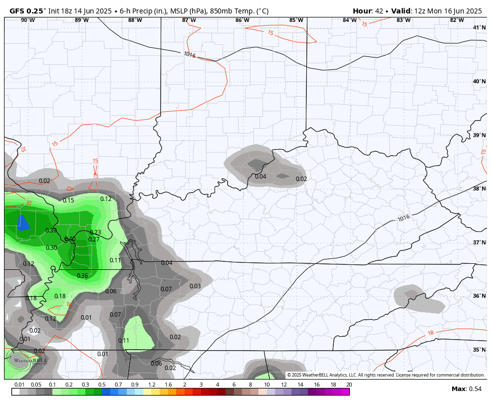
Locally heavy rains will be noted once again, so we will have to watch the creeks and streams for yet time.
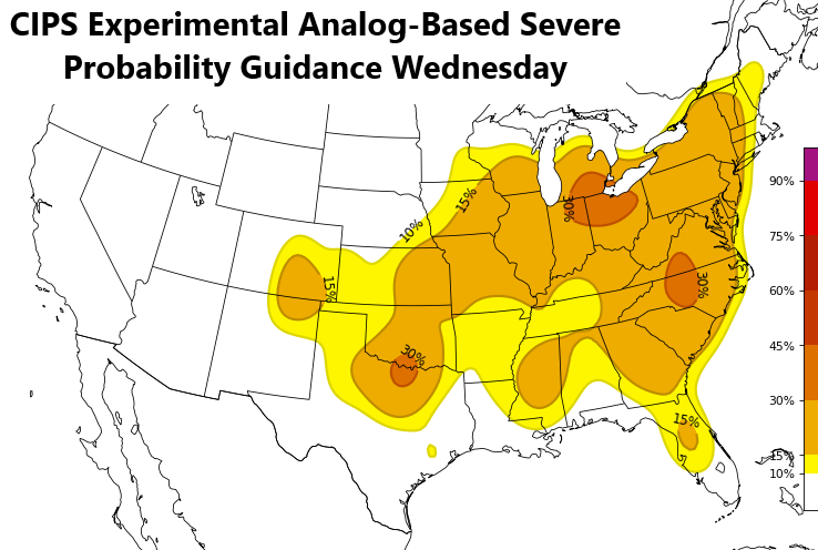
The setup from there looks to bring clusters of strong to severe storms in here from northwest to southeast Wednesday and Thursday…
The machine learning model from Colorado State University is highlighting the severe threat Wednesday and Thursday…
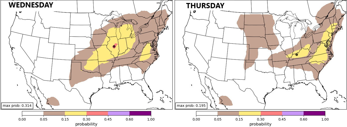
The analog guidance based on the GFS Ensembles is also seeing the potential…
Damaging winds usually accompany rounds of storms in this type of pattern. These storms are also loaded with lightning and torrential rains, leading us into another flash flood threat.
A quick surge in temps is a good bet around here next weekend with a shot at the first 90 degree temps into our region. You’re going to hear a lot about some serious heat, but that’s going to our north and into the northeastern part of the country.
Here are your storm tracking tools to end the weekend…


Have a great Sunday and take care.

We have not had that much rain this past week here in Maple. Hoping the experimental analogs fail. We don’t have a weather forecast here in Maple. Too rual I guess. We only receive forecast out of Louisville, which is much different. Starting next Saturday, the weather forecast for Louisville is a high temperature of 95 degrees, and a string of 90 + temperatures thereafter. The huge high pressure in the Atlantic getting stronger, and moving westward would be my guess.