Good Monday, everyone. We are coming off a tropical weekend full of high humidity levels and plenty of showers and storms. These storms caused flash flooding in some areas and the storms this week should do the exact same thing. Some of these storms may even be strong or severe.
Isolated showers and storms are out there early today before this action increases from southwest to northeast late today through Tuesday. Torrential rains are a good bet with these storms, leading to flash flooding in some areas.
Models will never accurately capture the actual rainfall intensity or locations, but they are giving us the signal for more flash flooding. The Hi Res NAM rainfall through Tuesday gives us a pretty good signal…
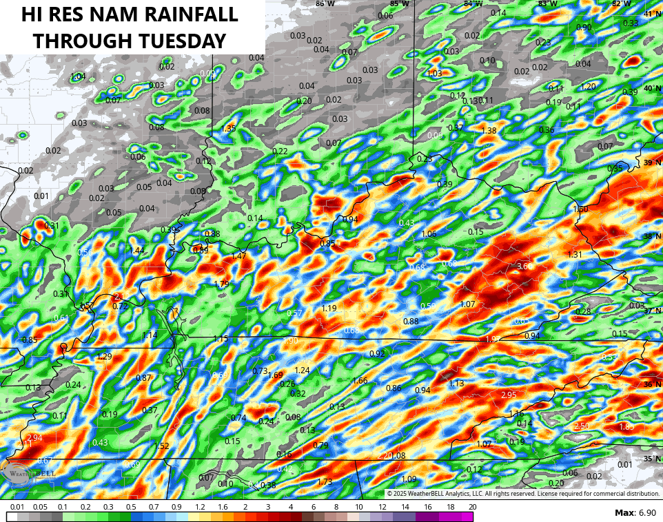
These storms will also be very noisy, producing a ton of lightning.
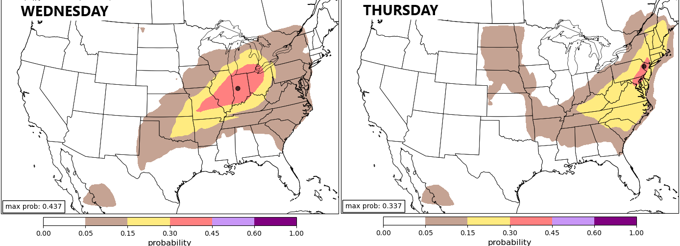
A slow-moving front drops toward the region Wednesday and Thursday, bringing the potential for a few strong to severe storms. The latest machine learning model from Colorado State University shows this threat…
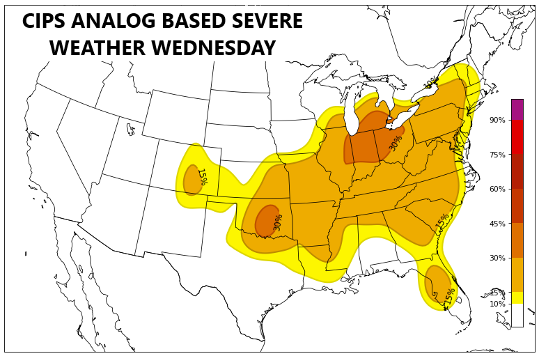
The analog based guidance from the GFS Ensembles is also seeing the potential…
That front drops through here by Friday with some pleasant air to round out the week. Temps then jump up this weekend as some serious heat bypasses us well to the north and northeast. 85-90 degree temps should be common this weekend.
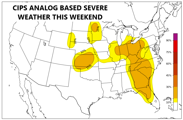
I’m going to be watching for the chance for thunderstorms to drop in here from the northwest this weekend. The latest analog-based data shows this possibility…
Rounds of showers and thunderstorms would then increase once again next week as the pattern reverts right back to stormy and wet.
The latest GFS Extended goes through the next month and change shows well above normal rainfall in our region…
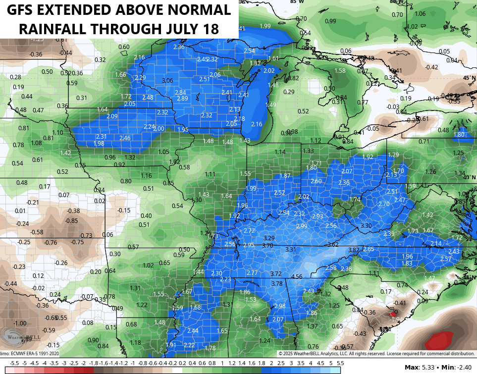
At this point, let’s just go ahead and break all the possible rainfall records we can for the year. It’s not like we have a choice anyway.
Would you trade the rain for some summer snows? Check out the snowfall forecast across Idaho and Montana in the coming few weeks…
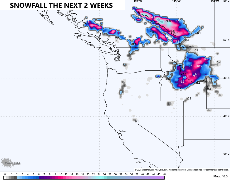
That’s pretty insane for this time of year, folks.
Here are your storm tracking tools to start another stormy week across the Commonwealth…


Have a magnificent Monday and take care.

*thumbs down*
We need sunshine and blistering heat.
Need the Sunshine and normal Summer temperatures with timely Rains. High elevation Snows anytime of the year is not unusual.
All the rain we’ve had so far and the dense foliage growth it has stimulated has held temps below 90° this year. With the local mid range forecast calling for a greater than 50 percent chance of rain on 8 out of the next 14 days, temps will be hard pressed to hit the low 90’s in July. Tropical activity will likely ramp up in August, and this will provide another damper on temperatures.
I don’t think that happens.
According my local weatherman here in far Western ky is forecasting mid 90’s this weekend
Upper 80’s and low 90’s here in Maple beginning this weekend.