Good Tuesday, everyone. It’s another day of tracking possible flash flooding across Kentucky and surrounding areas. I know this is sounding like a broken record, but that doesn’t change the fact of what Mother Nature is throwing us.
Here’s a breakdown of the rest of the week in weather:
- Showers and storms come at us in waves from southwest to northeast today.
- These storms will put down a tremendous amount of rain in some areas. A quick 2″-4″ will be possible in a few spots.
- Flash flooding is a real concern today across central and eastern Kentucky.
- A few of the storms may also be on the strong side.
- A better chance for strong to a few severe storms arrives Wednesday into early Thursday as a cold front drops in.
- Damaging wind is the primary player with any storm that flexes a little bit.
- The storms Wednesday into Thursday will also be capable of producing flash flooding.
- The cold front works through the state Thursday night with much better weather for Friday.
Today’s true severe storm threat is rather limited…

A Marginal Risk to Slight Risk then shows up for the entire region Wednesday…

This weekend looks very steamy with high humidity levels and highs generally 85-90 degrees. We are on the outside looking in on a big heat wave going up and over top of our region. Areas from the northern Ohio Valley to the northeastern part of the country will bake for several days.
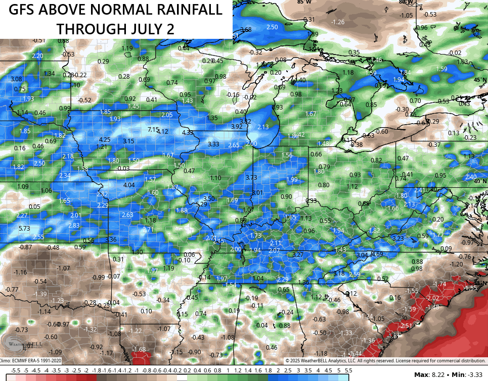
Showers and storms look to kick back in next week, keeping the next two weeks averaging above normal for rainfall…
I’ll have the latest on WKYT-TV starting at 4pm today. As always, I leave you with your complete storm tracking tools of the day…

Current watches

Possible Watch Areas

Make it a terrific Tuesday and take care.

Still calling bullsh-t on the models.
Looking more like a real deal heat wave in the making for some areas. Just in time for the official start to Summer. Got to be happy about that Jeff.
85 to 90 still too hot… especially with humidity… does anyone here use a dehumidifier?
Yes. One’s in the finished portion of the basement and the other is in the shop area (adjacent basement area). Set on 50%, they’re cycling on and off continually. Both need emptying every day or two. They make a huge difference, doing what the A/C alone cannot accomplish on its own.
That’s not hot at all.
The two A/C units I have keep the humidity at a constant 40 %. My basement is always cool and dry. The soil in our area drys out quickly, no matter how much it rains.