Good Wednesday, everyone. Rounds of strong to severe storms will roll across Kentucky today and some of these linger into Thursday. All of this is ahead of a cold front blasting through here to end the week.
Here’s a breakdown for you guys:
- Scattered showers and storms will be around through the first part of today.
- Some of these may be strong and put down enough rain for local flash flooding.
- The first of two rounds of storms will develop to our west and northwest this afternoon.
- This blasts eastward across the state this evening and will likely bring severe weather with it.
- Damaging winds are the main threat with this line. Pockets of large hail may also show up.
- A second line should develop behind this and bring another damaging wind threat.
- The tornado threat today is small, but it’s certainly there for central and western Kentucky, especially.
- Torrential rains will be noted with all the storms through tonight. This brings additional flash flooding issues to the Commonwealth.
- A few showers and storms linger into Thursday with the threat for a few severe storms in central and eastern Kentucky.
- Much better weather shows up behind this front on Friday. Mainly dry skies and near normal temps show up.
The latest future radar from the HRRR starts at 2pm today and goes through 8pm Thursday. This gives us a good look at the waves of storms during this time period…
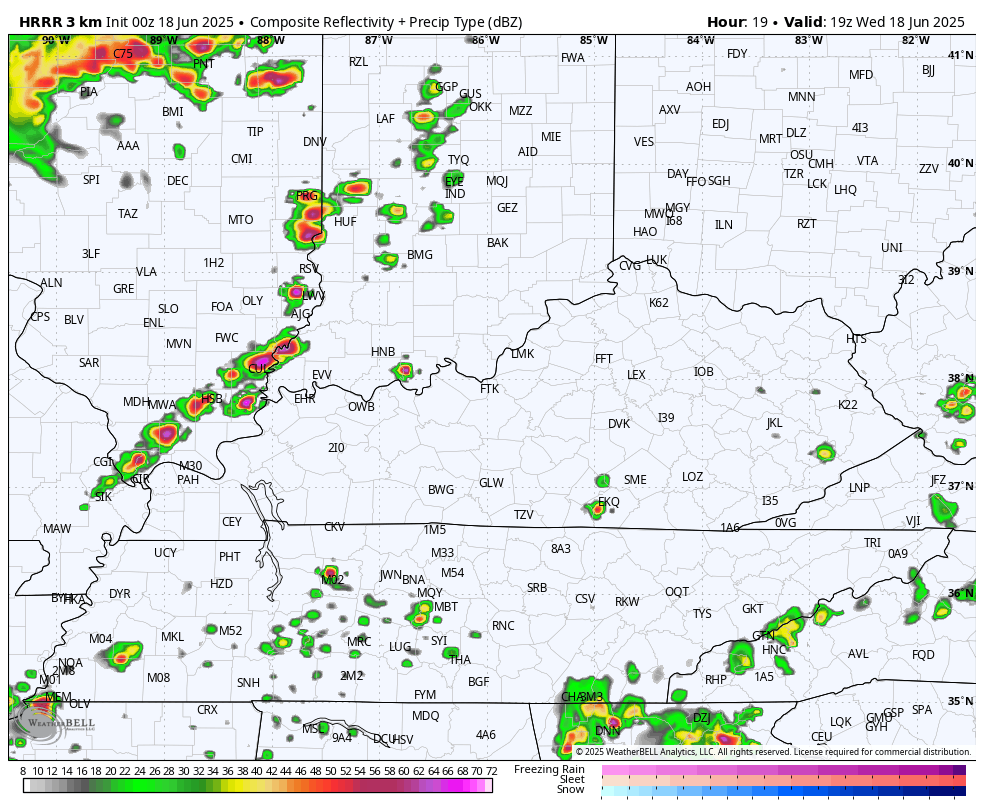
The Storm Prediction Center continues to highlight today’s severe storms threat with a Marginal Risk to an Enhanced Risk across our region…

As I mentioned, the chance for a tornado or two is there across western and central parts of the state…

The Damaging Wind Threat continues to run the highest…

The threat for large hail is there, too…

The lingering threat for severe storms is a bit lower for Thursday. Here’s the latest Severe Weather Outlook from the Storm Prediction Center…

Temps this weekend and early next week head toward the 90 degree mark with the muggy meter going into overdrive. The humidity levels will be absurd and make it feel much toastier than the thermometers. That wet ground with green vegetation helps keep the temps from going crazy. The core of this heat is to our north and northeast.
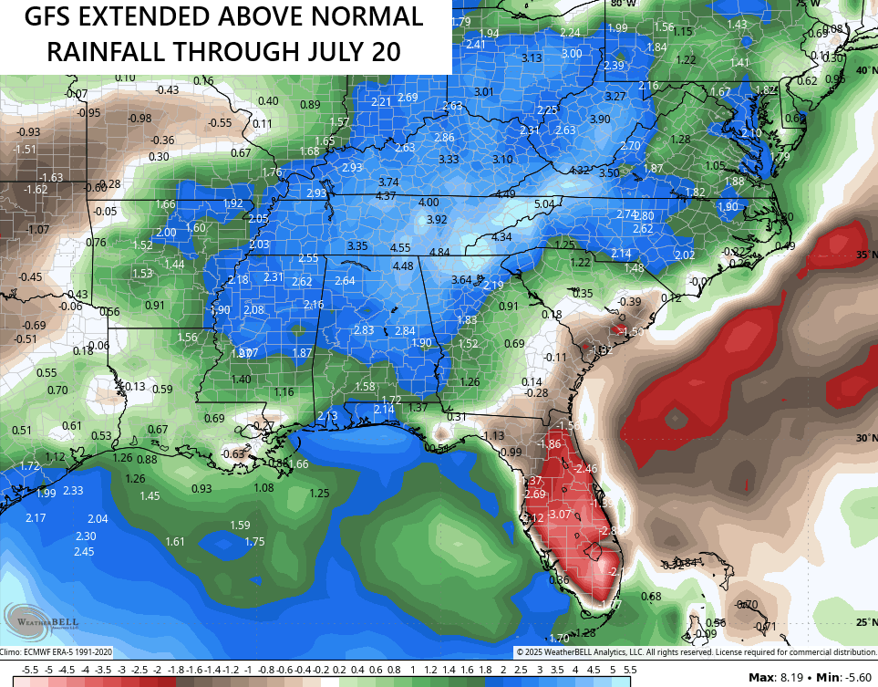
The pattern goes right back to stormy next week and it’s likely to remain that way for most of summer. The latest GFS Extended takes us through much of July and is growing wetter with each run…
I’ll have the latest on WKYT-TV starting at 4pm today. As always, I leave you with your complete storm tracking tools of the day…

Current watches

Possible Watch Areas

Make it a wonderful Wednesday and take care.

Not too concerned about this afternoon and evening’s storms, but will keep a close watch until the front comes through. Maybe we shall all see a typical Summer weekend, and it’s right on time. Can’t see this wet pattern continuing through the rest of the Summer months ?
I still don’t buy the GFS BS. It won’t be wet all summer.