Good Friday, everyone. It’s a MUCH better weather day taking shape across Kentucky and surrounding areas as pleasant temps invade for a day. This will be followed by our first surge of summer heat and humidity later this weekend into the first half of next week.
Temps out there today reach the low and mid 80s with partly sunny skies. Humidity levels are down compared to today and compared to where we’re going.
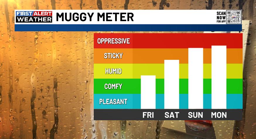
Saturday finds temps in the 85-90 degree range for central and eastern Kentucky with 90 or so in the west. Humidity levels jump up, but those really crank by Sunday and Monday, taking our Muggy Meter into the Oppressive category…
Heat Index temps for Sunday and Monday should reach 95-100 degrees in several areas…
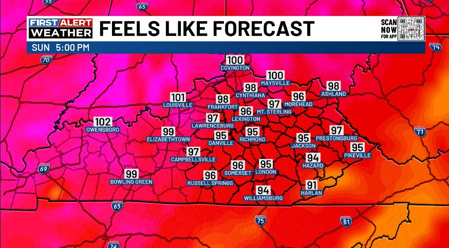
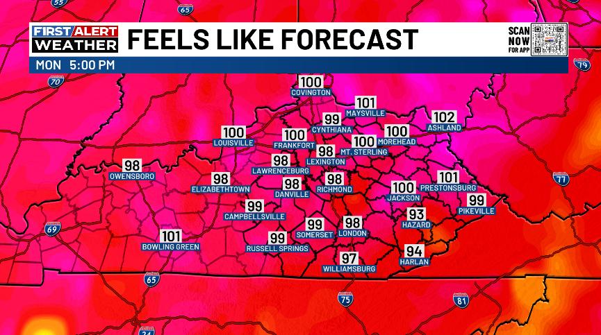
A few spots can do it a little better than the 100 degree mark for a heat index.
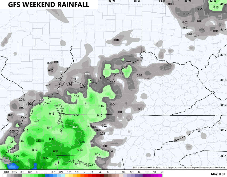
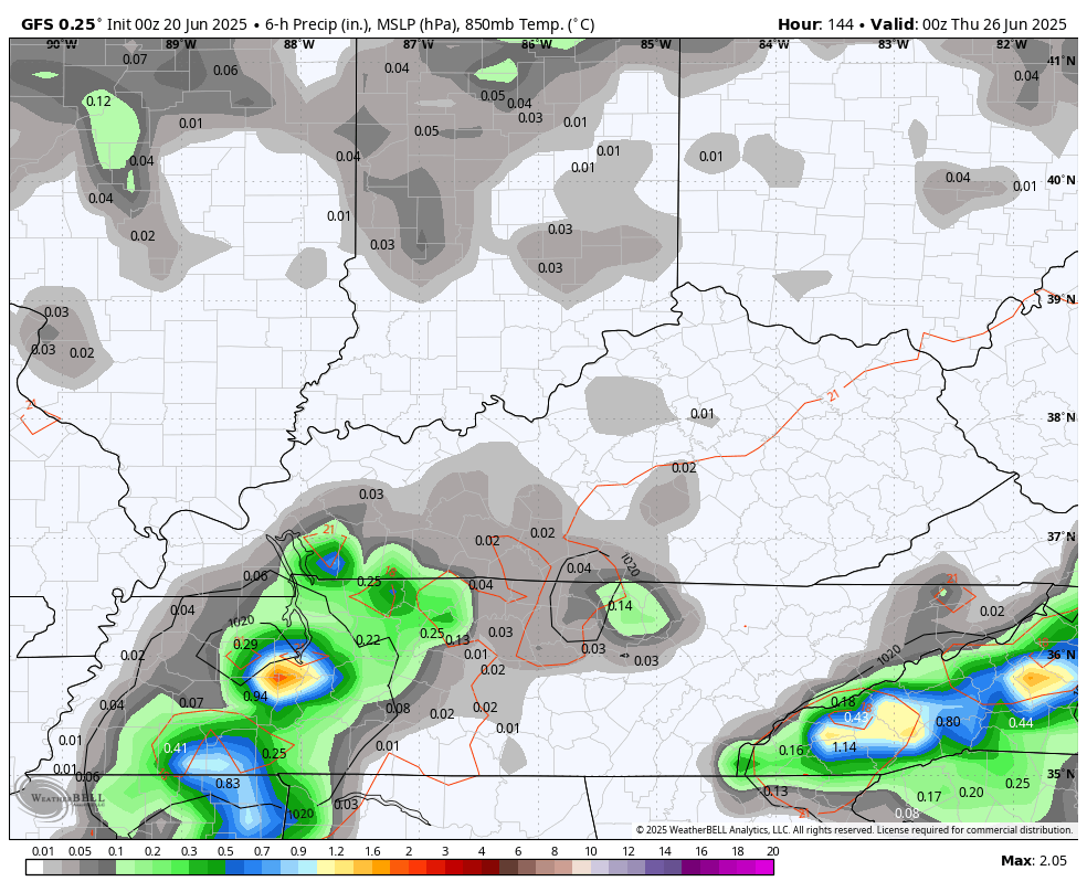
Isolated showers and storms will go up during this time with the best chance on Sunday. The GFS has the best coverage of these…
The threat for scattered showers and storms increases for the middle and end of next week. That’s when we will have to be on guard for some strong storms and more in the way of local flash flooding…
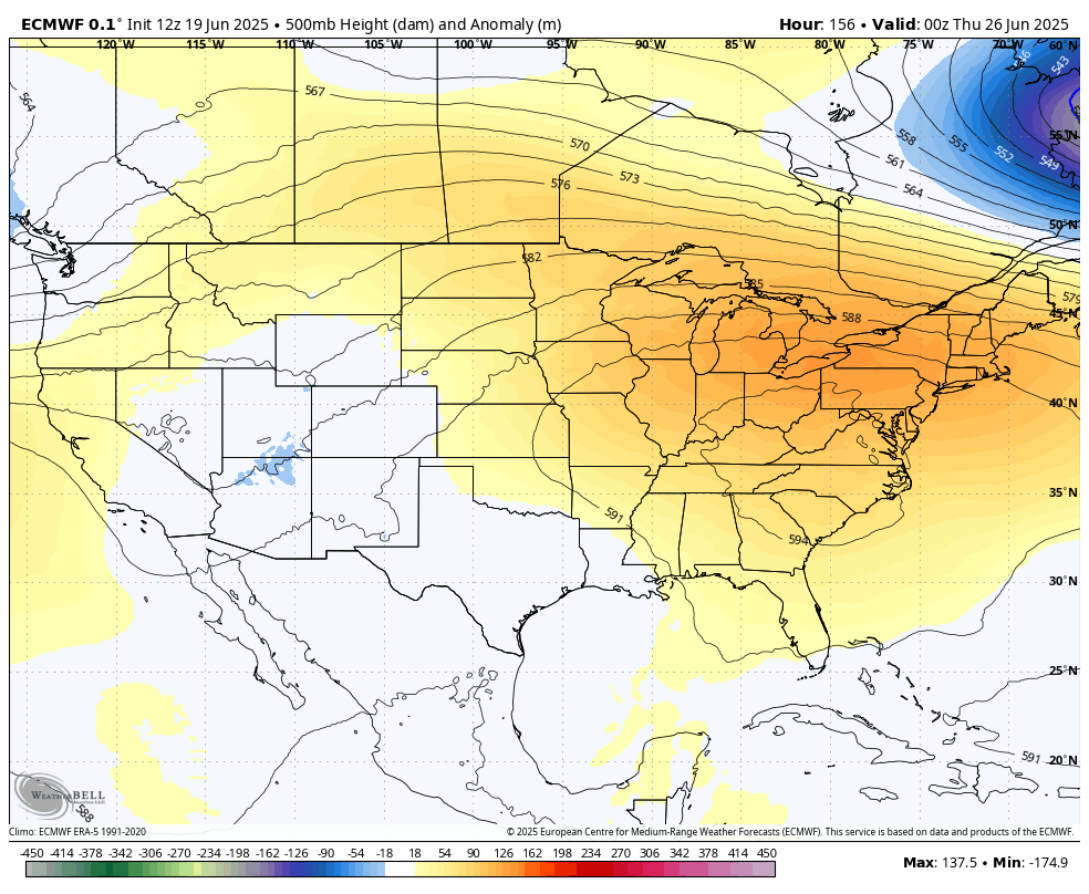
Temps will likely come back down and there’s the chance for another trough to dig into the eastern half of the country to end June and begin the month of July. The EURO is picking up on this very well…
The EURO has another surge of below normal temps for the 4th of July week…
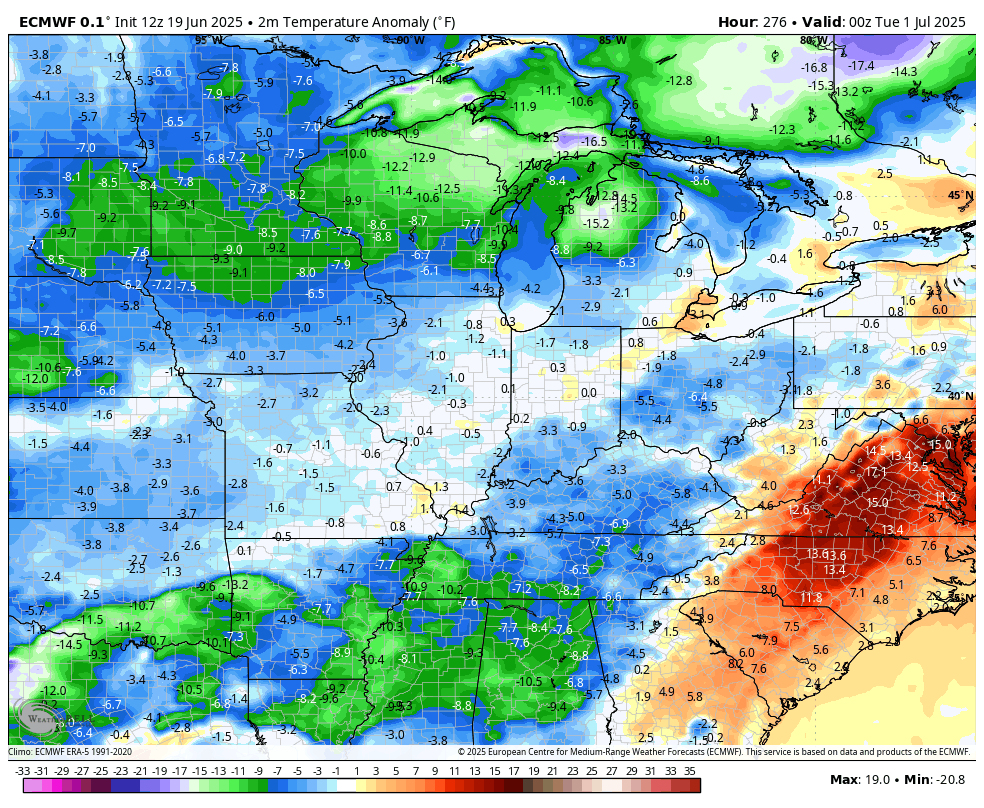
We shall see.
Make it a fantastic Friday and take care.

It could happen. I’ve seen some very cool temperatures on July 4th. The warmest I can remember was July 4th, 1976 at 105 degrees.
Not buying the EURO bs.