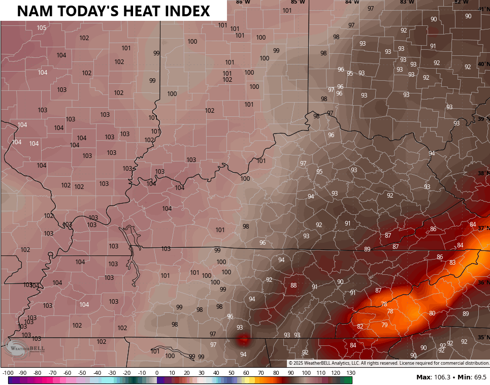
Good Saturday, everyone. It’s the first full day of Summer and the weather is changing to match the season. The steam is on this weekend and that carries us into early next week, but the pattern can still fire off some scattered storms.
The Heat Advisory criteria around here is for a heat index of 105 for 2 or more hours. The best chance for that to happen is across western Kentucky and that’s why they have a Heat Advisory…
The heat index values today are forecast to approach that in the west but come in just under. Central and eastern Kentucky sees low and mid 90s …
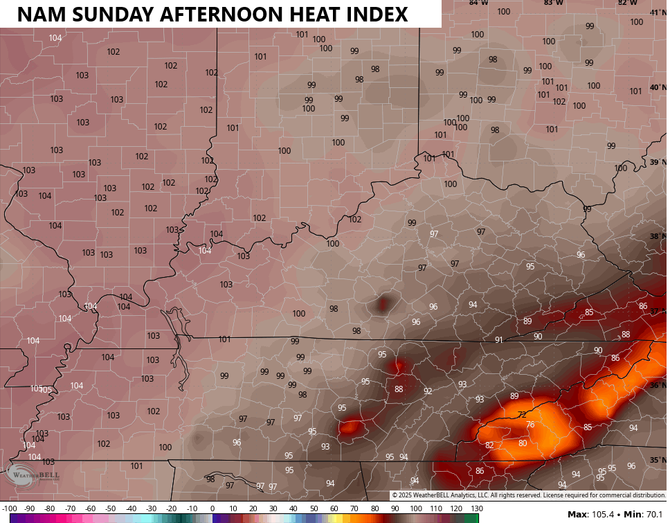
The heat index forecast for Sunday comes up for the rest of the state but stays similar in the west…
Monday has a similar look and feel…
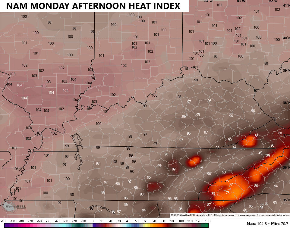
You can clearly see how the core of the heat stays to our north.
Much of this is driven by the humidity as actual temps only reach the upper 80s to low 90s, especially Sunday and Monday.
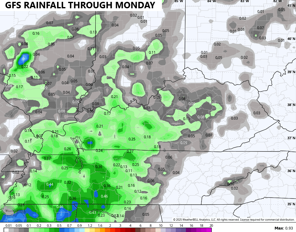
You will also notice some clouds going up during the afternoon hours during this time. Some isolated showers and storms will also be noted and that will also help us out some.
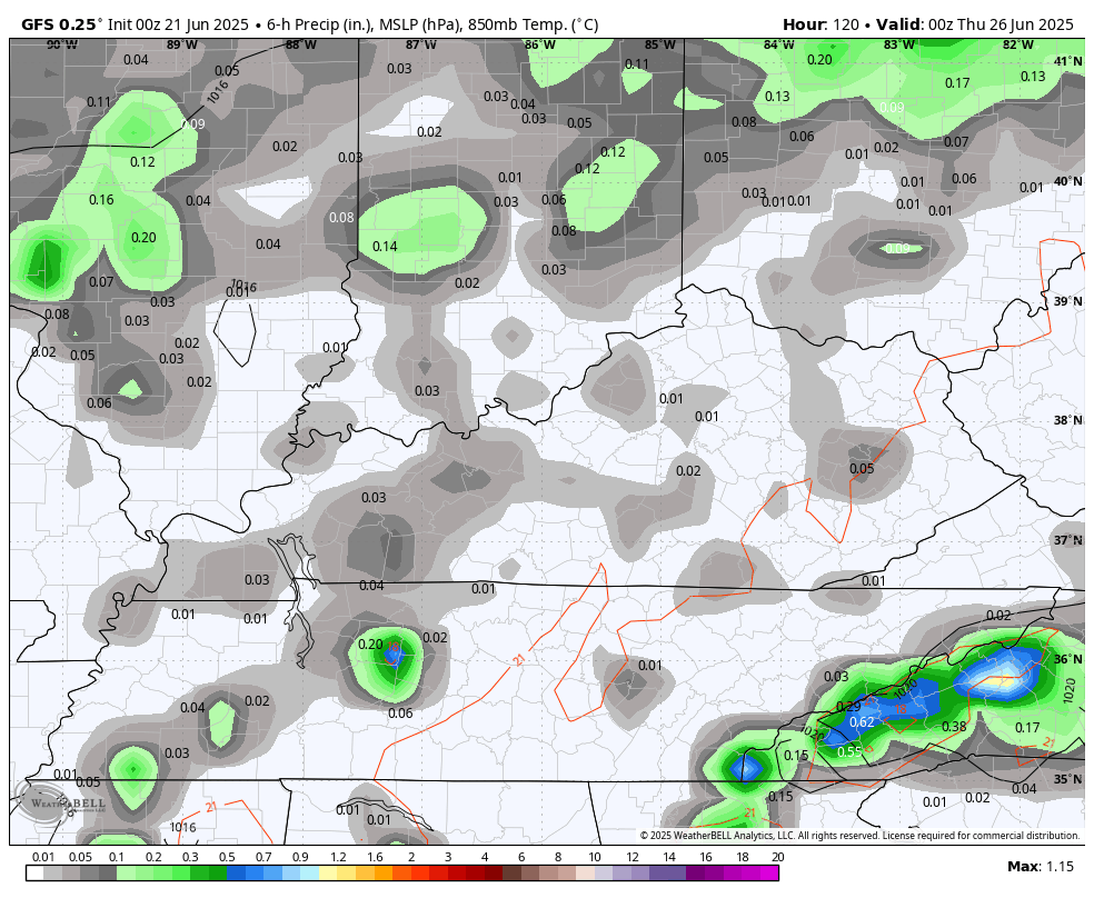
The GFS continues to show this possibility better than the other models…
Scattered showers and storms start to show up again by the middle and end of next week into the weekend…
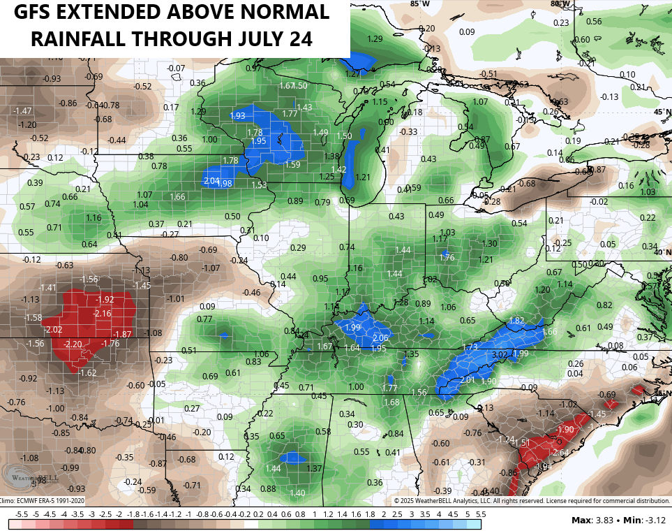
Looking farther down the road, the GFS Extended keeps us with above normal rains through much of July…
It is starting to skew a little warmer than normal…
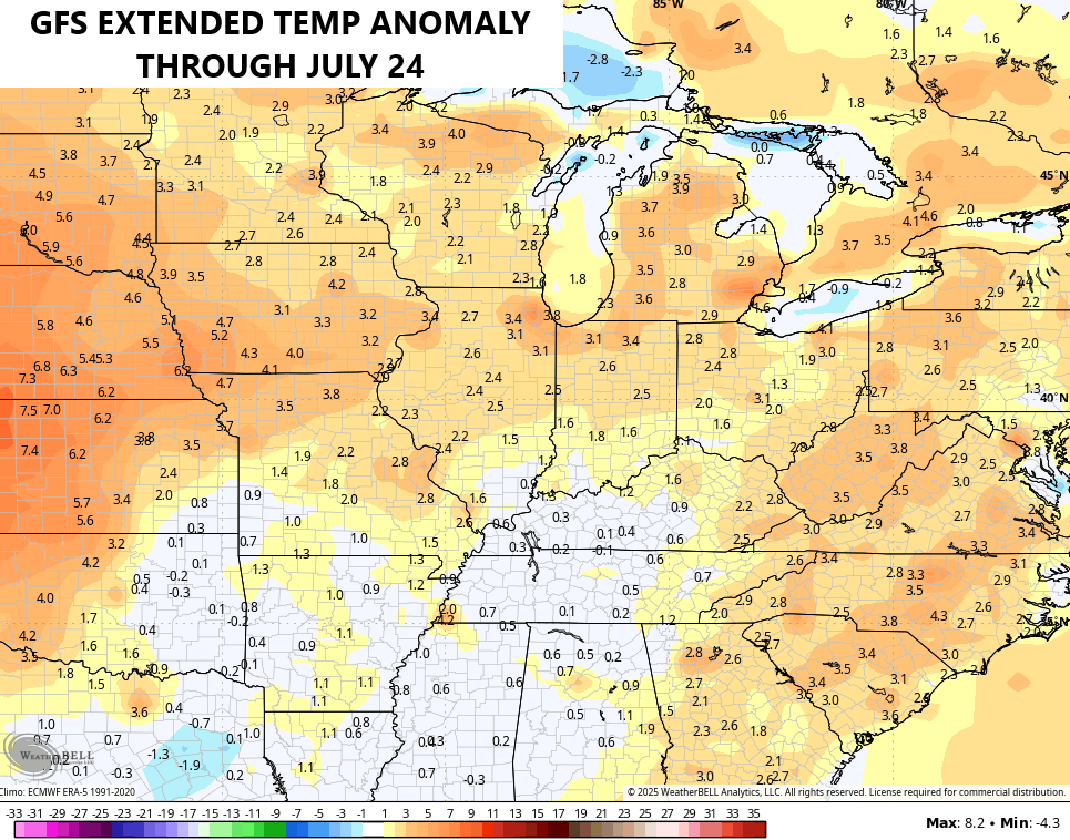
I’m more than ok with some summer temp action!!
I leave you with your radars to track any isolated showers and storms going up out there today…

Make it a great Saturday and take care.

The precipitation won’t be like that. 🙂
A very nice first day of Summer. I don’t think it will be that wet either Jeff.
Not too dry I hope