Good Sunday, everyone. Heat and humidity continue to increase out there today and that continues into the week ahead. Scattered showers and storms join in on the summer fun as the pattern reverts back to a familiar look to begin July.
Temps today and Monday generally hang in the upper 80s to low 90s with the humidity doing the dirty work. Heat index numbers range from the mid 90s to low 100s for many across the state. Obviously, you will have to pace yourself on outdoor activities.
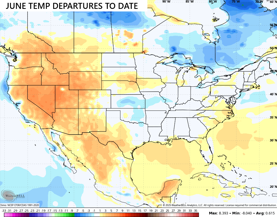
The heat is overdue as our temps for June have been running normal to a touch below and that goes for much of the central and eastern parts of the country…
Heat Advisories continue to show up in the west and north today…
…
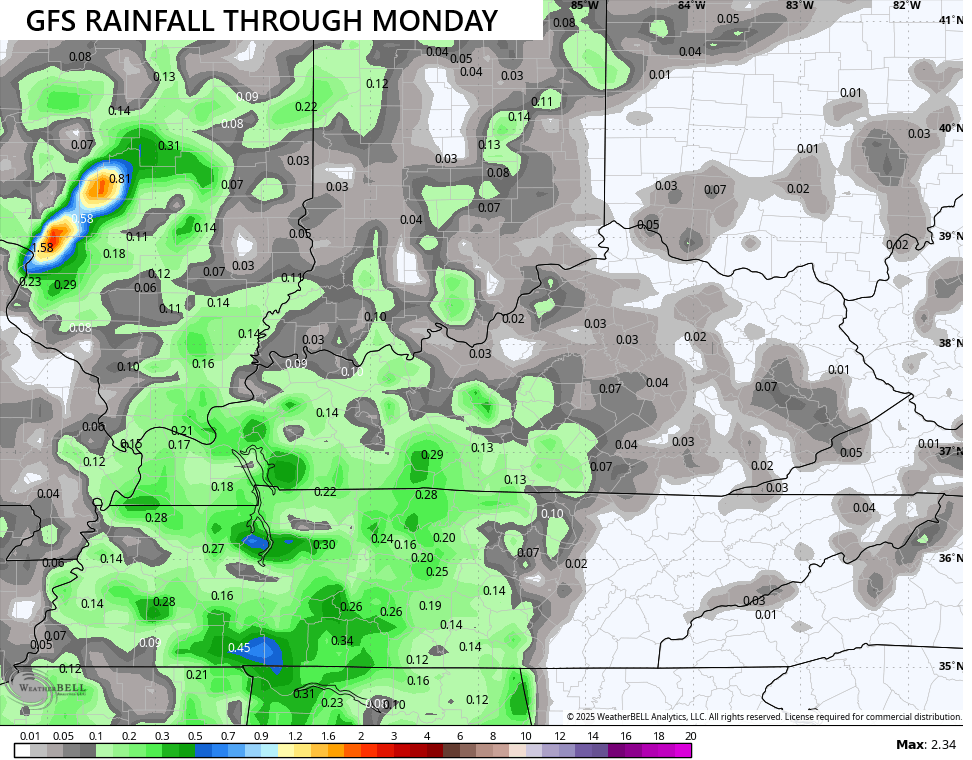
The potential for a shower or storm to go up is with us today with a better chance on Monday…
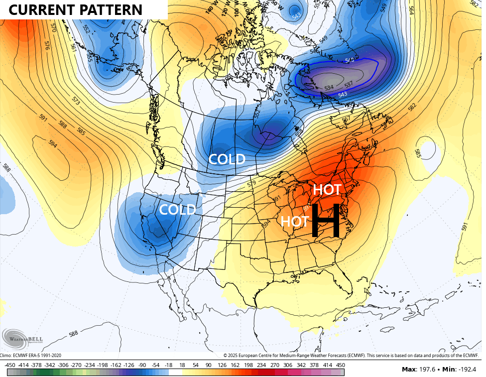
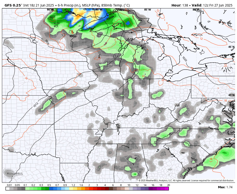
I mentioned how the pattern is already showing signs of reverting back to what we’ve seen for most of the past few months, and the models are seeing this. Here’s how we look right now…
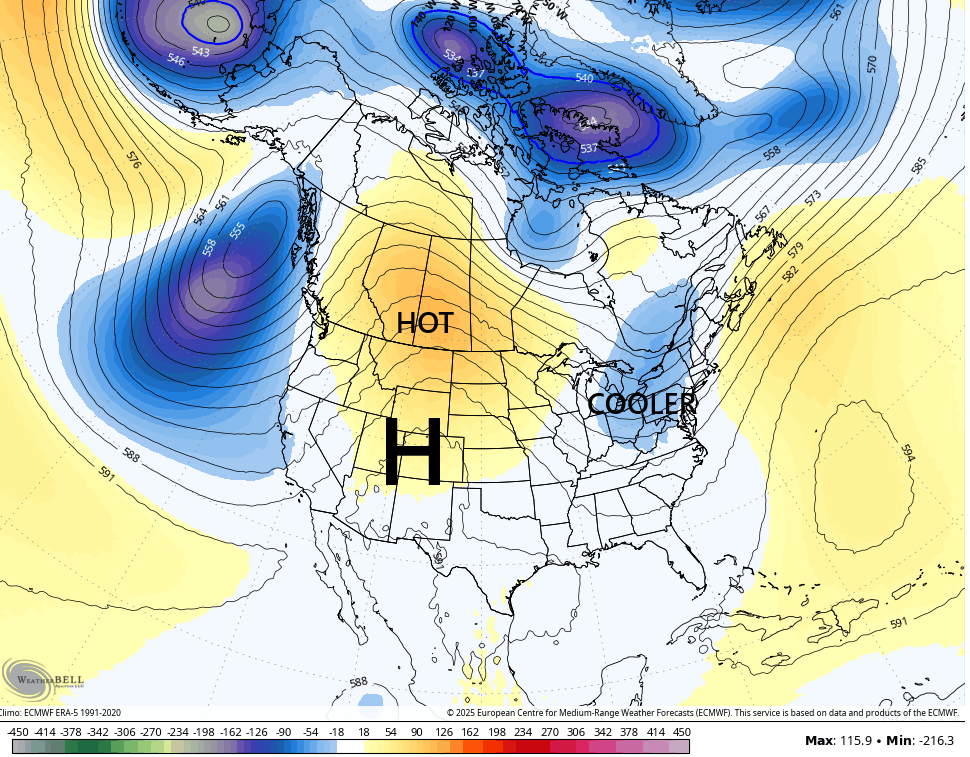
Match that up with what the forecast looks like for July 1st…
That transition brings scattered showers and storms later in the week ahead with an increase for the 4th of July week…
Are we really almost to the 4th of July??? What’s next… Talking about winter?
I leave you with your Kentucky weather radars to track today’s scattered storms…

Have a great Sunday and take care.

Yes, after the 4th I’m ready for discussions on Autumn and Winter.
We aren’t reverting to the old pattern. 🙂
It’s not that likely.
Currently 91 in Richmond, which is several degrees above normal for June 22 averages. If we hadn’t had the rains of late, I dare say we’d be pushing 100.