Good Monday to one and all. Heat index values around 100 were common on Sunday and we are back in that range for the next few days. As the steam hangs tough, scattered showers and storms start to join in on our fun and games.
Most of the state fell short of Heat Advisory criteria on Sunday and will likely do so again today. Heat Index criteria set by the NWS is for the Heat Index to hit 105 or greater for 2 hours or more.
Still, we will be in the ballpark today with another Heat Advisory going up for many…

Similar temps will be noted on Tuesday.
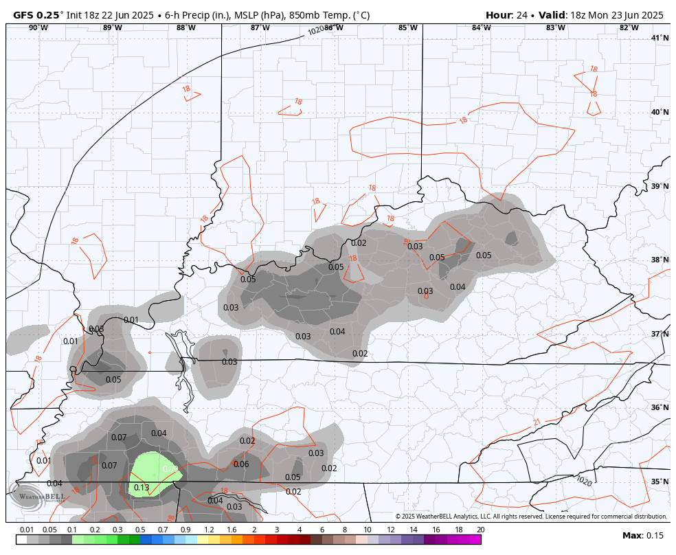
Scattered storms flare up today with a gradual increase in the action through the week…
That will certainly go a long way to knock the numbers down some, but this is a super steamy week.
The pattern continues to look to change it up to end June and roll into the 4th of July week. Showers and storms become much more common ahead of a cold front dropping in from the northwest.
The GFS sees it well…

So does the Canadian…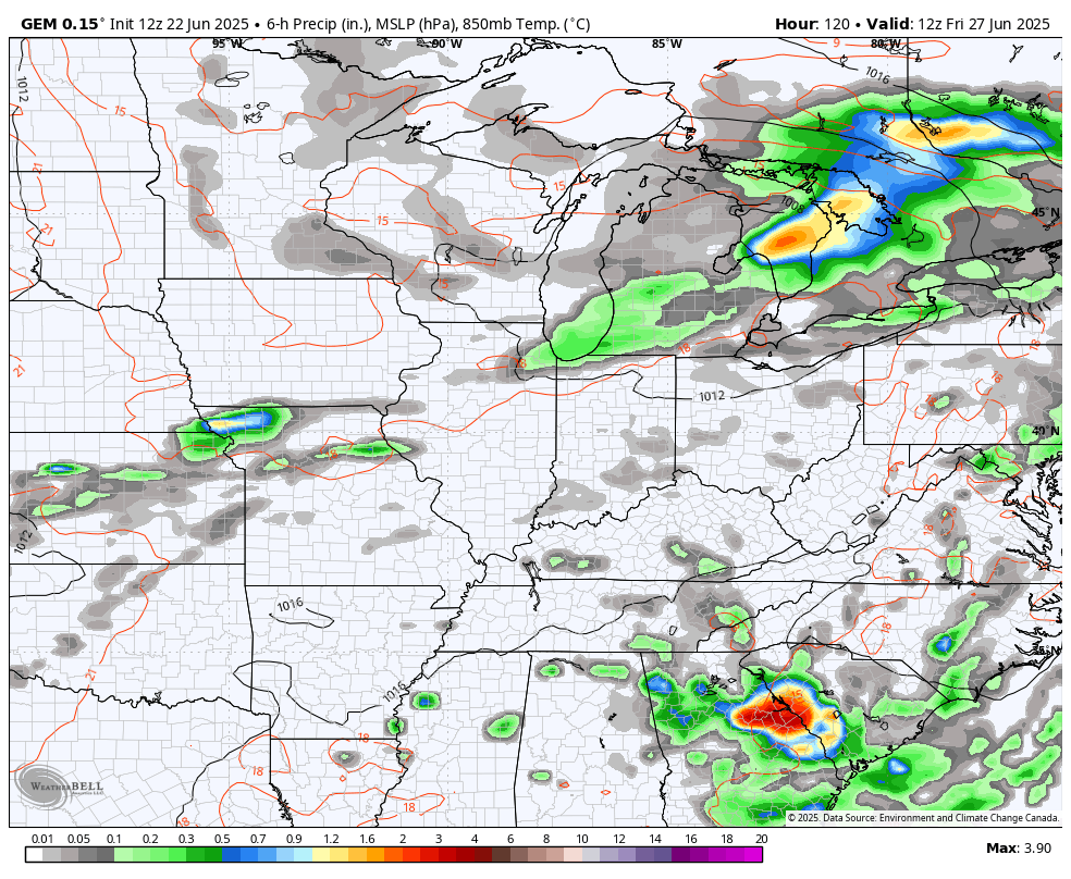
That should knock our temps down to comfy levels in the days leading up to the 4th. Actual temps may be below normal for a few days…
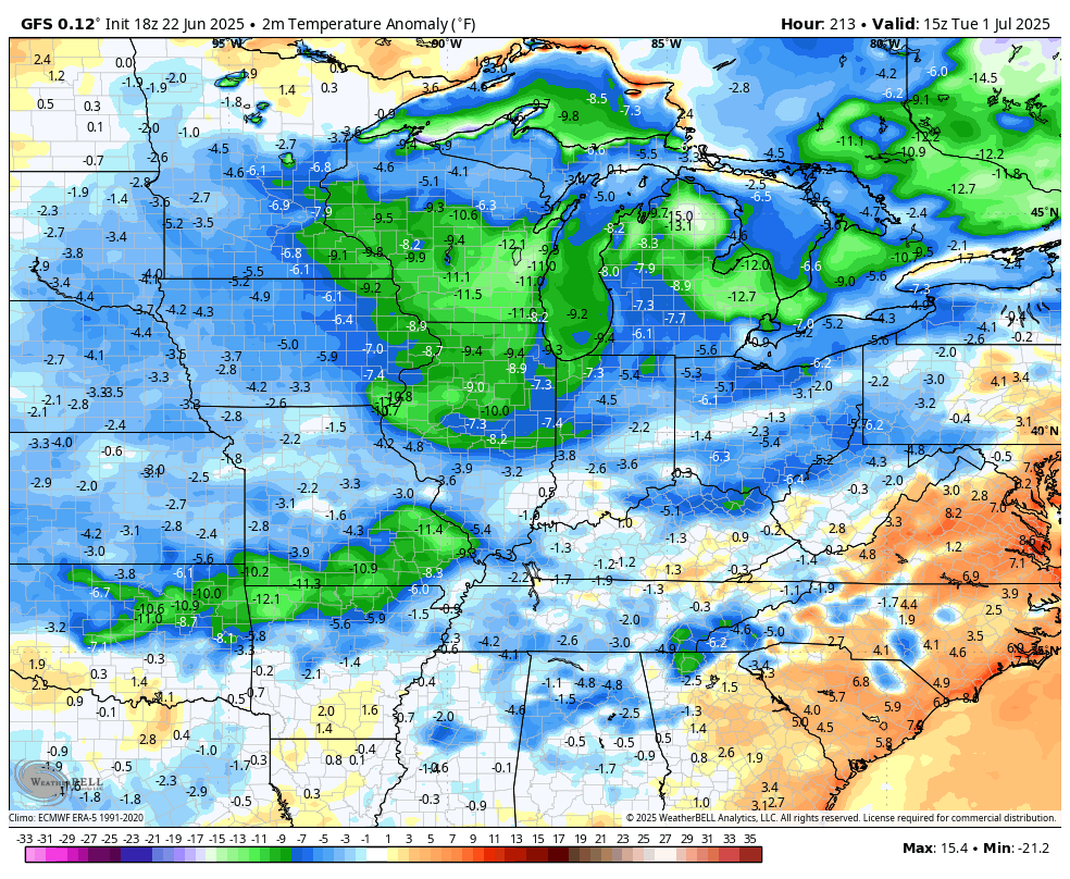
Below normal in July is still warm, but pretty darn nice!
The Atlantic Basin has been very quiet to start the Hurricane Season, but there’s one weak system way out in the ocean…


Make it a magnificent Monday and take care.

I new weeks ago that we would go from one extreme to another. I know how the midwest weather reacts. I’ve been living in this climate for 74 years.
Not new, but knew. Can’t even spell a simple word LOL….. I’m hoping that all Hurricanes from now on are ” Fish Storms. ” This Country doesn’t need anymore Disasters.
It was well above normal in Richmond yesterday with a high of 95. I was pleased and there was an evening rainfall to boot.
I’m I’m betting on the number of tropical systems during this year’s Atlantic hurricane season will end up below normal. However, I believe that a higher proportion of storms that form will reach “major” status (Category 3 and above), a t hat a few may threaten the East Coast and Gulf of Mexico shorelines.
Today marks the third day in a row where the dewpoint measured at my PWS exceeded 80°F, while the heat index values during the period hit 112°F on Saturday, 113°F on Sunday, and 116.5°F today.