Good Tuesday, everyone. We continue to with the hazy, hot and humid weather across the Commonwealth. Scattered storms have been joining the fun over the next few days and that’s a trend set to continue over the next few days.
Temps today generally range from the upper 80s to low 90s with a few of the traditional hot spots coming in above that. Humidity levels make it feel the part of high 90s to low 100s for a heat index.
The Heat Advisory has yet to verify over the past few days, but hope springs eternal that we can get sustained heat index numbers of 105 or greater…

The NWS criteria is no longer valid since they’re moving the goalposts. If several days of near 100 degree heat index is our new justification for a Heat Advisory, there are many summers of the past that would have had a Heat Advisory almost every day of the summer. But, I digress.
A few showers and storms go up today with a few more cranking on Wednesday and Thursday. As storms show better coverage, temps inch down just a bit each day. Any storm that goes up can produce local flash flooding.
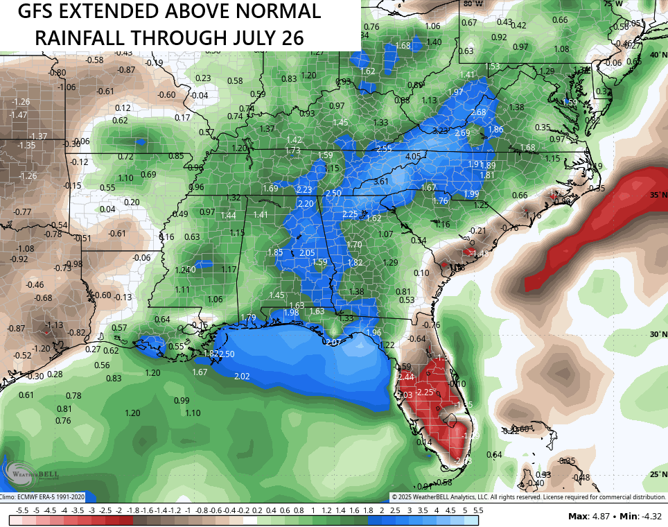
Showers and storms increase this weekend and continue into, at least, part of the 4th of July week and weekend.
The EURO brings a cold front through the region ahead of our Independence Day, giving us a break in the storms before they return a day or two later. This animation starts this Friday and goes through July 8th…
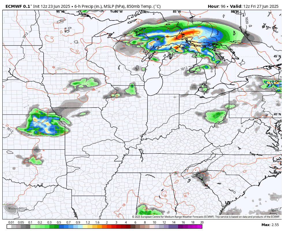
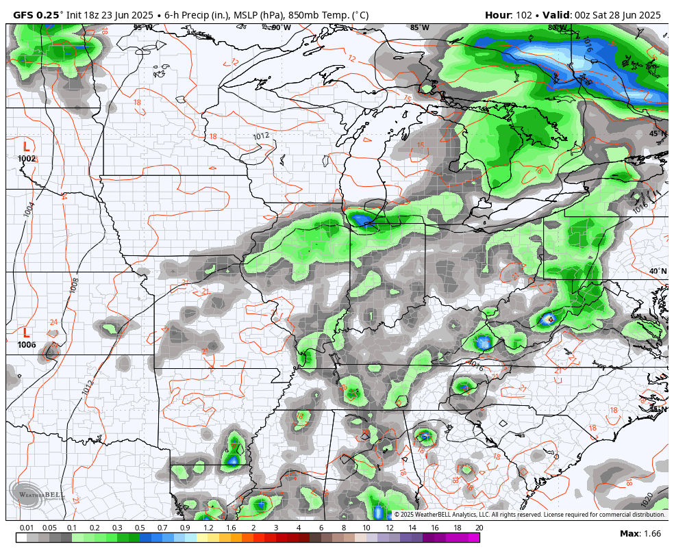
The GFS brings that cold front in here and slows it down, allowing for more storms through the big holiday and beyond…
This may very well be the beginning of another active stormy setup that goes through much of July…

Make it a terrific Tuesday and take care.

I HATE this weather… it’s so uncomfortable I don’t see how any can stand it other than swimmers… I literally DREAD it every year when it gets like this.
I love this weather. 🙂
This weather is very dangerous for the elderly.
Here’s is a link to why the weather is the way it is :
https://www.google.com/search?q=what%27s+causing+the+heat+wave+over+kentucky&sca_esv=019dea2479866187&sxsrf=AE3TifMxLGpcI0Whil7VyVMnGgXyJ_olKg%3A1750755585591&source=hp&ei=AWlaaLSuIqGLwbkP-fT2kAk&iflsig=AOw8s4IAAAAAaFp3Ea5D6DFLB6oVmy81k6pwG1ey1NrP&oq=what%27s+causing+the+heat+wave+over&gs_lp=Egdnd3Mtd2l6IiF3aGF0J3MgY2F1c2luZyB0aGUgaGVhdCB3YXZlIG92ZXIqAggBMgUQIRigATIFECEYoAEyBRAhGKABMgUQIRigATIFECEYoAEyBRAhGKsCMgUQIRirAkiysgJQAFjBhQJwAHgAkAEAmAGsAaABrxuqAQUxNC4xObgBAcgBAPgBAZgCIaACyh3CAgoQABiABBhDGIoFwgIQEAAYgAQYsQMYQxiDARiKBcICCxAAGIAEGJECGIoFwgIXEC4YgAQYkQIYsQMY0QMYgwEYxwEYigXCAhEQLhiABBixAxjRAxiDARjHAcICDxAAGIAEGEMYigUYRhj7AcICFBAuGIAEGLEDGNEDGIMBGNQCGMcBwgIKEAAYgAQYFBiHAsICCxAuGIAEGMcBGK8BwgIOEAAYgAQYsQMYgwEYigXCAg0QABiABBixAxhDGIoFwgITEAAYgAQYsQMYgwEYigUYRhj5AcICBRAAGIAEwgIFEC4YgATCAggQABiABBixA8ICEBAAGIAEGLEDGIMBGIoFGArCAgQQABgDwgIGEAAYFhgewgIIEAAYFhgKGB7CAgsQABiABBiGAxiKBcICCBAAGIAEGKIEwgIFEAAY7wWYAwCSBwQ2LjI3oAfxsAKyBwQ2LjI3uAfKHcIHBzItMjIuMTHIB_kB&sclient=gws-wiz
It almost seems like criteria changes to avoid bad press. If they don’t issue a heat advisory here, they will get blame if someone dies in the heat or suffers a heat stroke, they do issue it, and it doesn’t verify, people don’t seem to care.
The Heat Advisory is most certainly verifying in my corner of South Central Kentucky, especially in terms of humidity levels. Yesterday marked the third day in a row where the dewpoint measured at my PWS exceeded 80°F, while the heat index values during the period hit 112°F on Saturday, 113°F on Sunday, and 116.5°F on Monday. Today figures to be just as bad.
Ninety one degrees here in Maple. How many times can one comment on this heat wave. I’ll be glad when Fall and Winter discussion begins. Hoping the Fall is long with below normal temperatures and adequate precipitation. The Winter starts early and ends late with plenty of Snowstorms to track.