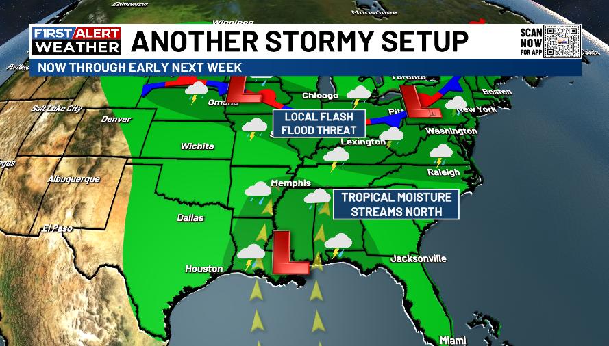
Good Tuesday, everyone. It’s another active weather day as torrential rain producing showers and storms rolling across Kentucky and this pattern is just getting started. Rounds of storms will increase, bringing an increase in the potential for flash flooding over the next week or so.
Here’s a quick breakdown of the where we are going:
- A few showers and storms are out there today, increasing from west to east.
- Locally heavy rains may cause local flash flooding issues.
- Wednesday and Thursday turn really tropical feeling with more in the way of showers and storms.
- Another front drops in from the northwest and stalls across the Ohio Valley later this week into the weekend.
- Clusters of showers and storms should drop in from northwest to southeast through the region.
- A few of these storms may be strong or severe. These complexes of storms can sometimes become big wind makers into our region.
- With ample amount of moisture available, these storms may produce a lot of rain. The flash flood threat will be with us.
Can some tropical moisture from the Gulf get involved and up the ante on possible flash flooding around here? That’s a possibility as we continue to watch a system crossing Florida enroute to the Gulf…

The National Hurricane Center is increasing the chances this develops…

We will have to keep a close eye on the possible interaction with that Gulf and the boundary in our region…
The GFS continues to suggest a lot of rain in our region over the next few weeks…
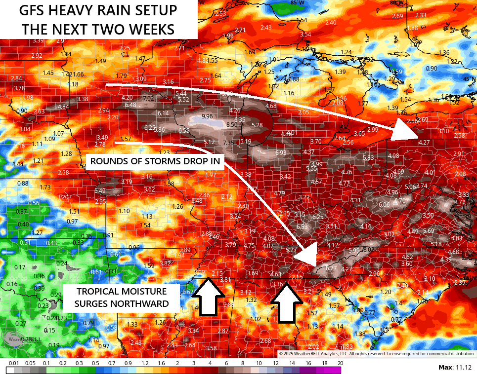
This is a pattern to keep a close eye on.
As usual, I leave you guys with your storm tracking tools…


Current watches

Possible Watch Areas

Make it a terrific Tuesday and take care.

So far, the models are flopping in Richmond. Not much rain lately.
Showers and Storms are around, just not in Richmond or Maple. This weather pattern will most likely be here through the rest of the Summer months. ENSO / neutral with a negative PDO ( really La Nina is still in charge. )
We had some rain here in wky, but not like what he has been advertising . Be glad get out of this pattern so some of that cool Canadian air can filter in.
We had a little rain the last couple of days at my house (more like sprinkles).. I checked just now it looks like KLEX got a huge rain last night around 430 am. Over and inch and a half. Funny how they end up receiving the MOST rain at the least likely time 4 ish (am) instead of the afternoon/evening. With that – that means we’re only halfway through July and KLEX has received justt shy of 40 inches of precip this year. That is WAYYYY above normal.